- Mueang Sing historical park
-
Mueang Sing historical park 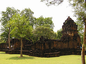
 Mueang Sing historical parkLocation in Thailand
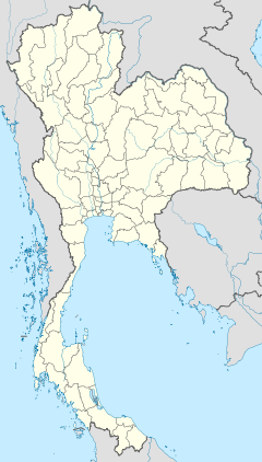
Coordinates: 14°2′25″N 99°14′29″E / 14.04028°N 99.24139°ECoordinates: 14°2′25″N 99°14′29″E / 14.04028°N 99.24139°E Name Proper name: Mueang Sing Location Country: Thailand Province: Kanchanaburi Location: Sai Yok Architecture and culture Primary deity: ? Architectural styles: Khmer History Date built:
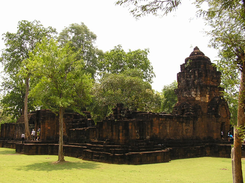
(Current structure)1180-1219 A.D. Creator: Jayavarman VII Mueang Sing (Thai: เมืองสิงห์ (Pronunciation)) is a historical park in the Sai Yok district, Kanchanaburi province, Thailand. The remains of two Khmer temples date to the 13th and 14th century. It was declared a historical park in 1987.
Built in the Bayon style, the temple relates to the Khmer kingdom in the reign of King Jayavarman VII (1180 to 1219). A stone inscription of Prince Vira Kumara praising his father, 23 cities are named. One of these cities was named Srichaiya Singhapura, which some scholars identify with Mueang Sing.
The name Mueang Sing first showed in the chronicles of the reign of King Rama I (1782-1809), when it was a fortified town protecting the town Kanchanaburi. In the reform of provincial administration at the end of the 19th century its status was reduced from Mueang to Tambon (commune).
Four monuments are existing inside the area of 736,000 m² enclosed by a laterite wall. The southern wall winds along the Khwae Noi river course, while the other three sides are quadratic. The main monument is in the center of the area, northwest of this is are the foundations of a second temple building. The other two monuments are of much smaller scale.
Angkorian sites Angkorian sites in Cambodia Angkor Ak Yum · Angkor Wat · Baksei Chamkrong · Banteay Kdei · Banteay Samré · Banteay Srei · Bat Chum · Chau Say Tevoda · East Baray · East Mebon · Kbal Spean · Krol Ko · Neak Pean · Phnom Bakheng · Phnom Bok · Phnom Krom · Phnom Kulen · Prasat Ak Yum · Prasat Kravan · Preah Khan · Pre Rup · Spean Thma · Srah Srang · Ta Keo · Ta Nei · Ta Prohm · Ta Som · Thommanon · West Baray · West Mebon · YasodharapuraAngkor Thom Roluos Elsewhere Ba Phnom · Banteay Chhmar · Banteay Prei Nokor · Beng Mealea · Koh Ker · Kuhak Nokor · Phnom Banan · Phnom Bayangkao · Phnom Chhnok · Phnom Chiso · Preah Khan Kompong Svay · Sambor Prei Kuk · Tonle Bati · Wat NokorAngkorian sites in Thailand Isan Khorat Plateau Ban Anan · Ban Bu · Ban Chan · Ban Chang Pi · Ban Plai · Ban Pluang · Ban Samor · Ban Sanom · Chom Phra · Don Tuan · Huai Thap Than · Khok Prasat · Ku Ka Sing · Ku San Tarat · Ku Suan Tang · Kuti Ruesi Ban Muang Khok · Kuti Ruesi Ban Nong Bua Rai · Muang Khaek · Muang Tum · Nang Ram · Nong Plong · Nong Ta Plaeng · Phimai · Pha Nom Wan · Phnom Rung · Phum Pon · Pluei Noi · Prang Goo · Prang Phom ma Tat · Ta Khwai · Ta Leng · Ta Muan · Ta Muan Tod · Tra Piang Tia · Ta Tom · Thamor · Sikhoraphum · Wat Chao Chan · Wat Dong Muang Tei · Wat Kampang Lang · Wat Mahathat · Wat Prang Thong · Wat Prapai Luang · Wat Sa Kampaeng Noi · Wat Sa Kampaeng Yai · Yai Ngao ·Sakonnakhon Plateau Ban Panna · Choeng Chum · Dum · Narai Cheng Weng · Phu PekElsewhere Khao Lon · Khao Noi · Mueang Sing · Prang Khaek · Prang Sam Yod · San Pra Kan · Sdok Kok Thom · Sri Tep historical parkAngkorian sites in Laos Disputed Angkorian sites Categories:- Angkorian sites
- Historical parks of Thailand
- Castles in Thailand
- Central Thailand geography stubs

Wikimedia Foundation. 2010.