- Liberty, Maine
Infobox Settlement
official_name = Liberty, Maine
settlement_type = Town
nickname =
motto =
imagesize = 250px
image_caption = Masonic Building on Main Street
image_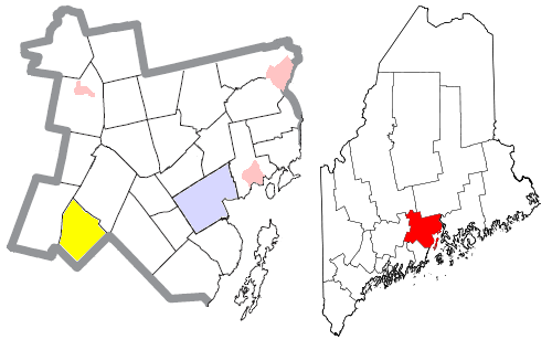
mapsize = 250px
map_caption = Location of Liberty (in yellow) in Waldo County and the state of Maine
mapsize1 =
map_caption1 =subdivision_type = Country
subdivision_name =United States
subdivision_type1 = State
subdivision_name1 =Maine
subdivision_type2 = County
subdivision_name2 = Waldo
government_footnotes =
government_type =
leader_title =
leader_name =
leader_title1 =
leader_name1 =
established_title =
established_date =unit_pref = Imperial
area_footnotes =
area_magnitude =
area_total_km2 = 73.3
area_land_km2 = 67.1
area_water_km2 = 6.2
area_total_sq_mi = 28.3
area_land_sq_mi = 25.9
area_water_sq_mi = 2.4population_as_of = 2000
population_footnotes =
population_total = 927
population_density_km2 = 13.8
population_density_sq_mi = 35.8timezone = Eastern (EST)
utc_offset = -5
timezone_DST = EDT
utc_offset_DST = -4
elevation_footnotes =
elevation_m = 198
elevation_ft = 650
latd = 44 |latm = 22 |lats = 15 |latNS = N
longd = 69 |longm = 20 |longs = 4 |longEW = Wpostal_code_type =
ZIP code
postal_code = 04949
area_code = 207
blank_name = FIPS code
blank_info = 23-39055
blank1_name = GNIS feature ID
blank1_info = 0582555
website =
footnotes =Liberty is a town in Waldo County,
Maine ,United States . The population was 927 at the 2000 census.Geography
According to the
United States Census Bureau , the town has a total area of 28.3square mile s (73.3km² ), of which, 25.9 square miles (67.1 km²) of it is land and 2.4 square miles (6.2 km²) of it (8.48%) is water.Demographics
As of the
census GR|2 of 2000, there were 927 people, 362 households, and 258 families residing in the town. Thepopulation density was 35.8 people per square mile (13.8/km²). There were 674 housing units at an average density of 26.0/sq mi (10.0/km²). The racial makeup of the town was 98.81% White, 0.11% African American, 0.11% Native American, 0.11% Asian, 0.11% from other races, and 0.76% from two or more races. Hispanic or Latino of any race were 0.43% of the population.There were 362 households out of which 35.9% had children under the age of 18 living with them, 56.1% are married couples living together, 10.8% had a female householder with no husband present, and 28.7% were non-families. 20.7% of all households were made up of individuals and 9.7% had someone living alone who was 65 years of age or older. The
average household size is 2.55 and the average family size was 2.94.In the town the population was spread out with 27.3% under the age of 18, 6.8% from 18 to 24, 28.6% from 25 to 44, 23.3% from 45 to 64, and 14.0% who are 65 years of age or older. The
median age is 39 years. For every 100 females there were 91.5 males. For every 100 females age 18 and over, there were 94.8 males.The median income for a household in the town was $34,583, and the median income for a family was $37,969. Males had a median income of $29,063 versus $24,286 for females. The
per capita income for the town was $16,201. 17.1% of the population and 15.4% of families are below the poverty line. Out of the total population, 23.8% of those under the age of 18 and 13.2% of those 65 and older were living below the poverty line.History
The midcoast area of Maine was inhabited by coastal and woodland Native Americans such as the
Abenaki (or Wabanaki) until they were mostly dislocated by Europeans beginning in the 1600s.The first
Europe an (English) people moved into the area in and around Liberty in the late 1700s. The first settlement was then known as Davistown Plantation, which is incorporated into neighboring Montville in the early 1800s.Mills in Liberty produced materials that were used in the shipbuilding industry that thrived in nearby coastal towns, such as Waldoboro, during the early 1800s.In 1827 Liberty separated from Montville and was incorporated as a town.
The middle to late 19th century saw a decline in population and goods produced. This correlates with the decline of the shipbuilding industry.
References
Further reading
*Hurwitz, Alfred. "History of Liberty, Maine," 1827-1975. Liberty, Maine,
*Liberty Historical Soc., Thorndike, Maine, Hutchins Brothers, c1975.
*Liberty Maine Historical Committee. "The town of Liberty: bits history and geography."
*N. White. "Thorndike, Maine", c1927.External links
* [http://www.davistownmuseum.org/TDMhistory.htm#DavistownChron The Davistown Museum Davistown History Project]
* [http://www.liberty.lib.me.us/ The Ivan O. Davis ~ Liberty Library]
* [http://www.state.me.us/cgi-bin/doc/parks/find_one_name.pl?park_id=27 Lake St. George State Park]
* [http://www.mvhs.sad3.k12.me.us/Sad3/WalkerWebPage/main_page.html Walker School] (Elementary school part of [http://www.mvhs.sad3.k12.me.us/ Maine School Administrative District #3] )
Wikimedia Foundation. 2010.