Puerto Cisnes — Infobox City official name = Puerto Cisnes other name = native name = nickname = motto = imagesize =250px image caption = flag size = 150px image seal size = image shield = shield size = 100px image blank emblem = blank emblem size = imagesize… … Wikipedia
Cochrane River — Origin Cochrane Lake Mouth Baker River Basin countries Chile/Argentina Length 11 miles The Cochrane River is a short river of Chile … Wikipedia
Queulat National Park — Infobox protected area | name = Queulat National Park iucn category = II caption = The white dot is the location of Coyhaique base width = 160 locator x = 121 locator y = 48 location = Aisén Region, Chile nearest city = Puerto Puyuhuapi lat… … Wikipedia
Lago Verde, Chile — Infobox City official name = Lago Verde other name = native name = motto = imagesize =250px image caption = flag size = 150px image seal size = image shield = shield size = 100px image blank emblem = blank emblem size = imagesize =250px image… … Wikipedia
Valdivia, Chile — Infobox City official name = Valdivia other name = native name = nickname = The City of Rivers motto = Muy Noble y Muy Leal (Very Noble and Very Loyal) imagesize =270px image caption =Typical postcard view of Valdivia from Pedro de Valdivia… … Wikipedia
Liste der Flüsse in Amerika — Die Liste der Flüsse in Amerika ist eine nach Staaten sortierte Auflistung von Flüssen auf dem amerikanischen Doppelkontinent. Siehe auch Liste der längsten Flüsse der Erde. Inhaltsverzeichnis 1 Flüsse in Nordamerika … Deutsch Wikipedia
Liste von Flüssen in Amerika — Die Liste von Flüssen in Amerika ist eine nach Staaten sortierte Auflistung von Flüssen auf dem amerikanischen Doppelkontinent. Siehe auch Liste der längsten Flüsse der Erde. Inhaltsverzeichnis … Deutsch Wikipedia
Patagonia — For other uses, see Patagonia (disambiguation). Official map of cartographer of the King of Spain, Juan de la Cruz Cano y Olmedilla, 1775. Patagonia is a region located in Argentina and Chile, integrating the southernmost section of the A … Wikipedia
Zona Austral — The Zona Austral (English: Austral Zone ) is one of the five natural regions into which CORFO divided continental Chile in 1950. It is surrounded by the Southern Zone and the Chacao Channel to the North, the Pacific Ocean and Drake s Passage to… … Wikipedia
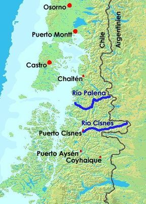
List of rivers of Chile — This list of rivers in Chile includes all the major rivers of Chile. See each article for their tributaries, drainage areas, etc. Usually significant tributaries appear in this list, under the river into which they drain. Note: The rivers are… … Wikipedia