- Pleasanton, Kansas
Infobox Settlement
official_name = Pleasanton, Kansas
settlement_type =City
nickname =
motto =
imagesize =
image_caption =
image_
imagesize =
image_caption =
image_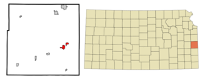
mapsize = 250px
map_caption = Location of Pleasanton, Kansas
mapsize1 =
map_caption1 =subdivision_type = Country
subdivision_name =United States
subdivision_type1 = State
subdivision_name1 =Kansas
subdivision_type2 = County
subdivision_name2 = Linn
government_footnotes =
government_type =
leader_title =
leader_name =
leader_title1 =
leader_name1 =
established_title =
established_date =unit_pref = Imperial
area_footnotes =area_magnitude =
area_total_km2 = 4.6
area_land_km2 = 4.2
area_water_km2 = 0.4
area_total_sq_mi = 1.8
area_land_sq_mi = 1.6
area_water_sq_mi = 0.1population_as_of = 2000
population_footnotes =
population_total = 1387
population_density_km2 = 327.0
population_density_sq_mi = 846.8timezone = Central (CST)
utc_offset = -6
timezone_DST = CDT
utc_offset_DST = -5
elevation_footnotes =
elevation_m = 262
elevation_ft = 860
latd = 38 |latm = 10 |lats = 35 |latNS = N
longd = 94 |longm = 42 |longs = 43 |longEW = Wpostal_code_type =
ZIP code
postal_code = 66075
area_code = 913
blank_name = FIPS code
blank_info = 20-56450GR|2
blank1_name = GNIS feature ID
blank1_info = 0477924GR|3
website =
footnotes =Pleasanton is a city in Linn County,
Kansas ,United States . The population was 1,387 at the 2000 census. Named for GeneralAlfred Pleasonton , the city was founded in 1869. [ [http://www.fstribune.com/story/1281629.html General Pleasonton Days set for Oct. 6, 7] , "Fort Scott Tribune ",2007-10-03 . Accessed2008-06-02 .]Geography
Pleasanton is located at coor dms|38|10|35|N|94|42|43|W|city (38.176326, -94.711997)GR|1.
According to the
United States Census Bureau , the city has a total area of 1.8square mile s (4.6km² ), of which, 1.6 square miles (4.2 km²) of it is land and 0.2 square miles (0.4 km²) of it (8.38%) is water.Demographics
As of the
census GR|2 of 2000, there were 1,387 people, 562 households, and 384 families residing in the city. Thepopulation density was 846.8 people per square mile (326.5/km²). There were 617 housing units at an average density of 376.7/sq mi (145.3/km²). The racial makeup of the city was 97.76% White, 0.65% African American, 0.50% Native American, 0.07% Asian, 0.14% from other races, and 0.87% from two or more races. Hispanic or Latino of any race were 0.65% of the population.There were 562 households out of which 30.6% had children under the age of 18 living with them, 55.0% were married couples living together, 10.0% had a female householder with no husband present, and 31.5% were non-families. 26.9% of all households were made up of individuals and 14.9% had someone living alone who was 65 years of age or older. The average household size was 2.47 and the average family size was 2.99.
In the city the population was spread out with 26.9% under the age of 18, 10.6% from 18 to 24, 24.4% from 25 to 44, 22.1% from 45 to 64, and 16.1% who were 65 years of age or older. The median age was 37 years. For every 100 females there were 91.8 males. For every 100 females age 18 and over, there were 94.6 males.
The median income for a household in the city was $25,714, and the median income for a family was $32,014. Males had a median income of $24,917 versus $18,333 for females. The
per capita income for the city was $13,309. About 18.8% of families and 21.5% of the population were below thepoverty line , including 27.5% of those under age 18 and 12.4% of those age 65 or over.References
External links
*Photos of [http://www.kansastravel.org/minecreekbattlefield.htm Mine Creek Battlefield - Civil War location just outside Pleasanton]
Wikimedia Foundation. 2010.