- Maia (Ribeira Grande)
-
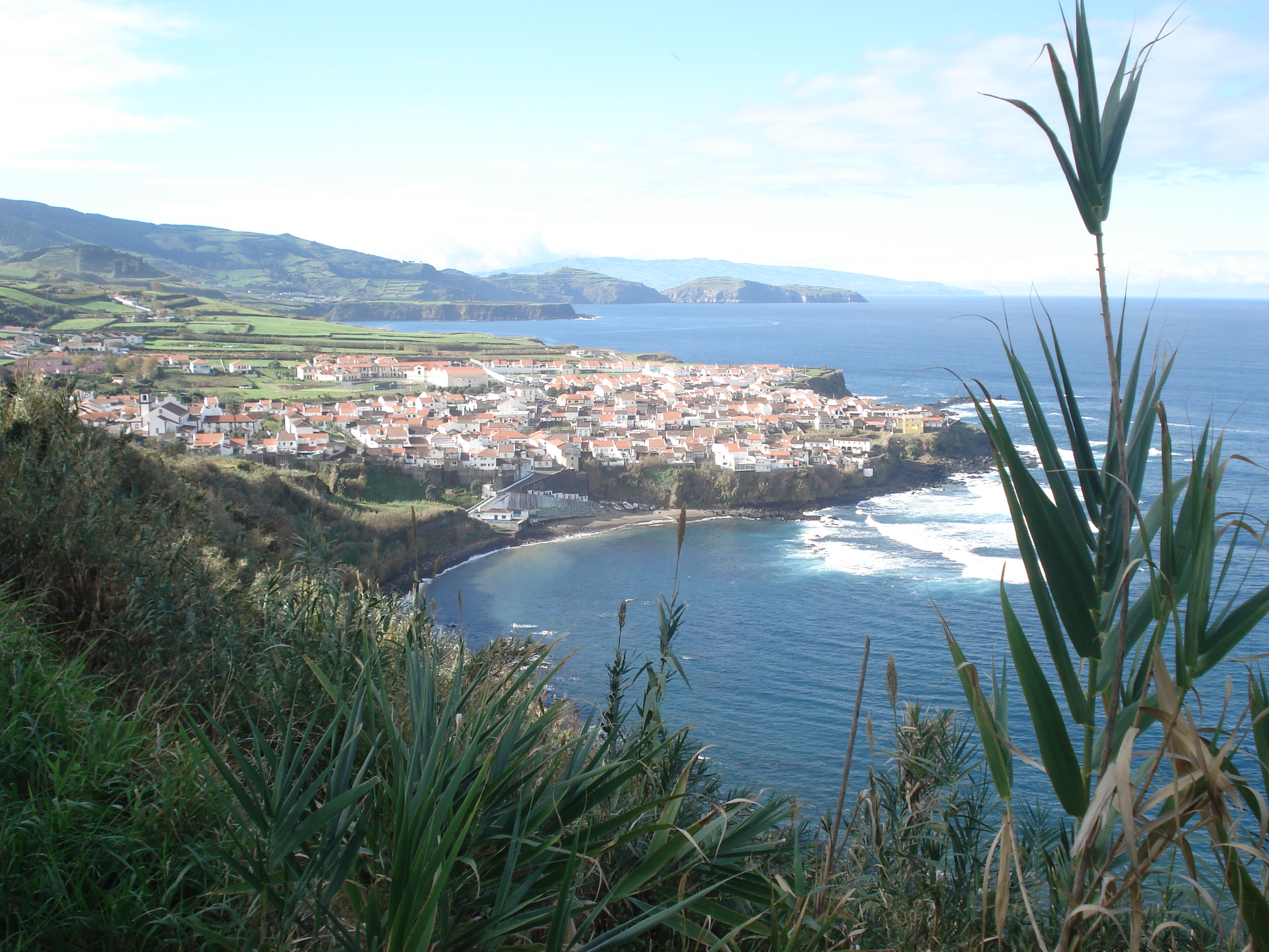
Maia Civil Parish (Freguesia) 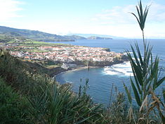 The coastal village of Maia, as seen from the hilltop belvedere
Official name: Freguesia da Maia Country  Portugal
Autonomous Region  Azores
Group Central Island São Miguel Municipality Ribeira Grande Localities Maia, Lombinha da Maia, Calços da Maia, Gorreana Center Maia - elevation 27 m (89 ft) - coordinates 37°49′57″N 25°23′18″W / 37.8325°N 25.38833°W Highest point Lomba dos Bezerros - location Picos, Maia, Ribeira Grande - elevation 758.25 m (2,488 ft) - coordinates 37°47′4″N 25°24′56″W / 37.78444°N 25.41556°W Lowest point Sea level - location Atlantic Ocean - elevation 0 m (0 ft) Length 7.6 km (5 mi), North-South Width 5.49 km (3 mi), West-East Area 21.97 km2 (8 sq mi) - land 21.483 km2 (8 sq mi) - water .007 km2 (0 sq mi) - urban .48 km2 (0 sq mi) Population 1,901 (2001) Density 21.97 / km2 (57 / sq mi) LAU Freguesia/Junta Freguesia - location Rua Santa Catarina, Maia, Ribeira Grande - elevation 22 m (72 ft) - coordinates 37°49′58″N 25°23′13″W / 37.83278°N 25.38694°W President Junta Jaime Manuel Serpa da Costa Rita President Assembleia Graça Borges Castanho Timezone Azores (UTC-1) - summer (DST) Azores (UTC0) ISO 3166-2 code PT- Postal Zone 9625-337 Maia Area Code & Prefix (+351) 292 XXX-XXXX Demonym Ribeira-grandense; Maiense Patron Saint Divino Espírito Santo Parish Address Rua Santa Catarina 18
9625-337 MaiaWikimedia Commons: Maia Website: cm-ribeiragrande.azoresdigital.pt Maia is a civil parish in Ribeira Grande Municipality in the Portuguese Azores. The population in 2001 is 1,901, its density is 86.5/km² and the area is 21.97 km². Maia is the largest parish in area in Ribeira Grande.
History
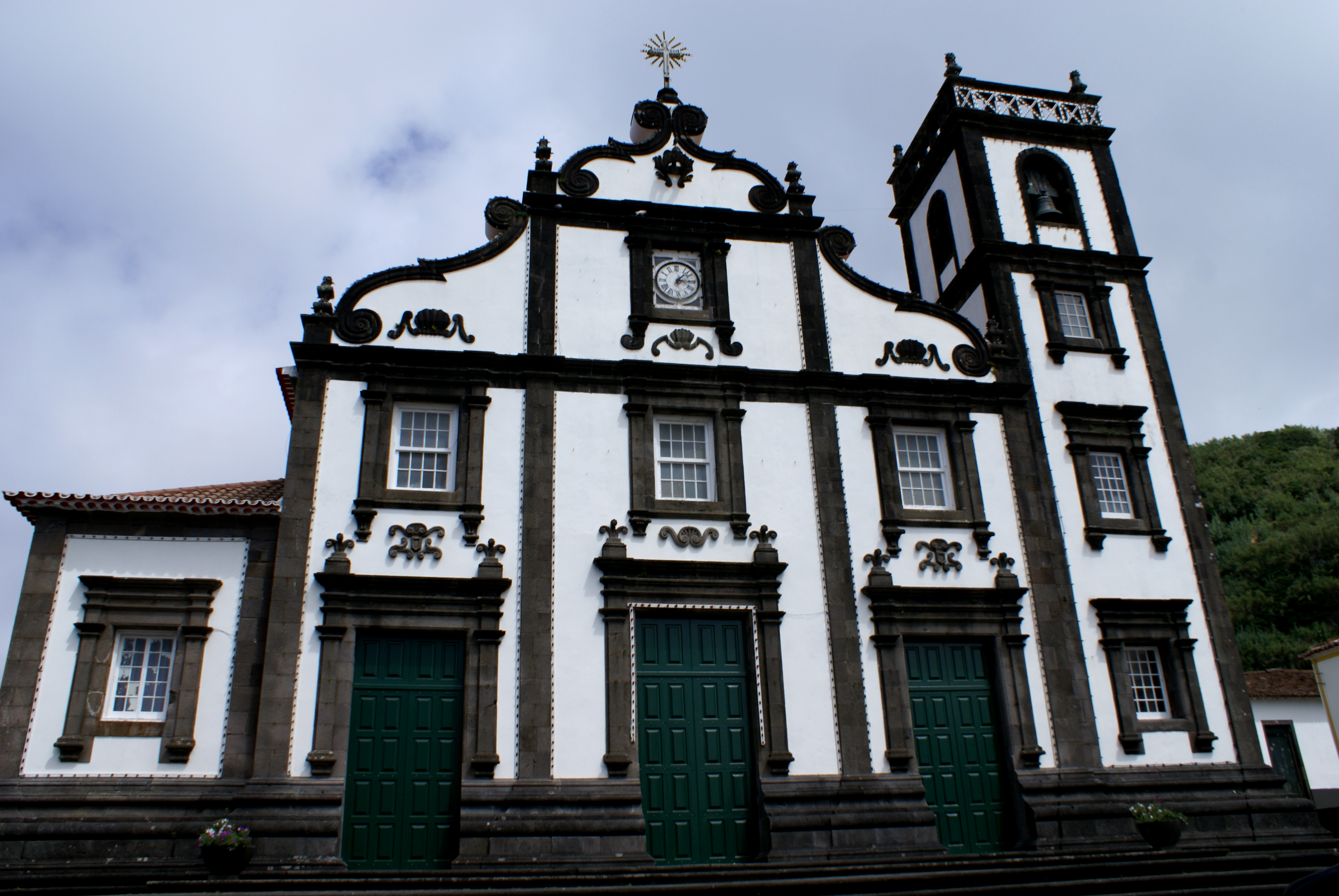
 The front facade of the Church of the Divino Espírito Santo
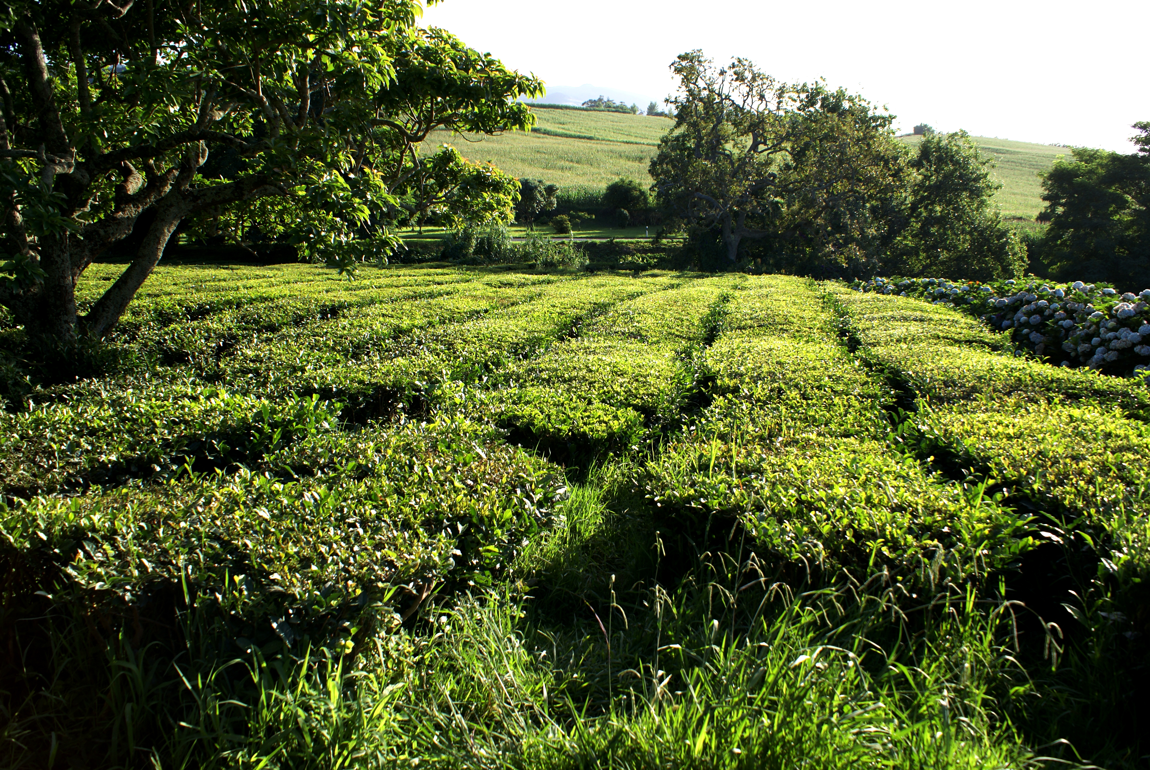
 The tea fields in the foothills of Gorreana, established in the 18th Century: the only European region to support tea production
The first Azorean historians referred to this parish, owing to the settlement of Inês da Maia, a noblewoman that established a home here in the 15th Century.
The settlement of the community dates back to the early settlement of Ribeira Grande; the construction of the main church was begun at the end of the 15th Century. By 1522, it had its third vicar. Maia became one of the northern coasts more rapidly growing places: one hundred after its foundation it had become a civil parish.
The parochial church was dedicated to the Holy Spirit in 1812, constructed after a 16th Century chapel, and expanded in 17th and 18th Centuries. The Solar do Lalém, constructed at the end of the 19th Century, with chapel and 18th Century portal
In the area of Gorreana, thus named for the fact that the first resident was a man named Gorreana or gorro de Ana, who owned a tea plantation, a rare thing in Europe. [1] This area is also the location of the Chapel of Nossa Senhora do Resgate (Portuguese: Ermida de Nossa Senhora do Resgate), from the 18th Century, constructed with a decorative facade by the local farmers. In its interior, azulejos were assembled on the alter with a medallion and the patron saint in the same decoration.
In the area of Lombinha da Maia, named for its location on a small hill/escarpment (Portuguese: lombinha), a small chapel was constructed in 1896, to the invocation of Nossa Senhora das Dores. Later it was adapted, with a baptistry and sacristy to support the parishioners.
Geography
Maia has a school, a lyceum, a gymnasia, a church and a square (praça).
References
- Notes
- ^ The importance of the tea factory (Portuguese: Fábrica de Chá Gorreana) was celebrated during its centanary of operation, when the business demonstrated the infusions and various species that were cultivated in Gorreana over the years.
Categories:- Azores geography stubs
- Parishes of Ribeira Grande (Azores)
- São Miguel Island
Wikimedia Foundation. 2010.