- Cromwell, Iowa
-
Cromwell, Iowa — City — Location of Cromwell, Iowa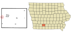
Coordinates: 41°2′27″N 94°27′45″W / 41.04083°N 94.4625°WCoordinates: 41°2′27″N 94°27′45″W / 41.04083°N 94.4625°W Country  United States
State  Iowa
IowaCounty Union Area – Total 0.3 sq mi (0.7 km2) – Land 0.3 sq mi (0.7 km2) – Water 0.0 sq mi (0.0 km2) Elevation 1,286 ft (392 m) Population (2000) – Total 120 – Density 416.6/sq mi (160.8/km2) Time zone Central (CST) (UTC-6) – Summer (DST) CDT (UTC-5) ZIP code 50842 Area code(s) 641 FIPS code 19-17490 GNIS feature ID 0455725 Cromwell is a city in Union County, Iowa, United States. The population was 120 at the 2000 census.
Geography
Cromwell is located at 41°2′27″N 94°27′45″W / 41.04083°N 94.4625°W (41.040940, -94.462423)[1].
According to the United States Census Bureau, the city has a total area of 0.3 square miles (0.78 km2), all of it land.
Demographics
As of the census[2] of 2000, there were 120 people, 47 households, and 31 families residing in the city. The population density was 416.6 people per square mile (159.8/km²). There were 50 housing units at an average density of 173.6 per square mile (66.6/km²). The racial makeup of the city was 99.17% White, and 0.83% from two or more races. Hispanic or Latino of any race were 0.83% of the population.
There were 47 households out of which 31.9% had children under the age of 18 living with them, 59.6% were married couples living together, 2.1% had a female householder with no husband present, and 34.0% were non-families. 34.0% of all households were made up of individuals and 8.5% had someone living alone who was 65 years of age or older. The average household size was 2.55 and the average family size was 3.32.
In the city the population was spread out with 30.0% under the age of 18, 5.8% from 18 to 24, 26.7% from 25 to 44, 30.0% from 45 to 64, and 7.5% who were 65 years of age or older. The median age was 37 years. For every 100 females there were 106.9 males. For every 100 females age 18 and over, there were 100.0 males.
The median income for a household in the city was $35,000, and the median income for a family was $36,750. Males had a median income of $24,375 versus $26,250 for females. The per capita income for the city was $12,190. There were 27.0% of families and 42.9% of the population living below the poverty line, including 56.8% of under eighteens and 23.8% of those over 64.
References
- ^ "US Gazetteer files: 2010, 2000, and 1990". United States Census Bureau. 2011-02-12. http://www.census.gov/geo/www/gazetteer/gazette.html. Retrieved 2011-04-23.
- ^ "American FactFinder". United States Census Bureau. http://factfinder.census.gov. Retrieved 2008-01-31.
Municipalities and communities of Union County, Iowa Cities 
Unincorporated
communityFootnotes ‡This populated place also has portions in an adjacent county or counties
Categories:- Cities in Iowa
- Populated places in Union County, Iowa

Wikimedia Foundation. 2010.