- Cylinder, Iowa
-
Cylinder, Iowa — City — Location of Cylinder, Iowa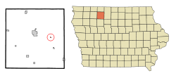
Coordinates: 43°5′21″N 94°33′0″W / 43.08917°N 94.55°WCoordinates: 43°5′21″N 94°33′0″W / 43.08917°N 94.55°W Country  United States
State  Iowa
IowaCounty Palo Alto Area – Total 0.1 sq mi (0.2 km2) – Land 0.1 sq mi (0.2 km2) – Water 0.0 sq mi (0.0 km2) Elevation 1,191 ft (363 m) Population (2000) – Total 110 – Density 1,625.1/sq mi (627.4/km2) Time zone Central (CST) (UTC-6) – Summer (DST) CDT (UTC-5) ZIP code 50528 Area code(s) 712 FIPS code 19-17985 GNIS feature ID 0455764 Cylinder is a city in Palo Alto County, Iowa, United States. The population was 110 at the 2000 census.
There is no clear evidence of the derivation of the name of the town. However, one story suggests that the name comes from a vehicle that passed over the creek and dropped a cylinder. There are other stories, but no clear definitive explanation.[citation needed]
Geography
Cylinder is located at 43°05′21″N 94°33′00″W / 43.089159°N 94.550092°W (43.089159, -94.550092).[1]
According to the United States Census Bureau, the city has a total area of 0.1 square miles (0.26 km2), all of it land.
Demographics
As of the census[2] of 2000, there were 110 people, 45 households, and 31 families residing in the city. The population density was 1,625.0 people per square mile (606.7/km2). There were 49 housing units at an average density of 723.9 per square mile (270.3/km2). The racial makeup of the city was 98.18% White, 0.91% from other races, and 0.91% from two or more races. Hispanic or Latino of any race were 1.82% of the population.
There were 45 households out of which 35.6% had children under the age of 18 living with them, 57.8% were married couples living together, 6.7% had a female householder with no husband present, and 31.1% were non-families. 26.7% of all households were made up of individuals and 13.3% had someone living alone who was 65 years of age or older. The average household size was 2.44 and the average family size was 2.97.
In the city the population was spread out with 29.1% under the age of 18, 4.5% from 18 to 24, 30.9% from 25 to 44, 23.6% from 45 to 64, and 11.8% who were 65 years of age or older. The median age was 36 years. For every 100 females there were 107.5 males. For every 100 females age 18 and over, there were 100.0 males.
The median income for a household in the city was $24,750, and the median income for a family was $40,625. Males had a median income of $30,625 versus $14,250 for females. The per capita income for the city was $12,953. There were 21.2% of families and 31.9% of the population living below the poverty line, including 62.5% of under eighteens and none of those over 64.
References
- ^ "US Gazetteer files: 2010, 2000, and 1990". United States Census Bureau. 2011-02-12. http://www.census.gov/geo/www/gazetteer/gazette.html. Retrieved 2011-04-23.
- ^ "American FactFinder". United States Census Bureau. http://factfinder.census.gov. Retrieved 2008-01-31.
Municipalities and communities of Palo Alto County, Iowa Cities Ayrshire | Curlew | Cylinder | Emmetsburg | Graettinger | Mallard | Rodman | Ruthven | West Bend‡

Footnotes ‡This populated place also has portions in an adjacent county or counties
Categories:- Cities in Iowa
- Populated places in Palo Alto County, Iowa

Wikimedia Foundation. 2010.