- Graettinger, Iowa
Infobox Settlement
official_name = Graettinger, Iowa
settlement_type =City
nickname =
motto =
imagesize =
image_caption =
image_
imagesize =
image_caption =
image_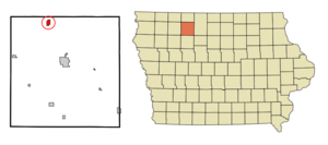
mapsize = 250x200px
map_caption = Location of Graettinger, Iowa
mapsize1 =
map_caption1 =subdivision_type = Country
subdivision_name =
subdivision_type1 = State
subdivision_name1 =
subdivision_type2 = County
subdivision_name2 = Palo Alto
government_footnotes =
government_type =
leader_title =
leader_name =
leader_title1 =
leader_name1 =
established_title =
established_date =unit_pref = Imperial
area_footnotes =area_magnitude =
area_total_km2 = 2.0
area_land_km2 = 2.0
area_water_km2 = 0.0
area_total_sq_mi = 0.8
area_land_sq_mi = 0.8
area_water_sq_mi = 0.0population_as_of = 2000
population_footnotes =
population_total = 900
population_density_km2 = 453.6
population_density_sq_mi = 1174.8timezone = Central (CST)
utc_offset = -6
timezone_DST = CDT
utc_offset_DST = -5
elevation_footnotes =
elevation_m = 382
elevation_ft = 1253
latd = 43 |latm = 14 |lats = 17 |latNS = N
longd = 94 |longm = 45 |longs = 4 |longEW = Wpostal_code_type =
ZIP code
postal_code = 51342
area_code = 712
blank_name = FIPS code
blank_info = 19-31800
blank1_name = GNIS feature ID
blank1_info = 0457009
website =
footnotes =Graettinger is a city in Palo Alto County,
Iowa ,United States . The population was 900 at the 2000 census.History
The city was built by German settlers who came first to Graettinger.fact|date=August 2007
Graettinger is the location of the oldest Labor Day celebration in the state of Iowa. Each year, the town celebrates with a parade, street dance, variety show, queen coronation, raffle drawing and various other events.fact|date=July 2008
Geography
Graettinger is located at coor dms|43|14|17|N|94|45|4|W|city (43.238180, -94.751217)GR|1.
According to the
United States Census Bureau , the city has a total area of 0.8square mile s (2.0km² ), all of it land.Demographics
As of the
census GR|2 of 2000, there were 900 people, 396 households, and 241 families residing in the city. Thepopulation density was 1,174.8 people per square mile (451.3/km²). There were 430 housing units at an average density of 561.3/sq mi (215.6/km²). The racial makeup of the city was 98.78% White, 0.11% African American, 0.56% Native American, and 0.56% from two or more races. Hispanic or Latino of any race were 0.89% of the population.There were 396 households out of which 27.0% had children under the age of 18 living with them, 51.3% were married couples living together, 7.6% had a female householder with no husband present, and 39.1% were non-families. 35.9% of all households were made up of individuals and 17.9% had someone living alone who was 65 years of age or older. The average household size was 2.25 and the average family size was 2.90.
In the city the population was spread out with 26.2% under the age of 18, 7.4% from 18 to 24, 25.2% from 25 to 44, 21.2% from 45 to 64, and 19.9% who were 65 years of age or older. The median age was 38 years. For every 100 females there were 87.9 males. For every 100 females age 18 and over, there were 83.4 males.
The median income for a household in the city was $28,988, and the median income for a family was $36,591. Males had a median income of $26,726 versus $17,721 for females. The
per capita income for the city was $15,520. About 3.9% of families and 9.4% of the population were below thepoverty line , including 5.4% of those under age 18 and 14.1% of those age 65 or over.References
External links
Wikimedia Foundation. 2010.