- Doon, Iowa
-
Doon, Iowa — City — Location of Doon, Iowa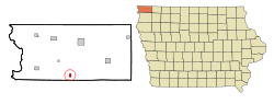
Coordinates: 43°16′43″N 96°13′55″W / 43.27861°N 96.23194°WCoordinates: 43°16′43″N 96°13′55″W / 43.27861°N 96.23194°W Country  United States
State  Iowa
IowaCounty Lyon Incorporated 1892 Area – Total 0.6 sq mi (1.5 km2) – Land 0.6 sq mi (1.5 km2) – Water 0.0 sq mi (0.0 km2) Elevation 1,296 ft (395 m) Population (2000) – Total 533 – Density 924.1/sq mi (356.8/km2) Time zone Central (CST) (UTC-6) – Summer (DST) CDT (UTC-5) ZIP code 51235 Area code(s) 712 FIPS code 19-21900 GNIS feature ID 0455957 Doon is a city in Lyon County, Iowa, United States, along the Rock River. The population was 533 at the 2000 census. The BNSF, or Burlington, Northern & Santa Fe Railway, passes through Doon.
Contents
History
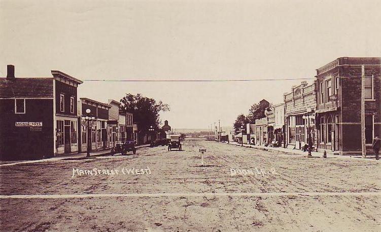
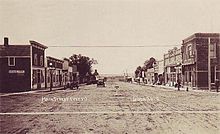 Main Street in 1922
Located on a plateau on the eastern bank of the Rock River, the city was named after the River Doon, made famous as the subject of Robert Burns' poem, Ye Banks and Braes o' Bonnie Doon. Founded by G. W. Bowers and A. H. Davison on September 6, 1889, the railway town was connected first by the Rock Valley Railway, followed by the Iowa & Dakota Railroad. The city was incorporated on March 8, 1892.
Geography
Doon is located at 43°16′43″N 96°13′55″W / 43.27861°N 96.23194°W (43.278727, -96.231922)[1].
According to the United States Census Bureau, the city has a total area of 0.6 square miles (1.6 km2), all of it land. Doon is drained by the Rock River, a tributary of the Big Sioux River.
The city is crossed by
 U.S. Route 75 and
  Iowa Highway 167.
Demographics
As of the census[2] of 2000, there were 533 people, 202 households, and 151 families residing in the city. The population density was 924.1 people per square mile (354.8/km²). There were 217 housing units at an average density of 376.2 per square mile (144.5/km²). The racial makeup of the city was 99.81% White and 0.19% Native American. Hispanic or Latino of any race were 0.38% of the population.
There were 202 households out of which 38.1% had children under the age of 18 living with them, 69.8% were married couples living together, 4.5% had a female householder with no husband present, and 24.8% were non-families. 22.8% of all households were made up of individuals and 9.9% had someone living alone who was 65 years of age or older. The average household size was 2.64 and the average family size was 3.13.
In the city the population was spread out with 30.0% under the age of 18, 9.0% from 18 to 24, 27.0% from 25 to 44, 18.6% from 45 to 64, and 15.4% who were 65 years of age or older. The median age was 32 years. For every 100 females there were 116.7 males. For every 100 females age 18 and over, there were 100.5 males.
The median income for a household in the city was $33,281, and the median income for a family was $39,773. Males had a median income of $26,607 versus $19,286 for females. The per capita income for the city was $14,698. About 6.4% of families and 7.0% of the population were below the poverty line, including 5.9% of those under age 18 and 12.1% of those age 65 or over.
Notable resident
- Frederick Manfred, author
References
- ^ "US Gazetteer files: 2010, 2000, and 1990". United States Census Bureau. 2011-02-12. http://www.census.gov/geo/www/gazetteer/gazette.html. Retrieved 2011-04-23.
- ^ "American FactFinder". United States Census Bureau. http://factfinder.census.gov. Retrieved 2008-01-31.
Further reading
- Tom Savage, A Dictionary of Iowa Place-names; 2007
- S. C. Hyde, Lyon County Genealogy -- Historical Sketch; 1872
External links
Municipalities and communities of Lyon County, Iowa Cities Alvord | Doon | George | Inwood | Larchwood | Lester | Little Rock | Rock Rapids

Unincorporated
communitiesBeloit | Granite
Categories:- Cities in Iowa
- Populated places in Lyon County, Iowa

Wikimedia Foundation. 2010.