- Larchwood, Iowa
Infobox Settlement
official_name = Larchwood, Iowa
settlement_type =City
nickname =
motto =
imagesize =
image_caption =
image_
imagesize =
image_caption =
image_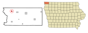
mapsize = 250px
map_caption = Location of Larchwood, Iowa
mapsize1 =
map_caption1 =subdivision_type = Country
subdivision_name =
subdivision_type1 = State
subdivision_name1 =
subdivision_type2 = County
subdivision_name2 = Lyon
government_footnotes =
government_type =
leader_title =
leader_name =
leader_title1 =
leader_name1 =
established_title =
established_date =unit_pref = Imperial
area_footnotes =area_magnitude =
area_total_km2 = 2.5
area_land_km2 = 2.5
area_water_km2 = 0.0
area_total_sq_mi = 1.0
area_land_sq_mi = 1.0
area_water_sq_mi = 0.0population_as_of = 2000
population_footnotes =
population_total = 788
population_density_km2 = 313.6
population_density_sq_mi = 812.1timezone = Central (CST)
utc_offset = -6
timezone_DST = CDT
utc_offset_DST = -5
elevation_footnotes =
elevation_m = 450
elevation_ft = 1476
latd = 43 |latm = 27 |lats = 16 |latNS = N
longd = 96 |longm = 26 |longs = 6 |longEW = Wpostal_code_type =
ZIP code
postal_code = 51241
area_code = 712
blank_name = FIPS code
blank_info = 19-43410
blank1_name = GNIS feature ID
blank1_info = 0458230
website =
footnotes =Larchwood is a city in Lyon County,
Iowa ,United States . The population was 788 at the 2000 census. Its main employer is the Novartis Animal Vaccines plant located 3 miles (5 km) southwest of the city.fact|date=January 2008Geography
Larchwood is located at coor dms|43|27|16|N|96|26|6|W|city (43.454351, -96.434897)GR|1.
According to the
United States Census Bureau , the city has a total area of 1.0square mile s (2.5km² ), all of it land.Demographics
As of the
census GR|2 of 2000, there were 788 people, 326 households, and 234 families residing in the city. Thepopulation density was 812.1 people per square mile (313.7/km²). There were 344 housing units at an average density of 354.5/sq mi (136.9/km²). The racial makeup of the city was 98.60% White, 0.13% Native American, 0.51% Asian, and 0.76% from two or more races.There were 326 households out of which 33.7% had children under the age of 18 living with them, 62.6% were married couples living together, 5.8% had a female householder with no husband present, and 28.2% were non-families. 26.4% of all households were made up of individuals and 15.3% had someone living alone who was 65 years of age or older. The average household size was 2.41 and the average family size was 2.91.
In the city the population was spread out with 24.2% under the age of 18, 10.0% from 18 to 24, 26.5% from 25 to 44, 20.6% from 45 to 64, and 18.7% who were 65 years of age or older. The median age was 38 years. For every 100 females there were 95.0 males. For every 100 females age 18 and over, there were 92.6 males.
The median income for a household in the city was $42,250, and the median income for a family was $48,125. Males had a median income of $30,938 versus $21,164 for females. The
per capita income for the city was $21,092. About 0.8% of families and 2.0% of the population were below thepoverty line , including 0.5% of those under age 18 and 8.6% of those age 65 or over.Notable natives
*
Kyle Vanden Bosch ,defensive end for theTennessee Titans References
External links
* [http://www.larchwoodiowa.com Larchwood, Iowa]
Wikimedia Foundation. 2010.