- Alburnett, Iowa
Infobox Settlement
official_name = Alburnett, Iowa
settlement_type =City
nickname =
motto =
imagesize =
image_caption =
image_
imagesize =
image_caption =
image_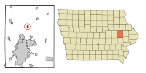
mapsize = 250x200px
map_caption = Location of Alburnett, Iowa
mapsize1 =
map_caption1 =subdivision_type = Country
subdivision_name =
subdivision_type1 = State
subdivision_name1 =
subdivision_type2 = County
subdivision_name2 = Linn
government_footnotes =
government_type =
leader_title =
leader_name =
leader_title1 =
leader_name1 =
established_title =
established_date =area_footnotes =
unit_pref = Imperial
area_magnitude =
area_total_km2 = 2.2
area_land_km2 = 2.2
area_water_km2 = 0.0
area_total_sq_mi = 0.9
area_land_sq_mi = 0.9
area_water_sq_mi = 0.0population_as_of = 2000
population_footnotes =
population_total = 559
population_density_km2 = 251.1
population_density_sq_mi = 650.3timezone = Central (CST)
utc_offset = -6
timezone_DST = CDT
utc_offset_DST = -5
elevation_footnotes =
elevation_m = 269
elevation_ft = 883
latd = 42 |latm = 8 |lats = 57 |latNS = N
longd = 91 |longm = 37 |longs = 11 |longEW = Wpostal_code_type =
ZIP code
postal_code = 52202
area_code = 319
blank_name = FIPS code
blank_info = 19-01000
blank1_name = GNIS feature ID
blank1_info = 0454117
website =
footnotes =Alburnett is a city in Linn County,
Iowa ,United States . The population was 559 at the 2000 census. It is part of the Cedar Rapids Metropolitan Statistical Area.History
In 1887, the
Illinois Central Railroad was built through Linn County's Otter Creek township. In the winter of that year a depot was built on land donated by Albert Burnett. Because he had given land for the depot, the name "Burnett" was chosen for its identification.Business interests began to center around the depot because the railroad offered an outlet to both the north and the south, and because of its proximity to
Cedar Rapids, Iowa . Mr. and Mrs. Burnett soon began planning a village.A short distant to the south Michael Weislogel, Sr. owned land on which he laid out lots. This development was called "Trentham". It was here that the first general store and post office was built. At the time, state law dictated that a depot and post office in the same community must carry the same name. Consequently, the post office name was changed to "Burnett".
Mail delivery problems soon developed between Burnett and the town of Bennett in Cedar County, Iowa. Mr. "Al" Burnett was forced to change the name of village to "Alburnett".
Alburnett was incorporated in 1912, becoming only incorporated town in the Otter Creek Township. The first elected mayor was C. E. Hense. Mr. Albert Burnett became one of the first councilmen, along with George Anderson, H.N. Rockwood, C.C. Naylor, and F.L. Glitchell.
Geography
Alburnett is located at coor dms|42|8|57|N|91|37|11|W|city (42.149257, -91.619618)GR|1.
According to the
United States Census Bureau , the city has a total area of 0.9square mile s (2.2km² ), all of it land.Demographics
As of the
census GR|2 of 2000, there were 559 people, 199 households, and 152 families residing in the city. Thepopulation density was 650.3 people per square mile (251.0/km²). There were 207 housing units at an average density of 240.8/sq mi (92.9/km²). The racial makeup of the city was 99.28% White, and 0.72% from two or more races. Hispanic or Latino of any race were 0.18% of the population.There were 199 households out of which 47.7% had children under the age of 18 living with them, 62.8% were married couples living together, 10.6% had a female householder with no husband present, and 23.6% were non-families. 21.6% of all households were made up of individuals and 10.1% had someone living alone who was 65 years of age or older. The average household size was 2.81 and the average family size was 3.32.
In the city the population was spread out with 34.5% under the age of 18, 6.4% from 18 to 24, 29.7% from 25 to 44, 19.7% from 45 to 64, and 9.7% who were 65 years of age or older. The median age was 32 years. For every 100 females there were 91.4 males. For every 100 females age 18 and over, there were 96.8 males.
The median income for a household in the city was $54,464, and the median income for a family was $61,094. Males had a median income of $41,442 versus $26,083 for females. The
per capita income for the city was $19,815. About 3.2% of families and 4.8% of the population were below thepoverty line , including 3.2% of those under age 18 and 12.0% of those age 65 or over.Government
Mayor
Trent B. Pearson
Council members
Dave Boesenberg, Jeremy Bartlet, Julie Towe, David Wood, and Craig Titler
The city council meets at 7:00 P.M. on the second Monday of each month at the Alburnett Fire Station Office, 120 N. Main Avenue.
References
External links
* [http://www.alburnett.com Alburnett Website]
* [http://www.alburnett.k12.ia.us Alburnett Community School District]
Wikimedia Foundation. 2010.