- Garrison, Iowa
Infobox Settlement
official_name = Garrison, Iowa
settlement_type =City
nickname =
motto =
imagesize =
image_caption =
image_
imagesize =
image_caption =
image_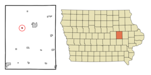
mapsize = 250px
map_caption = Location of Garrison, Iowa
mapsize1 =
map_caption1 =subdivision_type = Country
subdivision_name =
subdivision_type1 = State
subdivision_name1 =
subdivision_type2 = County
subdivision_name2 = Benton
government_footnotes =
government_type =
leader_title =
leader_name =
leader_title1 =
leader_name1 =
established_title =
established_date =unit_pref = Imperial
area_footnotes =area_magnitude =
area_total_km2 = 0.6
area_land_km2 = 0.6
area_water_km2 = 0.0
area_total_sq_mi = 0.2
area_land_sq_mi = 0.2
area_water_sq_mi = 0.0population_as_of = 2000
population_footnotes =
population_total = 413
population_density_km2 = 646.1
population_density_sq_mi = 1673.3timezone = Central (CST)
utc_offset = -6
timezone_DST = CDT
utc_offset_DST = -5
elevation_footnotes =
elevation_m = 268
elevation_ft = 879
latd = 42 |latm = 8 |lats = 37 |latNS = N
longd = 92 |longm = 8 |longs = 35 |longEW = Wpostal_code_type =
ZIP code
postal_code = 52229
area_code = 319
blank_name = FIPS code
blank_info = 19-30000
blank1_name = GNIS feature ID
blank1_info = 0456854
website =
footnotes =Garrison is a city in Benton County,
Iowa ,United States . The population was 413 at the 2000 census. It is part of the Cedar Rapids Metropolitan Statistical Area.Geography
Garrison is located at coor dms|42|8|37|N|92|8|35|W|city (42.143604, -92.143015)GR|1.
According to the
United States Census Bureau , the city has a total area of 0.2square mile s (0.6km² ), all of it land.Demographics
As of the
census GR|2 of 2000, there were 413 people, 159 households, and 113 families residing in the city. Thepopulation density was 1,673.3 people per square mile (637.8/km²). There were 177 housing units at an average density of 717.1/sq mi (273.4/km²). The racial makeup of the city was 97.82% White, 0.24% African American, 0.73% Asian, 0.24% from other races, and 0.97% from two or more races. Hispanic or Latino of any race were 1.69% of the population.There were 159 households out of which 32.7% had children under the age of 18 living with them, 58.5% were married couples living together, 11.3% had a female householder with no husband present, and 28.9% were non-families. 25.2% of all households were made up of individuals and 10.1% had someone living alone who was 65 years of age or older. The average household size was 2.60 and the average family size was 3.16.
In the city the population was spread out with 28.6% under the age of 18, 7.7% from 18 to 24, 27.6% from 25 to 44, 24.5% from 45 to 64, and 11.6% who were 65 years of age or older. The median age was 36 years. For every 100 females there were 93.9 males. For every 100 females age 18 and over, there were 95.4 males.
The median income for a household in the city was $187,485, and the median income for a family was $215,983. Males had a median income of $205,423 versus $164,824 for females. The
per capita income for the city was $126,857. About 10.5% of families and 13.0% of the population were below thepoverty line , including 22.2% of those under age 18 and 16.7% of those age 65 or over.Life in Garrison
In 2007 a remarkable description of life years ago in Garrison was published. The book is called "Little Heathens: Hard Times and High Spirits on an Iowa Farm During the Great Depression" (ISBN 978-0-553-38424-6). It was written by Mildred Armstrong Kalish who grew up in Garrison and became a Professor of English. The book tells of "a time, a place, and a way of life long gone."
Elizabeth Gilbert in theNew York Times Book Review wrote of "Little Heathens": "Not only trustworthy and useful, but also polished by real, rare happiness. It is a very good book, indeed. In fact, it's averyveryverygoodbook."References
External links
Wikimedia Foundation. 2010.