- Goorooyarroo Parish, Murray
Infobox Australian cadastral
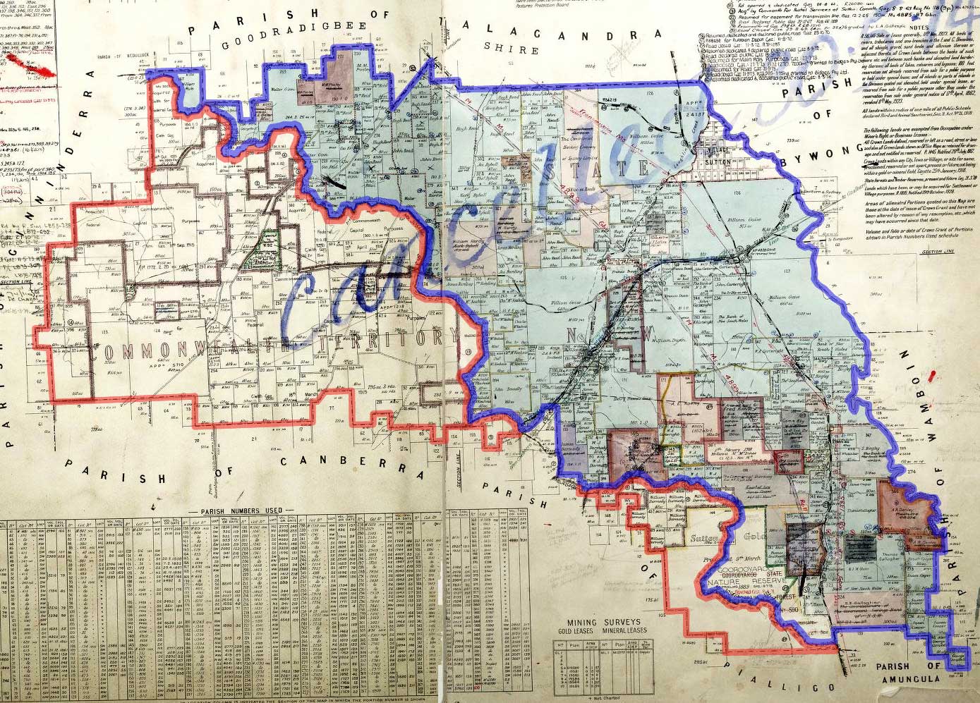
name = Goorooyarroo Parish
state = New South Wales
imagesize = 250px
caption = 1932 cadastral map with highlights: legend|#130eff|Boundary of Goorooyarroo parish since 1909 legend|#e5151a|Formerly part of the parish; transferred to the Commonwealth for the ACT in 1909
lga =Yarrowlumla Shire (former)
county = Murray
land district = Queanbeyan
division = Eastern
hundred =
est =
near-nw = Ginninderra
near-n = Talagandra
near-ne = Bywong
near-e = Wamboin
near-se = Amungula
near-s = Pialligo
near-sw = Canberra
near-w = GinninderraGoorooyarroo Parish, Murray County is a
parish ofMurray County, New South Wales , a cadastral unit for use onland titles . It is located to the north-east of theAustralian Capital Territory . About a third of the parish was transferred to the ACT in 1909; which included what is now the northern suburbs ofGungahlin . The [http://www.nationalparks.nsw.gov.au/parks.nsf/parkcontent/n0433?Opendocument&ParkKey=N0433&Type=Xo Goorooyarroo nature reserve] is in part of the area in the ACT which was part of the parish. [ [http://www.legislation.act.gov.au/di/2006-243/current/pdf/2006-243.pdf Legislation ACT government] ] A small part of theElectoral district of Monaro andElectoral district of Burrinjuck were in the parishas of 2007 as mentioned in their electoral district profiles. [ [http://www.elections.nsw.gov.au/state_government_elections/electoral_districts/all_districts_/burrinjuck Electoral commission of NSW, Burrinjuck electoral profile] ] [ [http://www.elections.nsw.gov.au/state_government_elections/electoral_districts/all_districts_/monaro Electoral commission of NSW, Monaro electoral profile] ]References
* [http://www.nla.gov.au/cdview/nla.map-gmod83-sd&mode=moreinfo Map showing proposed Federal Capital Territory and tenures of land within same, Charles Robt. Scrivener, 22nd May, 1909]
* [http://www.gnb.nsw.gov.au/name_search/extract?id=MaKqvqxOan Geographic names board of New South Wales]
Wikimedia Foundation. 2010.