- Ginninderra Parish, Murray
Infobox Australian cadastral
name = Ginninderra Parish
state = New South Wales
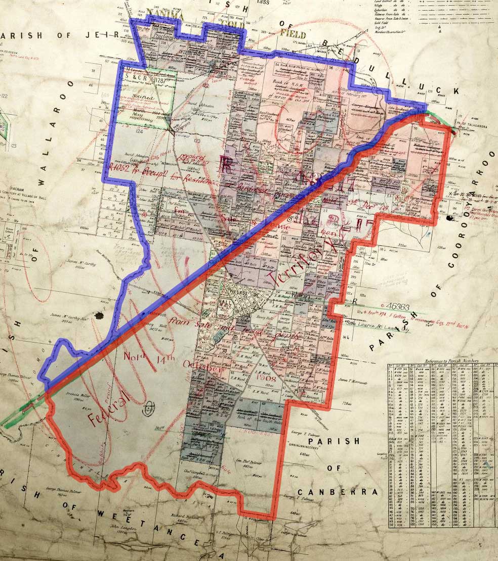
imagesize = 200px
caption = legend|#130eff|The Parish of Ginninderra since 1909 legend|#e5151a|Formerly part of the parish; transferred to the Commonwealth for the ACT in 1909
lga =Yass Valley Council
county = Murray
hundred =
est =
near-nw = Wallaroo
near-n = Bedulluck
near-ne = Talagandra
near-e = Goorooyarroo
near-se = Canberra
near-s = Weetangera
near-sw = Weetangera
near-w = WallarooGinninderra Parish, Murray County is one of the 54
parishes ofMurray County, New South Wales , a cadastral unit for use onland titles . It is now about half the size it was in the nineteenth century, after land in the parish was transferred to theAustralian Capital Territory in 1911. It once included what are now the north-western suburbs ofBelconnen , as well as Hall and part of WesternGungahlin , including Harcourt Hill in the modern suburb of Nicholls.Former boundaries
Before 1911, it included the area between Ginninderra Creek to the south to what is now near the northern tip of the
Australian Capital Territory to the north. Gooromon Creek was the boundary in the south-west. The parish included all of the present day suburbs of Fraser, Spence and Charnwood; and most of Flynn, Melba and Evatt (the parts north of Ginninderra Creek).References
* [http://nla.gov.au/nla.map-rm1753 Parish of Ginninderra, County of Murray, 1895]
* [http://www.nla.gov.au/cdview/nla.map-gmod83-sd&mode=moreinfo Map showing proposed Federal Capital Territory and tenures of land within same, Charles Robt. Scrivener, 22nd May, 1909]
* [http://www.gnb.nsw.gov.au/name_search/extract?id=MajLBKWAan Geographic Names Board of New South Wales]
Wikimedia Foundation. 2010.