- Weetangera Parish, Murray
Infobox Australian cadastral
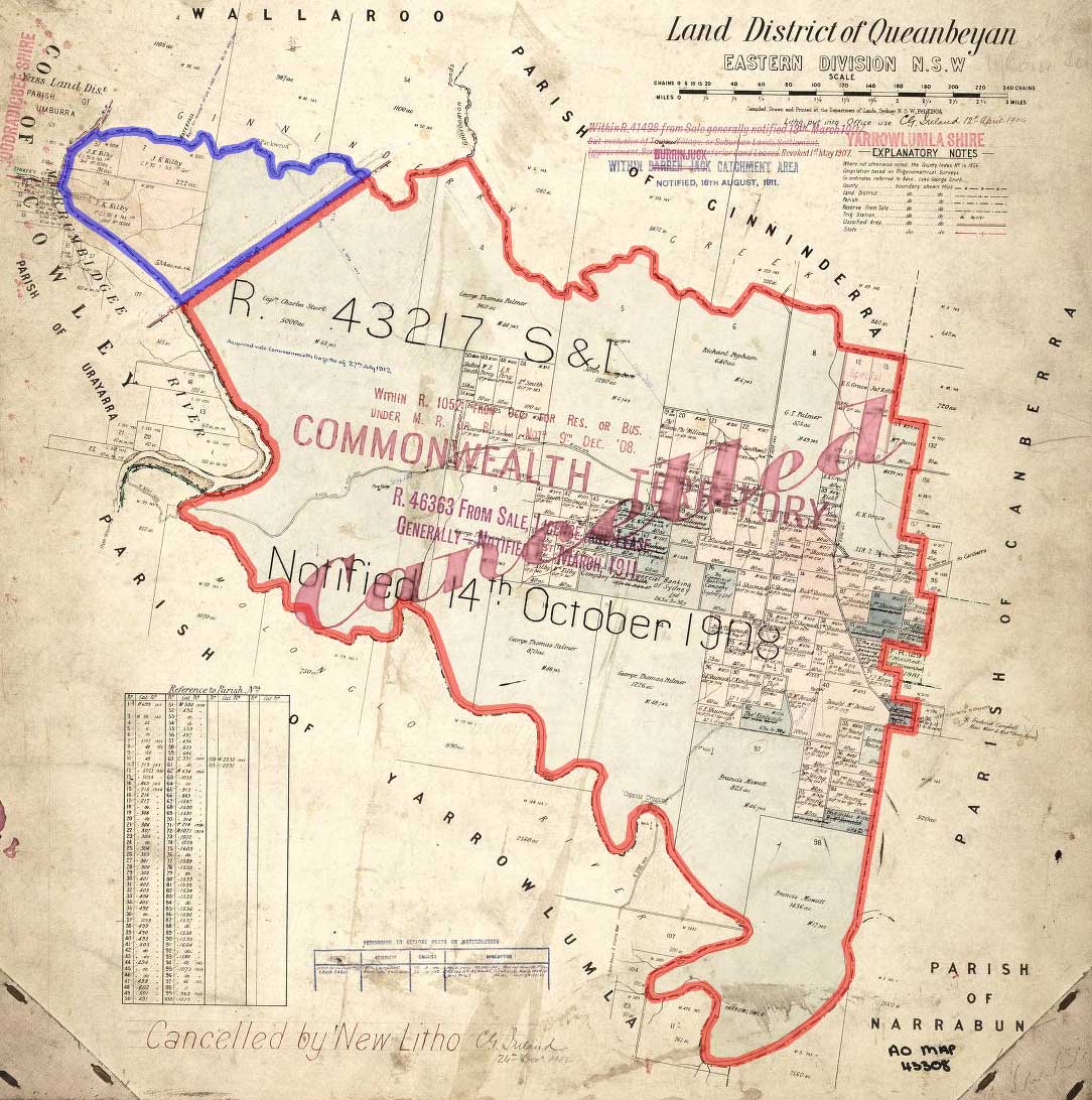
name = Weetangera Parish
state = New South Wales
imagesize = 200px
caption = legend|#130eff|The Parish of Weetangera since 1909 legend|#e5151a|Formerly part of the parish; transferred to the Commonwealth for the ACT in 1909
lga =Yass Valley Council
county = Murray
hundred =
est =
near-nw = Wallaroo
near-n = Ginninderra
near-ne = Canberra
near-e = Canberra
near-se = Narrabundah
near-s = Yarrolumla
near-sw = Urayarra (Cowley)
near-w = Urayarra (Cowley)Weetangera Parish, Murray County is a
parish ofMurray County, New South Wales , a cadastral unit for use onland titles . It is now very small, after most of the land in the parish was transferred to theAustralian Capital Territory in 1911, but it once included the south-west part of what is now theCanberra town centre ofBelconnen including the town centre. It currently includes a small section of land in New South Wales between the ACT border,Ginninderra Creek and theMurrumbidgee River .Former boundaries
Before 1911, it included the area between Ginninderra Creek to the north and the
Molonglo River to the south, with theMurrumbidgee River on the west, and land near what is currently the suburb of Aranda to the east. The name is still used today in the suburb of Weetangera, which was a small part of the much larger parish. In addition it included all of the present day suburbs of Holt, Higgins, Scullin, Florey, Hawker, Macquarie, and Cook, and the parts of Macgregor and Latham that are south of Ginninderra Creek.References
* [http://www.nla.gov.au/cdview/nla.map-gmod83-sd&mode=moreinfo Map showing proposed Federal Capital Territory and tenures of land within same, Charles Robt. Scrivener, 22nd May, 1909]
* [http://www.gnb.nsw.gov.au/name_search/extract?id=SXIOjzsyJP Geographic Names Board of New South Wales]
Wikimedia Foundation. 2010.