- Mount Akutan
-
Mount Akutan 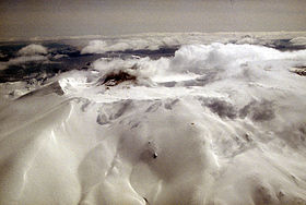
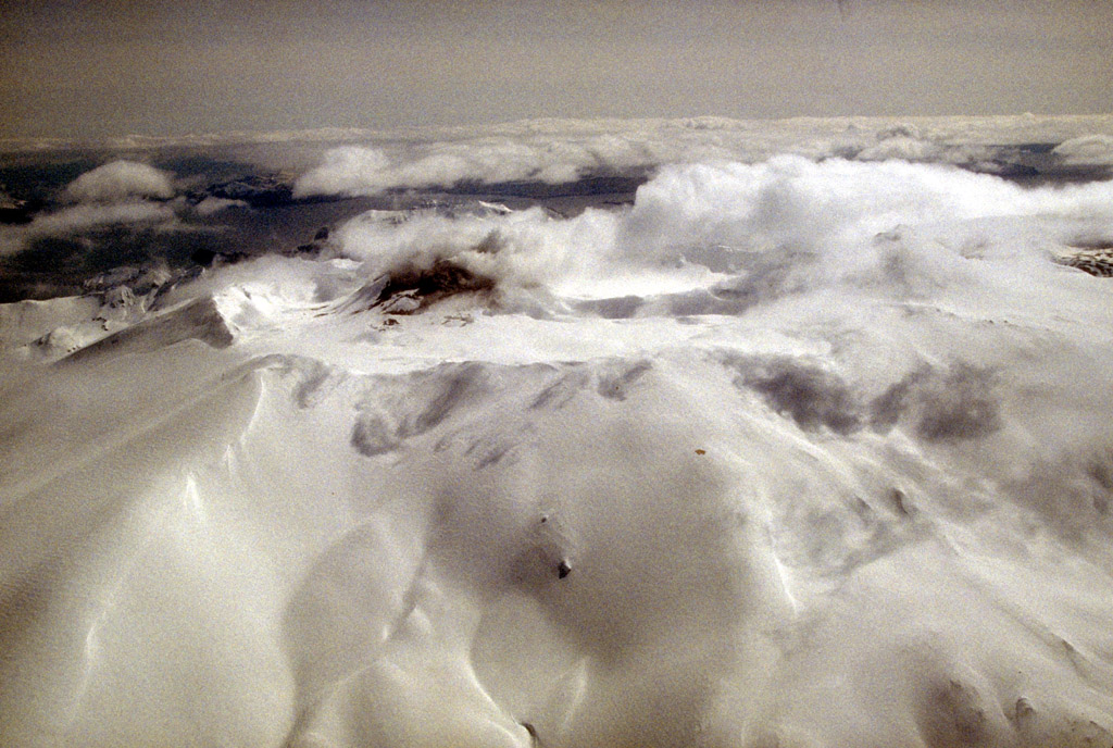
Aerial view of Akutan volcano that forms the west part of Akutan IslandElevation 4,275 ft (1,303 m) [1] Location Location Akutan Island, Alaska, USA Range Aleutian Range Coordinates 54°07′59″N 165°59′08″W / 54.13306°N 165.98556°WCoordinates: 54°07′59″N 165°59′08″W / 54.13306°N 165.98556°W[3] Topo map USGS Unimak A-6 NW[2] Geology Type Stratovolcano[1] Age of rock Pleistocene[1] Volcanic arc/belt Aleutian Arc[1] Last eruption 1992[1] Mount Akutan, officially Akutan Peak, is a stratovolcano in the Aleutian Islands of Alaska. Akutan Peak, at 4,275 feet (1,303 m), is the highest point on the caldera of the Akutan stratovolcano. Akutan contains a 2 km-wide caldera formed during a major explosive eruption about 1600 years ago. Recent eruptive activity has originated from a large cinder cone on the NE part of the caldera. It has been the source of frequent explosive eruptions with occasional lava effusion that blankets the caldera floor. A lava flow in 1978 traveled through a narrow breach in the north caldera rim to within 2 km of the coast. A small lake occupies part of the caldera floor. Two volcanic centers are located on the NW flank: Lava Peak is of Pleistocene age; and, a cinder cone lower on the flank which produced a lava flow in 1852 that extended the shoreline of the island and forms Lava Point. An older, mostly buried caldera seems to have formed in Pleistocene or Holocene time, while the current caldera formed in a VEI-5 eruption c. 340 AD.[4]
The volcano erupted most recently in 1992, but there is still fumarolic activity at the base of Lava Point and there are hot springs North-East of the caldera.[5]
See also
References
- ^ a b c d e "Akutan". Global Volcanism Program, Smithsonian Institution. http://www.volcano.si.edu/world/volcano.cfm?vnum=1101-32-. Retrieved 2009-01-16.
- ^ "Akutan Peak". Geographic Names Information System, U.S. Geological Survey. http://geonames.usgs.gov/pls/gnispublic/f?p=gnispq:3:::NO::P3_FID:1854189. Retrieved 2008-05-17.
- ^ "Akutan description and statistics". Alaska Volcano Observatory. http://www.avo.alaska.edu/volcanoes/volcinfo.php?volcname=Akutan&/akut.html. Retrieved 2008-05-17.
- ^ http://www.volcano.si.edu/world/volcano.cfm?vnum=1101-32-&volpage=erupt
- ^ http://www.volcano.si.edu/world/volcano.cfm?vnum=1101-32-
External links
- Alaska Volcano Observatory
- Volcanoes of the Alaska Peninsula and Aleutian Islands-Selected Photographs
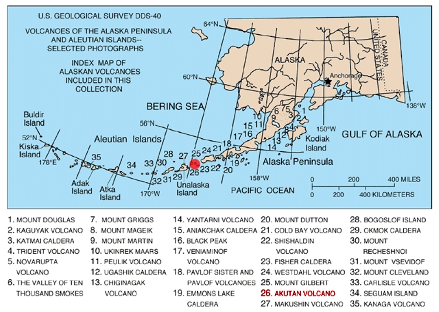
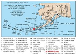 Map showing volcanoes of Alaska. The mark is set at the location of Mount Akutan.
 Categories:
- Landforms of Aleutians East Borough, Alaska
- Stratovolcanoes
- Pleistocene volcanoes
- Active volcanoes
- Mountains of Alaska
- Volcanoes of Alaska
- VEI-5 volcanoes
- Aleutian Range
- Southwest Alaska geography stubs
Wikimedia Foundation. 2010.