- Oldcotes
-
Coordinates: 53°23′N 1°07′W / 53.38°N 1.12°W
Oldcotes
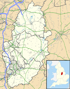
 Oldcotes shown within Nottinghamshire
OS grid reference SK5888 Shire county Nottinghamshire Region East Midlands Country England Sovereign state United Kingdom Police Nottinghamshire Fire Nottinghamshire Ambulance East Midlands EU Parliament East Midlands List of places: UK • England • Nottinghamshire Oldcotes is a village in Nottinghamshire, England. It is in the civil parish of Styrrup with Oldcotes. The village is centred around the crossroads of the A60 and A634 roads, five miles south east of Maltby.
The history of the village is long and varied. The earliest proof of occupation was the Roman Villa located under the church.
The main focus of the village centres on the Village Hall on Maltby Road, with a history society, bingo, bowls and dancing clubs. There is one public house in the village called the King William.
Hermeston Hall is located just to the south of the village.
External links
 Media related to Oldcotes at Wikimedia CommonsCategories:
- Villages in Nottinghamshire
- Nottinghamshire geography stubs
Wikimedia Foundation. 2010.

