- Mount Agassiz (California)
-
For other uses, see Mount Agassiz (disambiguation).
Mount Agassiz 
Mount Agassiz from Bishop Pass Trail.Elevation 13,899 ft (4,236 m) [1][2] Prominence 893 ft (272 m) [2] Parent peak North Palisade[3] Listing SPS peak[4] Location Fresno and Inyo counties, California, USA
 Mount Agassiz
Range Palisades, Sierra Nevada Coordinates 37°06′42″N 118°31′51″W / 37.1116003°N 118.5309396°WCoordinates: 37°06′42″N 118°31′51″W / 37.1116003°N 118.5309396°W[5] Topo map USGS North Palisade Climbing First ascent August 30, 1925 by Norman Clyde[6] Easiest route West slope,[6] scramble, (class 2)[4] Mount Agassiz, at 13,899 feet (4,236 m), is one of the twenty highest peaks of California. It is the northernmost, and easiest to climb, major summit of the Palisades.[6]
Contents
Geography
Agassiz is at the north end of the Palisades in the eastern Sierra Nevada, near Bishop Pass. It stands on the boundary between Kings Canyon National Park and Inyo National Forest, and Fresno and Inyo counties.[5]
History
In 1879, Lilbourne Winchell named it Agassiz Needle for Harvard University professor of zoology and geology Louis Agassiz.[7] Later, the USGS recognized it by its current name.
The peak is named after Swiss-American scientist Louis Agassiz. The name Agassiz Needle was originally applied to another nearby peak in 1879, likely Mount Winchell, but at some point the name moved to the current peak.[8]
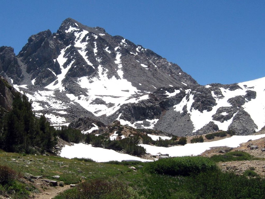
 A view of Mount Agassiz from the west, near Bishop Pass, showing a talus slope and several chutes, August 2007.
Climbing
There are three major routes to Agassiz's summit. The easiest is the west slope, both for its non-technical ascent and proximity to the Bishop Pass Trail. From South Lake, the trail climbs gently to Bishop Pass, and the summit route begins there. An attempt to ascend from the west via a chute can lead off route, to areas requiring more technical mountaineering skills and equipment.
Another class 2 scrambling route is the southeast face by the south ridge, from Agassiz Col.
A more technical route is the northeast face, which requires class 4 climbing. Norman Clyde established it by following a canyon, couloir and arête from Fifth Lake.[6]
See also
References
- ^ The NGVD 29 elevation of 13,893 feet was converted using VERTCON to the NAVD 88 elevation of 13,899 feet.
- ^ a b "Mount Agassiz, California". Peakbagger.com. http://www.peakbagger.com/peak.aspx?pid=2721. Retrieved 2007-08-18.
- ^ "North Palisade - California Mountain Atlas". Peaklist.org. http://www.PeakList.org/CAmtnatlas/tables/whitney/palisade.html. Retrieved 2008-09-08.
- ^ a b "Sierra Peaks Section List". Angeles Chapter, Sierra Club. http://angeles.sierraclub.org/sps/spslist.pdf. Retrieved 2011-06-06.
- ^ a b "Mount Agassiz". Geographic Names Information System, U.S. Geological Survey. http://geonames.usgs.gov/pls/gnispublic/f?p=gnispq:3:::NO::P3_FID:256133. Retrieved 2007-08-18.
- ^ a b c d Voge, Hervey Harper, ed. A Climber's Guide to the High Sierra (1st ed.). Sierra Club. LCCN 54014261. http://www.yosemite.ca.us/library/climbers_guide/palisades.html. Retrieved 2011-06-06.
- ^ Farquhar, Francis P. (1926). Place Names of the High Sierra. San Francisco: Sierra Club. http://www.yosemite.ca.us/library/place_names_of_the_high_sierra/a.html. Retrieved 2010-07-22.
- ^ Gudde, Erwin G. (1949). California Place Names. Berkeley: Univ. of California Press. p. 3.
External links
- "Mount Agassiz". SummitPost.org. http://www.summitpost.org/page/150921. Retrieved 2007-08-18.
Categories:- Mountains of Kings Canyon National Park
- Mountains of the John Muir Wilderness
- Mountains of Fresno County, California
- Mountains of Inyo County, California


Wikimedia Foundation. 2010.