- Priest River, Idaho
Infobox Settlement
official_name = Priest River, Idaho
other_name =
native_name =
nickname =
settlement_type =City
motto =
imagesize =
image_caption =
flag_size =
image_
seal_size =
image_shield =
shield_size =
image_blank_emblem =
blank_emblem_type =
blank_emblem_size =
imagesize =
image_caption =
flag_size =
image_
seal_size =
image_shield =
shield_size =
image_blank_emblem =
blank_emblem_type =
blank_emblem_size =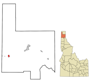
mapsize =
map_caption = Location in Bonner County and the state ofIdaho
mapsize1 =
map_caption1 =
image_dot_
dot_mapsize =
dot_map_caption =
dot_x =
dot_y =
pushpin_
pushpin_label_position =
pushpin_map_caption =
pushpin_mapsize =
subdivision_type = Country
subdivision_name =United States
subdivision_type1 = State
subdivision_name1 =Idaho
subdivision_type2 = County
subdivision_name2 = Bonner
subdivision_type3 =
subdivision_name3 =
subdivision_type4 =
subdivision_name4 =
government_footnotes =
government_type =
leader_title =
leader_name =
leader_title1 =
leader_name1 =
leader_title2 =
leader_name2 =
leader_title3 =
leader_name3 =
leader_title4 =
leader_name4 =
established_title =
established_date =
established_title2 =
established_date2 =
established_title3 =
established_date3 =
area_magnitude =
unit_pref = Imperial
area_footnotes =
area_total_km2 = 4.2
area_land_km2 = 4.1
area_water_km2 = 0.1
area_total_sq_mi = 1.6
area_land_sq_mi = 1.6
area_water_sq_mi = 0.0
area_water_percent =
area_urban_km2 =
area_urban_sq_mi =
area_metro_km2 =
area_metro_sq_mi =
area_blank1_title =
area_blank1_km2 =
area_blank1_sq_mi =
population_as_of = 2000
population_footnotes =
population_note =
population_total = 1754
population_density_km2 = 424.2
population_density_sq_mi = 1098.8
population_metro =
population_density_metro_km2 =
population_density_metro_sq_mi =
population_urban =
population_density_urban_km2 =
population_density_urban_sq_mi =
population_blank1_title =
population_blank1 =
population_density_blank1_km2 =
population_density_blank1_sq_mi =
timezone = Pacific (PST)
utc_offset = -8
timezone_DST = PDT
utc_offset_DST = -7
latd = 48
latm = 11
lats = 0
latNS = N
longd = 116
longm = 54
longs = 34
longEW = W
elevation_footnotes =
elevation_m = 652
elevation_ft = 2139
postal_code_type =ZIP code
postal_code = 83856
area_code = 208
blank_name = FIPS code
blank_info = 16-65530
blank1_name = GNIS feature ID
blank1_info = 0397069
website =
footnotes = Priest River is a city in Bonner County,Idaho ,United States . The population was 1,754 at the 2000 census.Geography
Priest River is located at coor dms|48|11|0|N|116|54|34|W|city (48.183388, -116.909555)GR|1.
According to the
United States Census Bureau , the city has a total area of 1.6square mile s (4.2km² ), of which, 1.6 square miles (4.1 km²) of it is land and 0.04 square miles (0.1 km²) of it (1.84%) is water.Demographics
As of the
census GR|2 of 2000, there were 1,754 people, 692 households, and 469 families residing in the city. Thepopulation density was 1,098.8 people per square mile (423.3/km²). There were 762 housing units at an average density of 477.4/sq mi (183.9/km²). The racial makeup of the city was 94.70% White, 1.43% Native American, 0.46% Asian, 0.51% from other races, and 2.91% from two or more races. Hispanic or Latino of any race were 1.60% of the population.There were 692 households out of which 35.1% had children under the age of 18 living with them, 54.9% were married couples living together, 9.1% had a female householder with no husband present, and 32.2% were non-families. 26.6% of all households were made up of individuals and 12.4% had someone living alone who was 65 years of age or older. The average household size was 2.53 and the average family size was 3.09.
In the city the population was spread out with 28.9% under the age of 18, 8.4% from 18 to 24, 26.6% from 25 to 44, 21.9% from 45 to 64, and 14.1% who were 65 years of age or older. The median age was 35 years. For every 100 females there were 96.0 males. For every 100 females age 18 and over, there were 93.3 males.
The median income for a household in the city was $26,765, and the median income for a family was $32,198. Males had a median income of $30,607 versus $16,034 for females. The
per capita income for the city was $14,125. About 14.0% of families and 18.9% of the population were below thepoverty line , including 27.7% of those under age 18 and 9.7% of those age 65 or over.References
External links
* [http://www.priestriver.org/ Priest River Website]
Wikimedia Foundation. 2010.