- Maalaea, Hawaii
Infobox Settlement
official_name = Maalaea, Hawaii
other_name =
native_name =
nickname =
settlement_type = CDP
motto =
imagesize =
image_caption =
flag_size =
image_
seal_size =
image_shield =
shield_size =
image_blank_emblem =
blank_emblem_type =
blank_emblem_size =
imagesize =
image_caption =
flag_size =
image_
seal_size =
image_shield =
shield_size =
image_blank_emblem =
blank_emblem_type =
blank_emblem_size =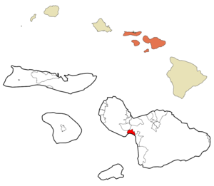
mapsize =
map_caption = Location in Maui County and the state ofHawaii
mapsize1 =
map_caption1 =
image_dot_
dot_mapsize =
dot_map_caption =
dot_x =
dot_y =
pushpin_
pushpin_label_position =
pushpin_map_caption =
pushpin_mapsize =
subdivision_type = Country
subdivision_name =United States
subdivision_type1 = State
subdivision_name1 =Hawaii
subdivision_type2 = County
subdivision_name2 = Maui
subdivision_type3 =
subdivision_name3 =
subdivision_type4 =
subdivision_name4 =
government_footnotes =
government_type =
leader_title =
leader_name =
leader_title1 =
leader_name1 =
leader_title2 =
leader_name2 =
leader_title3 =
leader_name3 =
leader_title4 =
leader_name4 =
established_title =
established_date =
established_title2 =
established_date2 =
established_title3 =
established_date3 =
area_magnitude =
unit_pref = Imperial
area_footnotes =
area_total_km2 = 19.9
area_land_km2 = 12.3
area_water_km2 = 7.5
area_total_sq_mi = 7.7
area_land_sq_mi = 4.8
area_water_sq_mi = 2.9
area_water_percent =
area_urban_km2 =
area_urban_sq_mi =
area_metro_km2 =
area_metro_sq_mi =
area_blank1_title =
area_blank1_km2 =
area_blank1_sq_mi =
population_as_of = 2000
population_footnotes =
population_note =
population_total = 454
population_density_km2 = 36.8
population_density_sq_mi = 95.3
population_metro =
population_density_metro_km2 =
population_density_metro_sq_mi =
population_urban =
population_density_urban_km2 =
population_density_urban_sq_mi =
population_blank1_title =
population_blank1 =
population_density_blank1_km2 =
population_density_blank1_sq_mi =
timezone = Hawaii-Aleutian
utc_offset = -10
timezone_DST =
utc_offset_DST =
latd = 20
latm = 48
lats = 34
latNS = N
longd = 156
longm = 29
longs = 27
longEW = W
elevation_footnotes =
elevation_m = 30
elevation_ft = 98
postal_code_type =
postal_code =
area_code = 808
blank_name = FIPS code
blank_info = 15-46400
blank1_name = GNIS feature ID
blank1_info = 0361945
website =
footnotes = Māokinaalaea is acensus-designated place (CDP) in Maui County, Hawaiokinai,United States . The population was 454 at the 2000 census. Māokinaalaea is the site of a small boat harbor, as well as the state-of-the-artMaui Ocean Center .Geography
Māokinaalaea is located at coor dms|20|48|34|N|156|29|27|W|city (20.809336, -156.490729)GR|1.
According to the
United States Census Bureau , the CDP has a total area of 7.7square mile s (19.9km² ), of which, 4.8 square miles (12.4 km²) of it is land and 2.9 square miles (7.5 km²) of it (37.94%) is water.Demographics
As of the
census GR|2 of 2000, there were 454 people, 263 households, and 119 families residing in the CDP. Thepopulation density was 95.3 people per square mile (36.7/km²). There were 600 housing units at an average density of 125.9/sq mi (48.6/km²). The racial makeup of the CDP was 85.90% White, 0.22% African American, 0.44% Native American, 6.61% Asian, 1.54% Pacific Islander, 0.88% from other races, and 4.41% from two or more races. Hispanic or Latino of any race were 4.41% of the population.There were 263 households out of which 5.7% had children under the age of 18 living with them, 39.2% were married couples living together, 4.6% had a female householder with no husband present, and 54.4% were non-families. 42.6% of all households were made up of individuals and 7.6% had someone living alone who was 65 years of age or older. The average household size was 1.73 and the average family size was 2.27.
In the CDP the population was spread out with 6.6% under the age of 18, 2.2% from 18 to 24, 23.8% from 25 to 44, 44.5% from 45 to 64, and 22.9% who were 65 years of age or older. The median age was 53 years. For every 100 females there were 112.1 males. For every 100 females age 18 and over, there were 112.0 males.
The median income for a household in the CDP was $53,750, and the median income for a family was $72,083. Males had a median income of $36,544 versus $36,250 for females. The
per capita income for the CDP was $43,571. About 3.3% of families and 3.7% of the population were below thepoverty line , including 23.5% of those under age 18 and none of those age 65 or over.Surfing
The wave called Māokinaalaea, or freight train is a right-hander off the jetty and over a shallow coral reef. it is considered to be one of the world's fastest waves, but happen only on large southerly swells . A proposed extension of the jetty to enlarge the harbor will destroy the wave and much of the coral reef.
Notes
References
*Citation
last = Clark
first = John R. K.
title = The Beaches of Maui County
publisher = University of Hawaii Press
year = 1989
pages = 50-51
isbn = 0824812468.External links
Wikimedia Foundation. 2010.