- Anahola, Hawaii
Infobox Settlement
official_name = Anahola, Hawaii
other_name =
native_name =
nickname =
settlement_type = CDP
motto =
imagesize =
image_caption =
flag_size =
image_
seal_size =
image_shield =
shield_size =
image_blank_emblem =
blank_emblem_type =
blank_emblem_size =
imagesize =
image_caption =
flag_size =
image_
seal_size =
image_shield =
shield_size =
image_blank_emblem =
blank_emblem_type =
blank_emblem_size =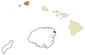
mapsize =
map_caption = Location in Kauai County and the state ofHawaii
mapsize1 =
map_caption1 =
image_dot_
dot_mapsize =
dot_map_caption =
dot_x =
dot_y =
pushpin_
pushpin_label_position =
pushpin_map_caption =
pushpin_mapsize =
subdivision_type = Country
subdivision_name =United States
subdivision_type1 = State
subdivision_name1 =Hawaii
subdivision_type2 = County
subdivision_name2 = Kauai
subdivision_type3 =
subdivision_name3 =
subdivision_type4 =
subdivision_name4 =
government_footnotes =
government_type =
leader_title =
leader_name =
leader_title1 =
leader_name1 =
leader_title2 =
leader_name2 =
leader_title3 =
leader_name3 =
leader_title4 =
leader_name4 =
established_title =
established_date =
established_title2 =
established_date2 =
established_title3 =
established_date3 =
area_magnitude =
unit_pref = Imperial
area_footnotes =
area_total_km2 = 10.2
area_land_km2 = 9.7
area_water_km2 = 0.5
area_total_sq_mi = 3.9
area_land_sq_mi = 3.8
area_water_sq_mi = 0.2
area_water_percent =
area_urban_km2 =
area_urban_sq_mi =
area_metro_km2 =
area_metro_sq_mi =
area_blank1_title =
area_blank1_km2 =
area_blank1_sq_mi =
population_as_of = 2000
population_footnotes =
population_note =
population_total = 1932
population_density_km2 = 198.8
population_density_sq_mi = 514.8
population_metro =
population_density_metro_km2 =
population_density_metro_sq_mi =
population_urban =
population_density_urban_km2 =
population_density_urban_sq_mi =
population_blank1_title =
population_blank1 =
population_density_blank1_km2 =
population_density_blank1_sq_mi =
timezone = Hawaii-Aleutian
utc_offset = -10
timezone_DST =
utc_offset_DST =
latd = 22
latm = 8
lats = 42
latNS = N
longd = 159
longm = 18
longs = 47
longEW = W
elevation_footnotes =
elevation_m = 9
elevation_ft = 30
postal_code_type =ZIP code
postal_code = 96703
area_code = 808
blank_name = FIPS code
blank_info = 15-02200
blank1_name = GNIS feature ID
blank1_info = 0358587
website =
footnotes = Anahola is acensus-designated place (CDP) in Kauaokinai County, Hawaiokinai,United States . The population was 1,932 at the 2000 census.History
During the reign of King
Kamehameha I , the islands of Kauaʻi was one of the last Hawaiian islands to join Kamehameha'sKingdom of Hawaiʻi . The ruler,Kaumualii , resisted Kamehameha for years, surviving two attempts to invade Kaua'i.Geography
Anahola is located at coor dms|22|8|42|N|159|18|47|W|city (22.145049, -159.312969)GR|1.
According to the
United States Census Bureau , the CDP has a total area of 3.9square mile s (10.2km² ), of which, 3.8 square miles (9.7 km²) of it is land and 0.2 square miles (0.5 km²) of it (4.57%) is water.The community is located on
Hawaii Route 56 at the northeast coast of the island ofKauai . Anahola is adjacent to Anahola Bay, abay of thePacific Ocean .Demographics
As of the
census GR|2 of 2000, there were 1,932 people, 549 households, and 422 families residing in the CDP. Thepopulation density was 514.8 people per square mile (198.9/km²). There were 606 housing units at an average density of 161.5/sq mi (62.4/km²). The racial makeup of the CDP was 13.72% White, 0.36% African American, 0.47% Native American, 7.14% Asian, 47.72% Pacific Islander, 1.40% from other races, and 29.19% from two or more races. Hispanic or Latino of any race were 8.13% of the population.There were 549 households out of which 36.4% had children under the age of 18 living with them, 53.2% were married couples living together, 17.5% had a female householder with no husband present, and 23.0% were non-families. 14.6% of all households were made up of individuals and 3.5% had someone living alone who was 65 years of age or older. The average household size was 3.52 and the average family size was 3.98.
In the CDP the population was spread out with 31.7% under the age of 18, 9.5% from 18 to 24, 27.8% from 25 to 44, 22.8% from 45 to 64, and 8.2% who were 65 years of age or older. The median age was 32 years. For every 100 females there were 101.0 males. For every 100 females age 18 and over, there were 95.6 males.
The median income for a household in the CDP was $41,771, and the median income for a family was $41,302. Males had a median income of $25,875 versus $27,000 for females. The
per capita income for the CDP was $13,829. About 12.4% of families and 14.2% of the population were below thepoverty line , including 21.5% of those under age 18 and 4.9% of those age 65 or over.References
External links
* [http://www.anaholahawaii.com/ Anahola webpage]
* [http://www.kauai.gov/ Kauai County page]
Wikimedia Foundation. 2010.