- Kawela Bay, Hawai'i
Infobox Settlement
official_name = Kawela Bay, Hawaii
other_name =
native_name =
nickname =
settlement_type = CDP
motto =
imagesize =
image_caption =
flag_size =
image_
seal_size =
image_shield =
shield_size =
image_blank_emblem =
blank_emblem_type =
blank_emblem_size =
imagesize =
image_caption =
flag_size =
image_
seal_size =
image_shield =
shield_size =
image_blank_emblem =
blank_emblem_type =
blank_emblem_size =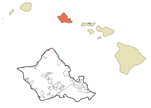
mapsize =
map_caption = Location in Honolulu County and the state ofHawaii
mapsize1 =
map_caption1 =
image_dot_
dot_mapsize =
dot_map_caption =
dot_x =
dot_y =
pushpin_
pushpin_label_position =
pushpin_map_caption =
pushpin_mapsize =
subdivision_type = Country
subdivision_name =United States
subdivision_type1 = State
subdivision_name1 =Hawaii
subdivision_type2 =
subdivision_name2 =
subdivision_type3 =
subdivision_name3 =
subdivision_type4 =
subdivision_name4 =
government_footnotes =
government_type =
leader_title =
leader_name =
leader_title1 =
leader_name1 =
leader_title2 =
leader_name2 =
leader_title3 =
leader_name3 =
leader_title4 =
leader_name4 =
established_title =
established_date =
established_title2 =
established_date2 =
established_title3 =
established_date3 =
area_magnitude =
unit_pref = Imperial
area_footnotes =
area_total_km2 = 5.2
area_land_km2 = 1.5
area_water_km2 = 3.7
area_total_sq_mi = 2.0
area_land_sq_mi = 0.6
area_water_sq_mi = 1.4
area_water_percent =
area_urban_km2 =
area_urban_sq_mi =
area_metro_km2 =
area_metro_sq_mi =
area_blank1_title =
area_blank1_km2 =
area_blank1_sq_mi =
population_as_of = 2000
population_footnotes =
population_note =
population_total = 410
population_density_km2 = 270.7
population_density_sq_mi = 701.1
population_metro =
population_density_metro_km2 =
population_density_metro_sq_mi =
population_urban =
population_density_urban_km2 =
population_density_urban_sq_mi =
population_blank1_title =
population_blank1 =
population_density_blank1_km2 =
population_density_blank1_sq_mi =
timezone = Hawaii-Aleutian
utc_offset = -10
timezone_DST =
utc_offset_DST =
latd = 21
latm = 42
lats = 10
latNS = N
longd = 158
longm = 0
longs = 40
longEW = W
elevation_footnotes =
elevation_m = 0
elevation_ft = 0
postal_code_type =
postal_code =
area_code = 808
blank_name = FIPS code
blank_info = 15-32700
blank1_name = GNIS feature ID
blank1_info = 1867256
website =
footnotes = Kawela Bay is acensus-designated place and small community in the Kookinaolauloa District on the Island of Ookinaahu, City & County of Honolulu. In Hawaiian, "ka wela" means "the heat". As of the 2000 Census, the CDP had a total population of 410.Kawela Bay is adjacent to (just west of) Turtle Bay and the Kuilima Resort. These coastal features and shorelines (including Kawela Bay itself) are mostly hidden from the traveler along Kamehameha Highway, although access to the shore can be found at Waialeokinae Beach Park with scenic Kukaimanini, an offshore islet. This area (for those travelling west) begins the North Shore of Ookinaahu. For those travelling east, the road turns inland at Kawela to cross the Kahuku Plain, coming again to the coast at Hukilau Beach in Lāokinaie on the windward ("kookinaolau") side of Ookinaahu.
The U.S.
postal code for Kawela Bay and nearby Kuilima is 96731.Geography
Kawela Bay is located at 21°42'10" North, 158°0'40" West (21.702767, -158.010997)GR|1. This community is located west of Kuilima and Kahuku and east from the communities of Waialeokinae, Sunset Beach, and Pūpūkea along Kamehameha Highway (State Rte. 83).
According to the
United States Census Bureau , the CDP has a total area of 2.0square mile s (5.2km² ), of which, 0.6 square miles (1.5 km²) of it is land and 1.4 square miles (3.7 km²) of it is water. The total area is 71.14% water, a statistic that can only be described as meaningless in as much as it is that portion of the census tract drawn out into thePacific Ocean (possibly large because of Kawela and Turtle bays).Demographics
As of the 2000 Census, there were 410 people, 189 households, and 113 families residing in the CDP. The
population density was 701.1 people per square mile (272.9/km²). There were 424 housing units at an average density of 725.1/sq mi (282.3/km²). The racial makeup of the CDP was 73.90% White, 0.98% Black or African American, 0.00% Native American, 8.78% Asian, 2.20% Pacific Islander, 1.22% from other races, and 12.93% from two or more races. 4.63% of the population were Hispanic or Latino of any race.There were 189 households out of which 21.7% had children under the age of 18 living with them, 47.1% were married couples living together, 9.5% had a female householder with no husband present, and 40.2% were non-families. 29.1% of all households were made up of individuals and 6.9% had someone living alone who was 65 years of age or older. The average household size was 2.17 and the average family size was 2.65.
In this census unit the population was spread out with 17.1% under the age of 18, 8.3% from 18 to 24, 28.3% from 25 to 44, 35.4% from 45 to 64, and 11.0% who were 65 years of age or older. The median age was 42 years. For every 100 females there were 114.7 males. For every 100 females age 18 and over, there were 109.9 males.
The median income for a household in the CDP was $49,167, and the median income for a family was $58,125. Males had a median income of $35,938 versus $36,625 for females. The
per capita income for the area was $28,481. 11.4% of the population and 10.1% of families were below thepoverty line . Out of the total population, 4.9% of those under the age of 18 and 0.0% of those 65 and older were living below the poverty line.References
Puukui, Mary K., S. H. Elbert, and E. T. Mookini. 1976. "Place Names of Hawaiokinai". The University Press of Hawaiokinai. 289 pp. External links
Wikimedia Foundation. 2010.