- Honoka'a, Hawai'i
Infobox Settlement
official_name = Honokaa, Hawaii
other_name =
native_name =
nickname =
settlement_type = CDP
motto =
imagesize =
image_caption =
flag_size =
image_
seal_size =
image_shield =
shield_size =
image_blank_emblem =
blank_emblem_type =
blank_emblem_size =
imagesize =
image_caption =
flag_size =
image_
seal_size =
image_shield =
shield_size =
image_blank_emblem =
blank_emblem_type =
blank_emblem_size =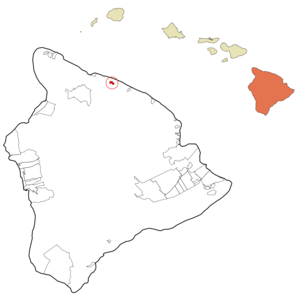
mapsize =
map_caption = Location in Hawaii County and the state ofHawaii
mapsize1 =
map_caption1 =
image_dot_
dot_mapsize =
dot_map_caption =
dot_x =
dot_y =
pushpin_
pushpin_label_position =
pushpin_map_caption =
pushpin_mapsize =
subdivision_type = Country
subdivision_name =United States
subdivision_type1 = State
subdivision_name1 =Hawaii
subdivision_type2 = County
subdivision_name2 = Hawaii
subdivision_type3 =
subdivision_name3 =
subdivision_type4 =
subdivision_name4 =
government_footnotes =
government_type =
leader_title =
leader_name =
leader_title1 =
leader_name1 =
leader_title2 =
leader_name2 =
leader_title3 =
leader_name3 =
leader_title4 =
leader_name4 =
established_title =
established_date =
established_title2 =
established_date2 =
established_title3 =
established_date3 =
area_magnitude =
unit_pref = Imperial
area_footnotes =
area_total_km2 = 3.3
area_land_km2 = 3.3
area_water_km2 = 0.0
area_total_sq_mi = 1.3
area_land_sq_mi = 1.3
area_water_sq_mi = 0.0
area_water_percent =
area_urban_km2 =
area_urban_sq_mi =
area_metro_km2 =
area_metro_sq_mi =
area_blank1_title =
area_blank1_km2 =
area_blank1_sq_mi =
population_as_of = 2000
population_footnotes =
population_note =
population_total = 2233
population_density_km2 = 671.6
population_density_sq_mi = 1739.5
population_metro =
population_density_metro_km2 =
population_density_metro_sq_mi =
population_urban =
population_density_urban_km2 =
population_density_urban_sq_mi =
population_blank1_title =
population_blank1 =
population_density_blank1_km2 =
population_density_blank1_sq_mi =
timezone = Hawaii-Aleutian
utc_offset = -10
timezone_DST =
utc_offset_DST =
latd = 20
latm = 4
lats = 39
latNS = N
longd = 155
longm = 27
longs = 51
longEW = W
elevation_footnotes =
elevation_m = 303
elevation_ft = 994
postal_code_type =ZIP code
postal_code = 96727
area_code = 808
blank_name = FIPS code
blank_info = 15-16450
blank1_name = GNIS feature ID
blank1_info = 0359281
website =
footnotes = Honokaokinaa is acensus-designated place (CDP) in Hawaiokinai County, Hawaiokinai,United States . The population was 2,233 at the 2000 census.Geography
Honokaokinaa is located at coor dms|20|4|39|N|155|27|51|W|city (20.077617, -155.464074).GR|1
According to the
United States Census Bureau , the CDP has a total area of 1.3square mile s (3.3km² ), all of it land.Demographics
As of the
census GR|2 of 2000, there were 2,233 people, 761 households, and 563 families residing in the CDP. Thepopulation density was 1,739.5 people per square mile (673.6/km²). There were 835 housing units at an average density of 650.5/sq mi (251.9/km²). The racial makeup of the CDP was 25.03% White, 0.09% African American, 0.04% Native American, 42.86% Asian, 3.94% Pacific Islander, 1.03% from other races, and 27.00% from two or more races. Hispanic or Latino of any race were 9.63% of the population.There were 761 households out of which 29.2% had children under the age of 18 living with them, 54.1% were married couples living together, 14.5% had a female householder with no husband present, and 25.9% were non-families. 23.1% of all households were made up of individuals and 14.1% had someone living alone who was 65 years of age or older. The average household size was 2.88 and the average family size was 3.37.
In the CDP the population was spread out with 25.2% under the age of 18, 7.1% from 18 to 24, 24.4% from 25 to 44, 21.7% from 45 to 64, and 21.6% who were 65 years of age or older. The median age was 40 years. For every 100 females there were 94.3 males. For every 100 females age 18 and over, there were 93.4 males.
The median income for a household in the CDP was $41,964, and the median income for a family was $45,962. Males had a median income of $28,359 versus $23,750 for females. The
per capita income for the CDP was $17,226. About 6.0% of families and 9.6% of the population were below thepoverty line , including 11.5% of those under age 18 and 4.5% of those age 65 or over.History
Honokaokinaa's economy was based primarily on the sugar production of The Hāmākua Sugar Company from 1873 to 1994 when Hawaiian sugar grew out of demand. With the closing of the Honokaokinaa sugar production, the economy has been in decline. However, Honokaokinaa has remained afloat without being hit too hard by the economic downturn.
The Big Island's Hāmākua Coast was the classic plantation community
People
Honokaokinaa is the home of the State of Hawaiokinai's Fourth Governor,
John D. Waihee III , who served from December 2, 1986 to December 2, 1994. Waihee is the first Native Hawaiian to hold that office of any of the United States.Culture
Honokaokinaa boasts a quaint and pleasant historic appeal about its downtown district. In 1930, The Honokaokinaa People's Theatre was built on Māmane Street by the Tanimoto family. Since 1993, the theater has hosted the Hāmākua Music Festival every Fall. The festival has hosted a number of renowned jazz, classical, and Hawaiian folk musicians including Ray Brown,
Gene Harris ,James Moody , Ken Peplowski,Howard Alden , Eric Marienthal,Big Brother and the Holding Company ,Hubert Laws , and many others. It has also contributed to the economy by bringing some tourism to the town since the Hāmākua Sugar Company discontinued the production of sugar in and around Honokaokinaa in 1994.Ranching, along with nascent diversified agriculture, is the primary industry in Honokaokinaa and the
Hamakua District. Honokaokinaa now boasts a Saturday farmers' market, held on Māmane Street, and nearby, the Andrade Meat Market, featuring locally raised and grass fed beef.While ranching and rodeos may seem idiosyncratic to some visitors, ranching in Hawaiokinai actually boasts a longer tradition than the United States mainland. This tradition is celebrated annually on Western Weekend, which in 2007 is from May 25 to May 28, and includes children's activities, Country Western Bands, a block party with Paniolo barbecue, a rodeo, and the ribald Saloon Girl Contest!
School
Honokaokinaa is home to the Honokaokinaa Dragons. There is the Honokaokinaa Elementary School then Honokaokinaa Middle School, and finally the High School. They are also known for their basketball team, both boys and girls. As a matter of fact, this past year the Wahine Dragons Varsity team placed 3rd in the HHSAA Basketball tournament.
References
External links
* [http://www.hamakuamusicfestival.com Hamakua Music Festival] Official website of the Hāmākua Music Festival.
Wikimedia Foundation. 2010.