- Pennsylvania Route 351
-
PA Route 351
Route information Maintained by PennDOT Length: 17.3 mi[1] (27.8 km) Existed: 1928 – present Major junctions West end:  SR 617 at the Ohio state line near S.N.P.J.
 PA 551 in Enon Valley
 PA 168 in New Galilee


 I-76 / Penna. Tpk. / I-376 in Big Beaver
 PA 18 in Koppel
East end: 
 PA 65 / PA 288 in Ellwood City
Location Counties: Lawrence, Beaver Highway system Roads in Pennsylvania
Interstate • US • State • Legislative←  PA 350
PA 352  →
→←  PA 450
PA 452  →
→Pennsylvania Route 351 (PA 351) is an 17-mile (27 km) long state highway located in Lawrence and Beaver counties in Pennsylvania. The western terminus is at the Ohio border near S.N.P.J. The eastern terminus is at PA 65/PA 288 in Ellwood City.
Route description
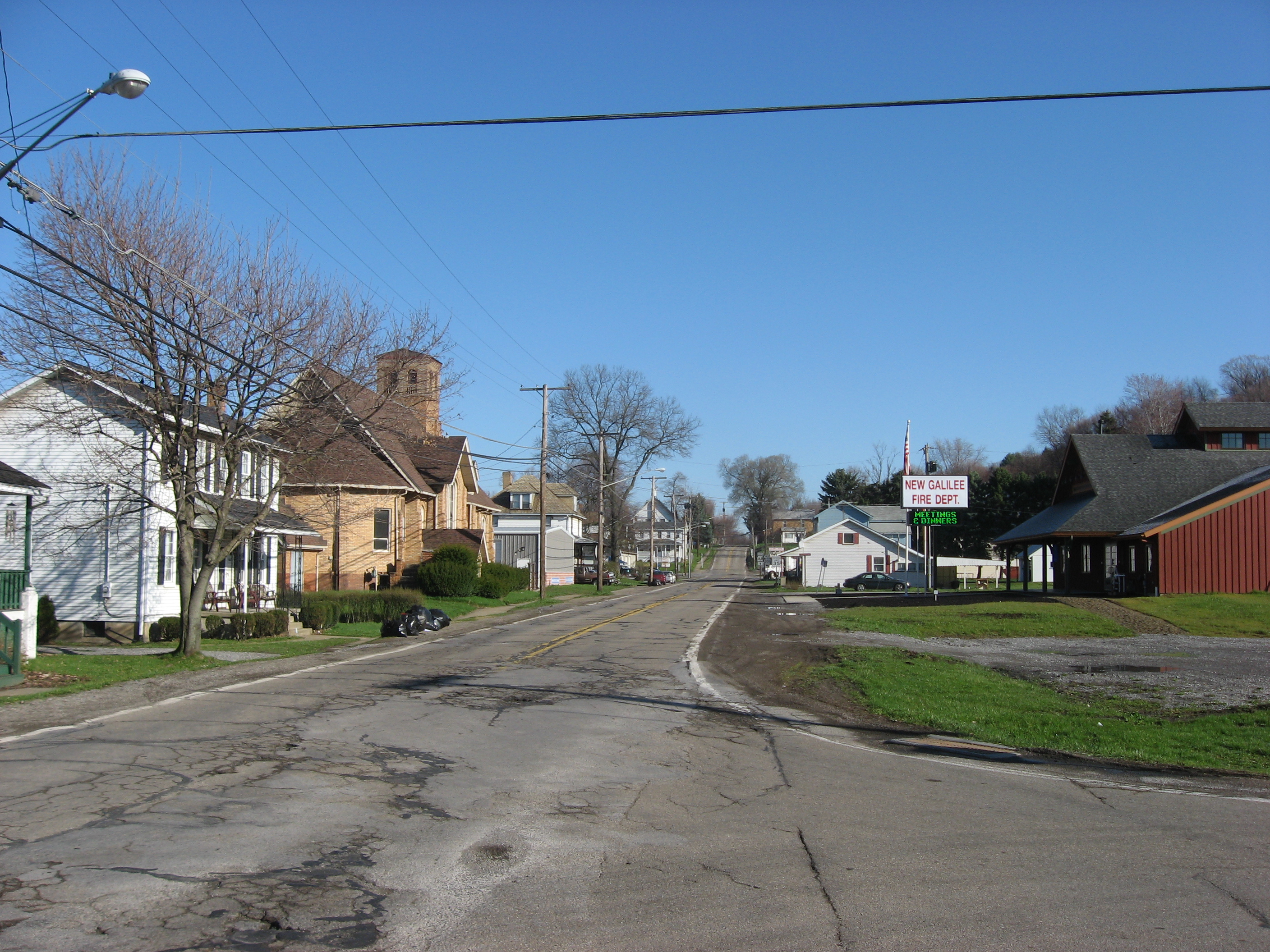
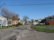 PA 351 westbound along the PA 168 concurrency in New Galilee
PA 351 begins at the Ohio border in Little Beaver Township, Lawrence County, where the road continues into Ohio as SR 617. From the state line, the route heads southeast on a two-lane undivided road, heading through open agricultural areas with some woods and homes. The road turns to the east-southeast and continues through more rural areas, crossing the North Fork Little Beaver Creek and reaching an intersection with PA 551. At this point, PA 351 forms a concurrency with PA 551, heading through more areas of farms, woods, and residences as it passes through Old Enon. The road heads into Enon Valley and becomes State Street, heading into residential areas and merging onto Main Street. PA 351 splits from PA 551 by turning east onto Vine Street, heading into agricultural areas and crossing back into Little Beaver Township, where it becomes an unnamed road. The road passes over a Norfolk Southern railroad line and turns to the south, heading into wooded areas with some homes.[1][2]
PA 351 enters Darlington Township in Beaver County and becomes Crescent Drive, turning southeast into a mix of farmland and woodland with some homes. The route crosses the North Fork Little Beaver Creek again and heads into more wooded areas, crossing into Big Beaver. The road turns south near more fields and heads into New Galilee, becoming Cleveland Drive and curving southwest past homes. PA 351 turns northeast onto Cleveland Street Extended before turning east onto Monroe Street, crossing the Norfolk Southern line. The route passes more homes before intersecting PA 168 and turning south to join that route on Centennial Avenue. PA 351 splits from PA 168 by turning east onto Fairlane Boulevard, crossing back into Big Beaver. The road turns to the northeast through woodland, coming to a bridge over I-76 (Pennsylvania Turnpike). From here, the route turns northeast through a mix of farms and woods with some homes, crossing over I-376. A short distance later, PA 351 comes to an intersection with Shenango Road, which provides access to both I-76 and I-376. Past this, the road passes a few fields and homes before continuing southeast through more forested areas. The route turns east through wooded areas of homes before coming to a junction with PA 18. At this intersection, PA 351 crosses into Koppel and becomes Arthur Street, passing residences and businesses. The route crosses a Norfolk Southern railroad line and turns north onto 5th Avenue, heading past more development. The road curves northeast and passes near industry, crossing under a CSX railroad line before becoming unnamed and heading northeast through woodland. PA 351 comes to a bridge that crosses over a CSX rail line before passing over the Beaver River into North Sewickley Township and heading over another CSX railroad line. Past the bridge, the route turns north onto River Road and heads through wooded areas with some commercial development.[1][3]
PA 351 heads into Wayne Township in Lawrence County and becomes West Lawrence Avenue, turning northeast and running through the residential community of Park Gate. The road heads into Ellwood City and turns to the east, becoming Lawrence Avenue and passing through business areas. Farther east, the route heads through the commercial downtown before turning south onto 4th Street. A block later, PA 351 turns east onto Crescent Avenue and passes homes before ending at PA 65/PA 288.[1][2]
Major intersections
County Location Mile[1] Destinations Notes Lawrence Little Beaver Township 0.0 SR 617 west (Youngstown Pittsburgh Road)Ohio border PA 551 north (Enon Road)West end of PA 551 overlap Enon Valley PA 551 south (Main Street)East end of PA 551 overlap Beaver New Galilee PA 168 north (Centennial Avenue)West end of PA 168 overlap PA 168 south (Centennial Avenue)East end of PA 168 overlap Big Beaver To I-376 / I-76 / Penna. Tpk. (Shenango Road)Koppel PA 18 (Big Beaver Boulevard)Lawrence Ellwood City 17.3 PA 65 / PA 288 (2nd Street)1.000 mi = 1.609 km; 1.000 km = 0.621 mi References
- ^ a b c d e Google, Inc. Google Maps – overview of Pennsylvania Route 351 (Map). Cartography by Google, Inc. http://maps.google.com/maps?saddr=PA+351+and+OH+617&daddr=40.85799,-80.28558+to:PA+65+and+PA+351&hl=en&ll=40.868353,-80.401039&spn=0.122284,0.338173&sll=40.858551,-80.285597&sspn=0.007644,0.021136&geocode=FdcdcAIdiV0z-ynL6BXskvUziDGbYPkoyiVEww%3BFYZxbwIddPA2-ykRpFGs8Xc0iDEkcM9Cxoiu_Q%3BFahvbwId8vw2-ykD_rwy8Xc0iDE-7p6OlRM_1A&mra=ls&via=1&t=h&z=12. Retrieved August 5, 2011.
- ^ a b PennDOT (2011). Lawrence County, Pennsylvania Highway Map (Map). ftp://ftp.dot.state.pa.us/public/pdf/BPR_pdf_files/Maps/GHS/Roadnames/lawrence_GHSN.PDF. Retrieved May 21, 2011.
- ^ PennDOT (2011). Beaver County, Pennsylvania Highway Map (Map). ftp://ftp.dot.state.pa.us/public/pdf/BPR_pdf_files/Maps/GHS/Roadnames/beaver_GHSN.PDF. Retrieved May 14, 2011.
Categories:- State highways in Pennsylvania

Wikimedia Foundation. 2010.