- Cochran, Georgia
-
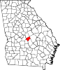
Cochran, Georgia, USA — City — Location in Bleckley County and the state of Georgia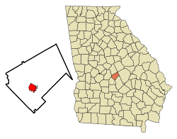
Coordinates: 32°23′12″N 83°21′2″W / 32.38667°N 83.35056°WCoordinates: 32°23′12″N 83°21′2″W / 32.38667°N 83.35056°W Country United States State Georgia County Bleckley Government - Mayor Clifford Avant Area - Total 4.2 sq mi (10.6 km2) - Land 4.1 sq mi (10.2 km2) - Water 0.1 sq mi (0.4 km2) Elevation 341 ft (104 m) Population (2000) - Total 4,455 - Density 1,090.5/sq mi (420.6/km2) Time zone EST (UTC-5) - Summer (DST) EDT (UTC-4) ZIP code 31014 Area code(s) 478 FIPS code 13-17328[1] GNIS feature ID 0355210[2] Cochran is a city in Bleckley County, Georgia, United States. The population was 4,455 at the 2000 census. The city is the county seat of Bleckley County[3].
Contents
History
Cochran, the County Seat of Bleckley County, Georgia, is named for Judge Arthur E. Cochran and was incorporated on March 19, 1869. Once known as Dykesboro, Cochran was settled by B. B. Dykes, who owned the site on which the town is built. The earliest settlers located here to engage in the turpentine industry.
Judge Cochran was largely instrumental in developing this section of Georgia through his work as President of the Macon & Brunswick Railroad, now the Southern Railway.
Government
The government of Cochran operates under a strong mayor-council system of local government. The current mayor of Cochran is Clifford Avant, and the City Manager is Matt Turknett. The Police Chief of Cochran is James M. Sanders, and the Fire Chief is Glenn A. Lord.
Recently, some of the Cochran Police Force has come under scrutiny for what appears to be child molestation charges. One officer has been charged and another has quit after being investigated for interference with custody.[4]
Geography
Cochran is located at 32°23′12″N 83°21′2″W / 32.38667°N 83.35056°W (32.386646, -83.350684)[5].
According to the United States Census Bureau, the city has a total area of 4.2 square miles (11 km2), of which, 4.1 square miles (11 km2) of it is land and 0.1 square miles (0.26 km2) of it (3.32%) is water.
Demographics
As of the census[1] of 2000, there were 4,455 people, 1,632 households, and 1,055 families residing in the city. The population density was 1,090.5 people per square mile (420.6/km²). There were 1,851 housing units at an average density of 453.1 per square mile (174.7/km²). The racial makeup of the city was 55.31% White, 42.09% African American, 0.09% Native American, 1.41% Asian, 0.47% from other races, and 0.63% from two or more races. Hispanic or Latino of any race were 0.99% of the population.
There were 1,632 households out of which 30.8% had children under the age of 18 living with them, 37.6% were married couples living together, 23.2% had a female householder with no husband present, and 35.3% were non-families. 31.9% of all households were made up of individuals and 15.6% had someone living alone who was 65 years of age or older. The average household size was 2.44 and the average family size was 3.10.
In the city the population was spread out with 26.1% under the age of 18, 15.6% from 18 to 24, 23.4% from 25 to 44, 19.5% from 45 to 64, and 15.4% who were 65 years of age or older. The median age was 33 years. For every 100 females there were 83.2 males. For every 100 females age 18 and over, there were 78.0 males.
The median income for a household in the city was $25,545, and the median income for a family was $35,854. Males had a median income of $29,434 versus $22,813 for females. The per capita income for the city was $13,354. About 14.8% of families and 21.5% of the population were below the poverty line, including 33.3% of those under age 18 and 23.0% of those age 65 or over.
Education
Bleckley County School District
Bleckley County students in grades Kindergarten to grade twelve are in the Bleckley County School District, that consists of a primary school, an elementary school, a middle school and a high school.[6] The district has 151 full-time teachers and over 2,355 students.[7]
- Bleckley County Primary School
- Bleckley County Elementary School
- Bleckley County Middle School
- Bleckley County High School
Higher Education
Famous Citizens
- Ed Roberts, MD, founder of MITS and creator of the Altair 8800 microcomputer, widely regarded as starting the microcomputer revolution.
- Musician and songwriter Clarence Reid, a.k.a. Blowfly.
References
- ^ a b "American FactFinder". United States Census Bureau. http://factfinder.census.gov. Retrieved 2008-01-31.
- ^ "US Board on Geographic Names". United States Geological Survey. 2007-10-25. http://geonames.usgs.gov. Retrieved 2008-01-31.
- ^ "Find a County". National Association of Counties. http://www.naco.org/Counties/Pages/FindACounty.aspx. Retrieved 2011-06-07.
- ^ Second Cochran Georgia Police Officer Morris Ross Arrested, Quits, Charged In Child Molestation Case - Officer Brent Powell Arrested Last Week | Bad Cop News
- ^ "US Gazetteer files: 2010, 2000, and 1990". United States Census Bureau. 2011-02-12. http://www.census.gov/geo/www/gazetteer/gazette.html. Retrieved 2011-04-23.
- ^ Georgia Board of Education, Retrieved May 31, 2010.
- ^ School Stats, Retrieved May 31, 2010.
External links
Municipalities and communities of Bleckley County, Georgia County seat: Cochran City Cochran
Town Footnotes ‡This populated place also has portions in an adjacent county or counties
Categories:- Cities in Georgia (U.S. state)
- Populated places in Bleckley County, Georgia
- County seats in Georgia (U.S. state)


Wikimedia Foundation. 2010.