- Midway-Hardwick, Georgia
-
This article is about the census-designated place in Baldwin County, Georgia. For the former county seat of Bryan County, Georgia, see Hardwick, Georgia. For other towns called Hardwick, see Hardwick (disambiguation).
Midway-Hardwick, Georgia — CDP — Location in Baldwin County and the state of Georgia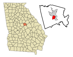
Coordinates: 33°3′9″N 83°14′14″W / 33.0525°N 83.23722°WCoordinates: 33°3′9″N 83°14′14″W / 33.0525°N 83.23722°W Country United States State Georgia County Baldwin Area – Total 4.9 sq mi (12.7 km2) – Land 4.9 sq mi (12.7 km2) – Water 0 sq mi (0 km2) – 4.91 sq mi (12.7 km2) Elevation 282 ft (86 m) Population (2000) – Total 5,819 – Density 1,186/sq mi (404.3/km2) Time zone Eastern (EST) (UTC-5) – Summer (DST) EDT (UTC-4) Area code(s) 478 FIPS code 13-51394[1] Midway-Hardwick is a census-designated place (CDP) in Baldwin County, Georgia, United States. The population was 5,819 at the 2000 census. It is laid out around central state hospital. It is part of the Milledgeville Micropolitan Statistical Area. The zip code for Hardwick is 31034. Hardwick was home to Oglethorpe University during the 19th Century.
Contents
Geography
Midway-Hardwick is located at 33°3′9″N 83°14′14″W / 33.0525°N 83.23722°W (33.052571, -83.237130)[2].
According to the United States Census Bureau, the CDP has a total area of 4.9 square miles (13 km2), of which, 4.9 square miles (13 km2) of it is land and 0.04 square miles (0.10 km2) of it (0.41%) is water.
Famous People
- William Usery, Jr., United States Secretary of Labor (1976–1977)
Demographics
Historical populations Census Pop. %± 1950 14,774 — 1960 16,909 14.5% 1970 14,047 −16.9% 1980 8,977 −36.1% 1990 4,910 −45.3% 2000 5,819 18.5% source:[3] As of the census[1] of 2000, there were 5,819 people, 1,868 households, and 1,277 families residing in the CDP. The population density was 1,046.8 people per square mile (403.8/km²). There were 2,223 housing units at an average density of 453.2/sq mi (174.8/km²). The racial makeup of the CDP was 25.02% White, 72.56% African American, 0.43% Native American, 0.64% Asian, 0.31% from other races, and 1.03% from two or more races. Hispanic or Latino of any race were 0.58% of the population.
There were 1,868 households out of which 34.2% had children under the age of 18 living with them, 31.0% were married couples living together, 30.3% had a female householder with no husband present, and 31.6% were non-families. 25.5% of all households were made up of individuals and 6.3% had someone living alone who was 65 years of age or older. The average household size was 2.64 and the average family size was 3.17.
In the CDP the population was spread out with 28.4% under the age of 18, 11.9% from 18 to 24, 29.6% from 25 to 44, 18.9% from 45 to 64, and 11.2% who were 65 years of age or older. The median age was 32 years. For every 100 females there were 80.3 males. For every 100 females age 18 and over, there were 75.1 males.
The median income for a household in the CDP was $29,300, and the median income for a family was $33,382. Males had a median income of $25,682 versus $21,365 for females. The per capita income for the CDP was $16,192. About 17.4% of families and 21.0% of the population were below the poverty line, including 31.6% of those under age 18 and 10.7% of those age 65 or over.
Government and infrastructure
The United States Postal Service operates the Hardwick Post Office.[4]
The Georgia Department of Corrections Men's State Prison is in Milledgeville, near Midway-Hardwick.[5][6][7]
References
- ^ a b "American FactFinder". United States Census Bureau. http://factfinder.census.gov. Retrieved 2008-01-31.
- ^ "US Gazetteer files: 2010, 2000, and 1990". United States Census Bureau. 2011-02-12. http://www.census.gov/geo/www/gazetteer/gazette.html. Retrieved 2011-04-23.
- ^ "CENSUS OF POPULATION AND HOUSING (1790-2000)". U.S. Census Bureau. http://www.census.gov/prod/www/abs/decennial/index.html. Retrieved 2010-07-30.
- ^ "Post Office™ Location - HARDWICK." United States Postal Service. Retrieved on December 1, 2010.
- ^ "Men's State Prison." Georgia Department of Corrections. Retrieved on December 1, 2010.
- ^ "Milledgeville city, Georgia." U.S. Census Bureau. Retrieved on December 1, 2010.
- ^ "Midway-Hardwick CDP, Georgia." U.S. Census Bureau. Retrieved on December 1, 2010.
Municipalities and communities of Baldwin County, Georgia City 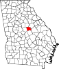
CDP Midway-Hardwick
Categories:- Populated places in Baldwin County, Georgia
- Census-designated places in Georgia (U.S. state)
- Populated places in Georgia (U.S. state) with African American majority populations
- Milledgeville micropolitan area


Wikimedia Foundation. 2010.