- Sopchoppy, Florida
Infobox Settlement
official_name = Sopchoppy, Florida
other_name =
native_name =
nickname =
settlement_type =City
motto =
imagesize =
image_caption =
flag_size =
image_
seal_size =
image_shield =
shield_size =
image_blank_emblem =
blank_emblem_type =
blank_emblem_size =
imagesize =
image_caption =
flag_size =
image_
seal_size =
image_shield =
shield_size =
image_blank_emblem =
blank_emblem_type =
blank_emblem_size =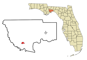
mapsize = 250x200px
map_caption = Location in Wakulla County and the state ofFlorida
mapsize1 =
map_caption1 =
image_dot_
dot_mapsize =
dot_map_caption =
dot_x =
dot_y =
pushpin_
pushpin_label_position =
pushpin_map_caption =
pushpin_mapsize =
subdivision_type = Country
subdivision_name = flag|United States
subdivision_type1 = State
subdivision_name1 = flag|Florida
subdivision_type2 = County
subdivision_name2 = noflag|Wakulla
subdivision_type3 =
subdivision_name3 =
subdivision_type4 =
subdivision_name4 =
government_footnotes =
government_type =
leader_title =
leader_name =
leader_title1 =
leader_name1 =
leader_title2 =
leader_name2 =
leader_title3 =
leader_name3 =
leader_title4 =
leader_name4 =
established_title =
established_date =
established_title2 =
established_date2 =
established_title3 =
established_date3 =
area_magnitude =
unit_pref = Imperial
area_footnotes =
area_total_km2 = 3.9
area_land_km2 = 3.9
area_water_km2 = 0
area_total_sq_mi = 1.5
area_land_sq_mi = 1.5
area_water_sq_mi = 0
area_water_percent =
area_urban_km2 =
area_urban_sq_mi =
area_metro_km2 =
area_metro_sq_mi =
area_blank1_title =
area_blank1_km2 =
area_blank1_sq_mi =
population_as_of = 2000
population_footnotes =
population_note =
population_total = 426
population_density_km2 = 109.2
population_density_sq_mi = 284
population_metro =
population_density_metro_km2 =
population_density_metro_sq_mi =
population_urban =
population_density_urban_km2 =
population_density_urban_sq_mi =
population_blank1_title =
population_blank1 =
population_density_blank1_km2 =
population_density_blank1_sq_mi =
timezone = Eastern (EST)
utc_offset = -5
timezone_DST = EDT
utc_offset_DST = -4
latd = 30 |latm = 3 |lats = 36 |latNS = N
longd = 84 |longm = 29 |longs = 28 |longEW = W
elevation_footnotes =
elevation_m = 9
elevation_ft = 30
postal_code_type =ZIP code
postal_code = 32358
area_code = 850
blank_name = FIPS code
blank_info = 12-66925GR|2
blank1_name = GNIS feature ID
blank1_info = 0306416GR|3
website =
footnotes =Sopchoppy is a city in Wakulla County,
Florida ,United States . It is part of theTallahassee, Florida Metropolitan Statistical Area. The population was 426 at the 2000 census. As of2004 , the population recorded by theU.S. Census Bureau is 465 [http://www.census.gov/popest/cities/tables/SUB-EST2004-04-12.xls] .Ochlockonee River State Park is nearby.Geography
Sopchoppy is located at coor dms|30|3|36|N|84|29|28|W|city (30.059994, -84.491084)GR|1.
According to the
United States Census Bureau , the city has a total area of 1.5square mile s (3.9km² ), all of it land.History
The town's name is a corruption of "Lockchoppe." Derived from the Muskogee "lokchapi" ("lokcha" (acorn) / "api" (stem)), this was the old name of the nearby river. [ [http://www.flheritage.com/facts/reports/names/city3.cfm City name origins] ]
Sopchoppy came into existence in
1894 . After the CT&G Railroad Company had built a railway through the area, theyplat ted the town on property they already owned in the area, across the river from Greenough. To encourage people to settle there, the railroad engaged in a significant advertising campaign, exaggerating the quality of the soil and climate. [ [http://www.littletownmart.com/fdh/sopchoppy.htm The Sopchoppy River] ]Demographics
As of the
census GR|2 of 2000, there were 426 people, 178 households, and 111 families residing in the city. Thepopulation density was 280.4 people per square mile (108.2/km²). There were 216 housing units at an average density of 142.2/sq mi (54.9/km²). The racial makeup of the city was 78.40% White, 18.08% African American, 1.17% Native American, 0.70% Asian, 1.17% from other races, and 0.47% from two or more races. Hispanic or Latino of any race were 3.99% of the population.There were 178 households out of which 32.0% had children under the age of 18 living with them, 43.8% were married couples living together, 15.2% had a female householder with no husband present, and 37.6% were non-families. 32.6% of all households were made up of individuals and 11.2% had someone living alone who was 65 years of age or older. The average household size was 2.39 and the average family size was 3.09.
In the city the population was spread out with 26.8% under the age of 18, 8.2% from 18 to 24, 29.1% from 25 to 44, 22.5% from 45 to 64, and 13.4% who were 65 years of age or older. The median age was 38 years. For every 100 females there were 86.0 males. For every 100 females age 18 and over, there were 80.3 males.
The median income for a household in the city was $29,583, and the median income for a family was $33,750. Males had a median income of $30,833 versus $17,188 for females. The
per capita income for the city was $14,165. About 14.4% of families and 17.1% of the population were below thepoverty line , including 11.9% of those under age 18 and 48.2% of those age 65 or over.References
External links
* [http://www.sopchoppyflorida.com Sopchoppy Preservation and Improvement Association]
Wikimedia Foundation. 2010.