- Old Ottawa East
-
"Ottawa East" redirects here. For the federal electoral district see Ottawa East (electoral district); for the provincial electoral district, see Ottawa East (provincial electoral district).
Ottawa East — Neighbourhood — Location in Ottawa
 Ottawa East
Coordinates: 45°24′45″N 75°40′35″W / 45.4125°N 75.67639°W Country Canada Province Ontario City Ottawa Established Archville Incorporated 1888 (Village of Ottawa East) Annexation 1907 (City of Ottawa) Government - Mayor Jim Watson - MPs Paul Dewar - MPPs Yasir Naqvi - Councillors David Chernushenko Area - Total 1.12 km2 (0.4 sq mi) Elevation 70 m (230 ft) Population (2006) - Total 4,907 - Density 4,393.4/km2 (11,378.9/sq mi) Canada 2006 Census Time zone Eastern (EST) (UTC-5) Forward sortation area K1S 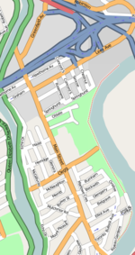

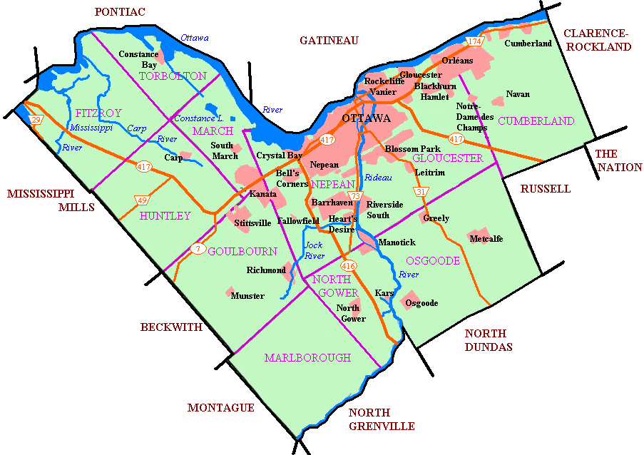
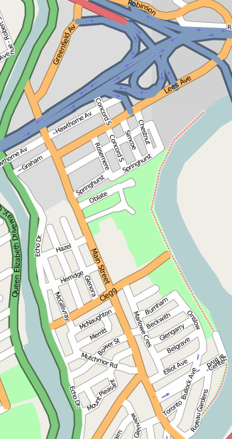
Old Ottawa East or just Ottawa East is a neighbourhood of Ottawa, Canada. It is located south of Nicholas Street and between the Rideau Canal and the Rideau River. The southern border is generally defined by Main Street and Riverdale Avenue. To the south is the neighbourhood of Old Ottawa South to the northwest is Sandy Hill. Old Ottawa East includes the Lees Avenue area. This small neighbourhood was originally the suburban community of Archville that was incorporated as the village of Ottawa East in 1888. In 1907 it was amalgamated with the growing community of Ottawa. Running through the centre of the neighbourhood is Main Street, which was the central road of Archville, but which is not particularly central to modern Ottawa. The neighbourhood is home to Saint Paul University, Lady Evelyn Alternative School, St. Nicholas Adult High School and Immaculata High School. In 2006, the population was 4,907.
Reeves:
- James Ballantyne
- Henry George Roche
See also

Centretown Sandy Hill 
Overbrook  Old Ottawa East

The Glebe Old Ottawa South Riverview External links
Categories:- Ottawa stubs
- Neighbourhoods in Ottawa
- Former municipalities now in Ottawa
Wikimedia Foundation. 2010.