- Gulf Breeze, Florida
:"The "Gulf Breeze" was also a
passenger train run byAmtrak ."Infobox Settlement
official_name = Gulf Breeze, Florida
other_name =
native_name =
nickname =
settlement_type =City
motto =
flag_size =
image_
seal_size =
image_shield =
shield_size =
image_blank_emblem =
blank_emblem_type =
blank_emblem_size =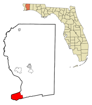
mapsize = 250x200px
map_caption = Location in Santa Rosa County and the state ofFlorida
mapsize1 =
map_caption1 =
image_dot_
dot_mapsize =
dot_map_caption =
dot_x =
dot_y =
pushpin_
pushpin_label_position =
pushpin_map_caption =
pushpin_mapsize =
subdivision_type = Country
subdivision_name = flag|United States
subdivision_type1 = State
subdivision_name1 = flag|Florida
subdivision_type2 = County
subdivision_name2 = noflag|Santa Rosa
subdivision_type3 =
subdivision_name3 =
subdivision_type4 =
subdivision_name4 =
government_footnotes =
government_type =
leader_title =Mayor
leader_name = Lane Gilchrist
leader_title1 =City Manager
leader_name1 = Buzz Eddy
leader_title2 =
leader_name2 =
leader_title3 =
leader_name3 =
leader_title4 =
leader_name4 =
established_title =
established_date =
established_title2 =
established_date2 =
established_title3 =
established_date3 =
area_magnitude =
unit_pref = Imperial
area_footnotes =
area_total_km2 = 61.0
area_land_km2 = 12.3
area_water_km2 = 48.7
area_total_sq_mi = 23.5
area_land_sq_mi = 4.8
area_water_sq_mi = 18.8
area_water_percent =
area_urban_km2 =
area_urban_sq_mi =
area_metro_km2 =
area_metro_sq_mi =
area_blank1_title =
area_blank1_km2 =
area_blank1_sq_mi =
population_as_of = 2005
population_footnotes =
population_note =
population_total = 6455
population_density_km2 = 514.88
population_density_sq_mi = 1192.0
population_metro = 26061
population_density_metro_km2 =
population_density_metro_sq_mi =
population_urban =
population_density_urban_km2 =
population_density_urban_sq_mi =
population_blank1_title =
population_blank1 =
population_density_blank1_km2 =
population_density_blank1_sq_mi =
timezone = CST
utc_offset = -5
timezone_DST = CDT
utc_offset_DST = -6
latd = 30 |latm = 26 |lats = 36 |latNS = N
longd = 87 |longm = 12 |longs = 41 |longEW = W
elevation_footnotes =
elevation_m = 5
elevation_ft = 16
postal_code_type =
postal_code =
area_code = 850
blank_name = FIPS code
blank_info = 12-28000GR|2
blank1_name = GNIS feature ID
blank1_info = 0283485GR|3
website = http://www.cityofgulfbreeze.com
footnotes =Gulf Breeze is a city located on the
Fairpoint Peninsula inSanta Rosa County, Florida ,United States and is asuburb of Pensacola which lies to the north, acrossPensacola Bay . The population was 5,665 at the 2000 census. As of 2005, the population recorded by theU.S. Census Bureau is 6,455. [http://factfinder.census.gov/servlet/SAFFPopulation?_event=Search&_name=Gulf+Breeze&_state=04000US12&_county=Gulf+Breeze&_cityTown=Gulf+Breeze&_zip=&_sse=on&_lang=en&pctxt=fph]Geography
Gulf Breeze is located at coor dms|30|21|36|N|87|10|41|W|city (30.359933, -87.178190).GR|1
According to the
United States Census Bureau , the city has a total area of 23.5square mile s (61.0km² ).4.8 square miles (12.3 km²) of it is land and 18.8 square miles (48.7 km²) of it (79.79%) is water.The City of Gulf Breeze is now often referred to as "Gulf Breeze Proper." This differentiates it from other communities further east which are assigned Gulf Breeze addresses by the U.S. Postal Service but lie outside of the city limits.
Growth of the city itself is geographically restricted, surrounded by major water bodies on three sides. Additionally, the eastern portion of Gulf Breeze is occupied by the Naval Live Oaks Reservation. As a result, new growth occurs outside of the city limits along U.S. Highway 98.
[
 Gulf Breeze (lower center) is north of
 Pensacola Beach, Florida , south ofPensacola , and surrounded byPensacola Bay .]Hurricanes
From 1995 to 2005, Gulf Breeze has received several direct hits and severe blows from numerous hurricanes. In 1995, Hurricane Erin and Opal made landfall just south of the city. While Erin caused mild damage to the area,
Hurricane Opal devastated much of the neighboring Pensacola Beach and Navarre communities. Nine years later, in 2004,Hurricane Ivan made landfall west of the Gulf Breeze but caused widespread damage in the city, destroying many homes and businesses. In 2005,Hurricane Dennis passed just east of the city. Damage from this storm was more severe than that received in communities lying further west.Points of interest
Gulf Breeze became famous in
1987 as the site of severalUFO sightings.cite web|url=http://www.ufocasebook.com/gulfbreeze.html|title=Gulf Breeze UFO Incident|accessdate=2007-03-26] (seeGulf Breeze UFO incident ).AAA has designated Gulf Breeze as also one of seven "strict enforcement areas" for traffic laws in the United States. This rating is one level short of
speed trap , and is only shared by six other cities and towns nationwide.cite web|url=http://www.aaasouth.com/acs_news/9203.asp|title=AAA Auto Club South|accessdate=2007-03-26]Gulf Breeze also received media attention for instituting a program to allow volunteers to drive
police car s within the city and report traffic violations topolice . Volunteers receive training in radio use and first aid but are not empowered to makearrest s or traffic stops.cite web | title=Fake Cops Drive Real Cruisers
url=http://www.foxnews.com/story/0,2933,148287,00.html#2
accessdate=2007-03-26]Demographics
As of the
census GR|2 of 2000, there were 5,665 people, 2,377 households, and 1,678 families residing in the city. Thepopulation density was 1,192.0 people per square mile (460.5/km²). There were 2,553 housing units at an average density of 537.2/sq mi (207.5/km²). The racial makeup of the city was 97.39% White, 0.25% African American, 0.55% Native American, 0.56% Asian, 0.02% Pacific Islander, 0.18% from other races, and 1.06% from two or more races. Hispanic or Latino of any race were 1.36% of the population.There were 2,377 households out of which 28.1% had children under the age of 18 living with them, 57.7% were married couples living together, 10.6% had a female householder with no husband present, and 29.4% were non-families. 25.3% of all households were made up of individuals and 13.0% had someone living alone who was 65 years of age or older. The average household size was 2.36 and the average family size was 2.83.
In the city the population was spread out with 22.3% under the age of 18, 4.6% from 18 to 24, 22.5% from 25 to 44, 29.7% from 45 to 64, and 20.8% who were 65 years of age or older. The median age was 45 years. For every 100 females there were 89.4 males. For every 100 females age 18 and over, there were 83.6 males.
The median income for a household in the city was $52,522, and the median income for a family was $61,661. Males had a median income of $44,408 versus $28,159 for females. The
per capita income for the city was $34,688. About 3.8% of families and 4.2% of the population were below thepoverty line , including 5.5% of those under age 18 and 1.2% of those age 65 or over.Schools
*
Gulf Breeze High School ( [http://www.santarosa.k12.fl.us/gbh website] )
* [http://www.santarosa.k12.fl.us/gbm Gulf Breeze Middle School]
* [http://www.santarosa.k12.fl.us/gbe Gulf Breeze Elementary School]
* [http://www.santarosa.k12.fl.us/obe Oriole Beach Elementary School]References
External links
* [http://www.thezoonorthwestflorida.org/ The Zoo of Northwest Florida] — the regional zoo, still recovering from damage inflicted by Hurricane Ivan in 2004
* [http://www.gulfbreezechamber.com/ Gulf Breeze Area Chamber of Commerce] — the area'schamber of commerce

Wikimedia Foundation. 2010.