- Nicoya
-
For other uses, see Nicoya (disambiguation).
Nicoya — City —  Location in Costa Rica
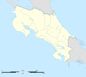
 Nicoya
Coordinates: 10°09′N 85°27′W / 10.15°N 85.45°WCoordinates: 10°09′N 85°27′W / 10.15°N 85.45°W Country  Costa Rica
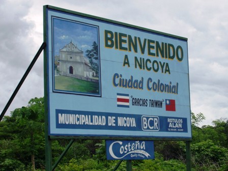
Province Guanacaste Province Canton Nicoya Canton Founded 1523 Joined Republic of Costa Rica 1824-1825 Government - Mayor Eduardo Gutiérrez Rosales Highest elevation[1] 123 m (404 ft) Lowest elevation[1] 3 m (10 ft) Population (2000) - Total 20,945 Time zone Central Standard Time (UTC-6) Nicoya is a town in Costa Rica's Guanacaste province, and one of its most important tourist zones. It serves as a transport hub to Guanacaste's beaches and national parks. According to the 2000 census, the city's population was 13,334—second only to Liberia in the province. The city is also the district seat of a cantón of the same name, which in 2000 had 20,945 residents[2].
The town was built in an old colonial style, in the Cordillera Volcánica de Guanacaste. Agriculture and cattle form the backbone of the city's economy, as well as the province which surrounds it.
In early 2006, a group of researchers led by adventure writer Dan Buettner and supported by National Geographic Magazine, the National Institute for Aging, and Allianz Healthcare, designated Nicoya as a Blue Zone. This designation is granted to global regions that are characterized by the longest life expectancies. Among the ideal Nicoyan lifestyle characteristics cited by the research were the water’s high calcium content, intense daily physical activity, year-long fruit consumption, and close inter-generational relationships.
While the town elected 61 year old Lorenzo Rosales Vargas[1] as mayor on December 3, 2006 he was only able to serve for about a year before quiting due to health reasons. Since May 5, 2008 Eduardo Gutiérrez Rosales has been holding the office instead as Nicoya's first supply mayor. They are both members of the National Liberation Party (PLN).[3]
Contents
History
When conquistador Gil Gonzalez Dávila entered Nicoya in 1523, it was the largest cacicazgo (chiefdom) on the Pacific coast of Costa Rica. The city and peninsula of Nicoya derive their name from the cacique (chief) Nicoa (or Nicoya) who welcomed Dávila and his men. The Treasurer on Dávila’s expedition, Andres de Cereceda, reported a population of 6,063 inhabitants under Nicoya’s leadership, almost five and a half times larger than the next largest settlement visited by the Spanish along the Pacific coast in the early 1520s (Peralta 1883:29-31). According to sixteenth-century chronicler Gonzalo Fernandez de Oviedo y Valdez (1959:363) who visited Nicoya in 1529, the layout of the indigenous community was similar to that of the larger settlements in nearby Nicaragua and included a central plaza with temples, a low pyramidal mound used for human sacrifice, and specialized plazas for markets and chief’s residences.
Many of the earliest colonial documents that could tell us much about precolombian Nicoya appear to have been lost in a fire that burned the town’s archives in 1783 (ANCR Exp. 273). In the resulting documentary vacuum, a number of interpretations regarding prehispanic Nicoya have emerged. Foremost amongst them is the belief that as the southernmost representatives of Mesoamerica, Nicoyans lived in nucleated villages and Cereceda’s accounting of 6,063 souls represented the number of inhabitants of one village under chief Nicoya’s control (Melendez 1959). The contemporary city of Nicoya is generally believed to be situated on the site of that village.
The center of Nicoya is spatially organized in the traditional Spanish American pattern, with a central plaza surrounded by streets ordered in a grid pattern to the cardinal directions. Atypically, the church is situated in the northeastern corner of the central plaza, however not facing the plaza from a surrounding street, as was the Iberian norm. Today the church is locally referred to as the templo colonial; local oral history maintains that the church dates from some time between 1522 and 1544, when the parish of Nicoya was founded (Mora 1988).
The eminent Costa Rican historian Carlos Melendez took note of the unusual location of the templo colonial in the urban core of the city and, based on Oviedo’s brief description of the indigenous community, hypothesized that the church had been built atop the indigenous sacrificial mound. Melendez’ hypothesis fits the known Spanish pattern of direct superimposition of Catholic politico-religious structures on pre-existing indigenous structures such as pyramids in Mesoamerica and Andean South America, or kiva structures in the U.S. Southwest. In short, Melendez argued that the location of the colonial church in the northeastern corner of Nicoya’s central plaza is not merely an aberration from the common Iberian pattern of facing the plaza, but is coincident with the location of the sacrificial mound in the northeastern corner of the plaza of indigenous Nicoya as described by Oviedo in 1529 (Melendez 1978).
Archaeological excavations were conducted in and around the city of Nicoya in the early 1990s to test these theories and to better understand how the indigenous community was transformed into a colonial town (Lawrence 23005, 2009). Excavations within the center of Nicoya failed to produce any evidence of a substantial pre-Columbian presence in the city’s center. Investigations into the surrounding valley failed to unequivocally identify a single site as the probable home to Nicoya. However, several large (5-10 hectare/12-24 acres) archaeological sites were located in similar ecological niches throughout the valley. They are situated along river and stream banks at the point where streams leave the hills that surround the valley and cross the undulating valley floor.
At least two of these sites are considered likely candidates for protohistoric Nicoya. One is situated just outside contemporary Nicoya along the banks of the Rio Chipanzé and the other is located in the hamlet of Sabana Grande, six kilometers north of Nicoya. This site appears to be larger than the rest; it exhibits low earthen mounds, and is particularly prized by local looters for its high-quality polychrome pottery and gold artifacts. Apparently a much greater quantity of high-quality artifacts have been removed from the vicinity of Sabana Grande than from Nicoya or anywhere else in the valley. Furthermore, it is interesting to note that the colonial ejido (lands held in common by the indigenous community) of the Indian community of Nicoya was in Sabana Grande, not Nicoya (ANCR Exp. 301; Exp. 792; Exp. 3710).
It is only possible to consider either of these sites as protohistoic Nicoya if we discard the notion that it was a single community of over 6,000+ souls. Neither site is near the size necessary to hold that number of people if we accept even as an approximate Newson’s (1987:87) estimates of 0.045 to 0.06 persons/hectare for Pacific Nicaragua at Spanish contact, and as little as 0.02 persons/hectare for Nicoya. A closer reading of the ethnohistoric material in conjunction with the archaeological information at hand is necessary in order to form a more realistic picture of Nicoya on the eve of conquest. It is worthwhile returning the Andres de Cereceda, Treasurer of Gil Gonzalez Dávila’s 1522 expedition, and review his own words in regards to Nicoya: “The chief Nicoya is five leagues further on, inland: they baptized 6,603 souls; he gave 13,442 pesos in gold, with a little more that the chief Mateo gave” (in Peralta 1883:30). As mentioned above, 6,603 is typically taken to represent the number of inhabitants of the cacique, Nicoya’s town, but Cereceda never makes that assertion, only that they baptized that number of people. Furthermore, he refers to a second chief, Mateo, whose residence was never specified.
An alternative interpretation of Cereceda’s figures would understand them as representing the inhabitants of several settlements politically affiliated with Nicoya but not the members of one massive community. The cacique Nicoya may not have had tributary villages under his direct control, but it is not unlikely that there were several villages within his orbit of influence that he could persuade to treat with the Spanish. A model of dispersed settlement of politically affiliated villages rather than one large nucleated town better fits the archaeological and ethnohistoric information at hand. It should be noted that Oviedo, who visited Nicoya in 1529 and recorded aspects of the town’s layout, never remarked on the great size of the settlement. Oviedo was in Nicoya before precipitous population decline had taken its effect, and one would expect some remark from this astute observer had Nicoya been such a populous and highly nucleated center as has been thought.
If the above hypothesis is true, what does modern-day Nicoya represent historically? Amongst other tools of colonial administration, the Spanish crown created a policy called la congregación, or the forced resettlement of native peoples into nucleated settlements in order to more closely watch and control their charges. The evidence at hand lead one to further hypothesize that the present-day Nicoya is the product of Spanish colonial congregación, formed by the forced amalgamation of people from the various prehispanic settlements dispersed throughout the region. When this may have been done, and under what circumstances, are unknown. As mentioned above, the historical documents, which would have recorded such an event, would have been destroyed in the 1783 fire that completely destroyed the colonial archives in Nicoya. Further research in other repositories may yet provide confirmation for this interpretation.
Colonial Nicoya
As discussed above Nicoya, was the largest indigenous chiefdom encountered by the Spanish when they first entered northwestern Costa Rica in 1523. Historical records are mute on what these people called themselves or the precise detail of their political organization. Other than the fact that they spoke a language belonging to the Oto-Manguean language family, nothing is known of their tongue. According to records from that first encounter in 1523, over 6,000 souls were saved by baptism performed by the expedition’s priest (Oviedo y Valdez 1959). During the first fifty years of Conquest, Nicoya was of great local importance as a transshipment point between the more active Spanish colonies in Nicaragua and Panama; a staging area and breadbasket for the initial entradas (initial forays) into the interior of Costa Rica by Juan Vázquez de Coronado; and a rich encomienda (source of tribute) for the governor of Nicaragua, Pedrarias Dávila and his family (Peralta 1883; Melendez 1983). Each of these economic activities dissipated within a brief period of time, however, and Nicoya rapidly devolved into a colonial backwater.
Interestingly, there is no historical record that Nicoya ever offering armed resistance against the invaders and as was mentioned above, they quickly accepted Christianity. It was armed resistance and rejection of Catholicism that justified the Holy War waged by the Spanish against the native peoples of the Americas. Regardless of justification, the historical record speaks clearly that native Nicoyans were incorporated into the Spanish colonial empire and simply became identified by the racial category of Indios (Indians).
In becoming "Indians," native Nicoyans were being ascribed by royal decree to a racial category from which it was difficult to escape. Ostensibly, Spanish colonial policy was designed to protect native peoples, who were wards of the state and church. Sensible to the economic effects of massive population decline, the Crown acted during the 16th and 17th centuries to protect their charges from the ill effects of direct exposure to Europeans. Segregation was one means to an end, a colonial policy established Pueblos de Indios (Indian towns) in which Spaniards (excepting crown and ecclesiastical authorities) were prohibited from living. In essence, it provided a series of static rights and obligations and a relationship to the State that was inviolate.
As newly-minted Indians, 16th century Nicoyans were taken as slaves and the community obligated to pay tribute in goods and services (known as the encomienda) to a succession of Spanish families as reward for their service to the Crown during the Conquest. As discussed above, there is also indirect evidence that the native Nicoyans were forced to resettle from their original hamlets and villages to a single, nucleated town that is the Nicoya of today (Melendez 1983). It was not uncommon for the Spanish authorities to order such resettlement as a response to the need to maintain control over indigenous peoples as they suffered a precipitous decline in numbers during the 16th and early 17th centuries. As populations thinned out, the Spanish would simply order the survivors to move to a single community in order to maintain a political, economic and ecclesiastical eye on them.
Nicoya was one such Indian town and in the 1760s boasted no more than about 320 inhabitants (ANCR Exp. 315). The structure of social relations had been established in the community approximately two centuries before and at the time, had certainly provided a measure of security for them. The native Nicoyans were provided with a new social identity within the colonial order– "Indians" – and a social space within a hierarchical caste system based on race that defined their rights and obligations, and a physical space (the town) in which they could exist. The Indians were obligated to make tribute payments, but were given limited powers of self-government and had (in theory) access to a public defender’s office (Defensor de Indios) for their corporate legal defense.
By the decade of the 1760s however, life in Nicoya was becoming more and more tenuous. The Spanish colonial enterprise, as all colonial enterprises, was an extractive one. Valuable goods were quickly identified and exported to Spain or other colonies: at first the precious metals, followed by traffic in human beings, and later by a variety of agricultural commodities. The small Indian community could not provide sufficient labor and the region’s population was therefore augmented by the presence of members from two other racial groups as recognized in Spanish colonial social system: Mulatos, (undoubtedly arrived from Panama, although the historical record is silent on this issue); and Ladinos, or people of mixed Native and Spanish ancestry.
What had evolved by the mid-18th century in Spanish-dominated portions of lower Central America was, in essence, a system of apartheid, in which islands of isolated indigenous communities were surrounded by non-indigenous peoples of heterogeneous background. Spanish, Mulatos and Ladinos settled on the cattle ranches surrounding Nicoya and, with direct access to the principal factor of production (land), were easily able to dominate the local economy. A creole culture emerged amongst the non-Indians on their dispersed ranches, a local variant of a lifeway based on cattle ranching that spread along Pacific margin of Central America all the way to what is now the southwestern United States. Social relations between the local creoles and the Indians of Nicoya are hard to gauge, the documentary record was not typically concerned with such matters.
However, one colonial document from 1765 may be highly indicative of the poor state of relations between the two ethnic groups and illustrative of the stark difference in the degree of estrangement between the Indians of Nicoya and surrounding Ladino community (ANCR Exp. 244). The document presents a petition to the Crown by a union of 200 Ladinos to form their own town apart from that of Nicoya. The arguments supporting their request were phrased in the language of ethnic group solidarity: the Ladinos sought the improvements that came from leaving their dispersed ranches and living in a town of their own and away from the Indians in Nicoya. Nicoya was reported to be economically defunct and it’s community quickly dying. The choice presented by the Ladinos was one between life in the form of a new creole town and death if they had to rely on Nicoya. Crown agreed to their petition.
The representation that the Ladinos made of social conditions in Nicoya may not have been far off. Essentially isolated within their community and surrounded by more-or-less hostile neighbors, the native community persisted, it would appear, more by the weight of centripetal forces exterior to the community itself, keeping in check the centrifugal pressures within the community for dissolution. In more concrete terms, the economic and political needs of the State maintained the artificial boundaries and structure of an "Indian" community, well past the date when the community, as an ethnically identifiable social entity, would have dissolved through the typical processes of acculturation and assimilation.
To this historically particular moment we add the structural contradictions in the political structure of the Spanish colonies. The point of contact between Crown and Indians was the local administrative authority, the Corregidor. Provided enormous leeway in the weak state system of governance, the position of Corregidor was purchased and the individual who held for a specified number of years it was free to exploit it for their personal economic benefit. They did so by functioning within a closed market system as the sole distributor of manufactured goods to the Indians in the towns they controlled and by purchasing marketable good produced by the ‘Indians’ under their charge. No controls were placed on prices beyond the caprice of the Corregidor, who had the coercive power of the state to insure that their price demands were met. While the Corrregidor did fulfill an important economic role, clearly the system was ripe for abuse, and abused it was (Baskes 2000).
The Indian revolt of 1760-61
By the mid-18th century, or the middle phase of the colonial period, an uneasy balance of power and authority had evolved between different elements of colonial society in Nicoya and its surrounding hinterland. The Indian community of Nicoya persisted weakly as a shadow of its former self, maintained by a tradition of reciprocal ties of rights and obligations to patriarchal Crown authority. However, this tradition rested primarily on a crucial link, the Corregidor, and in late 1750s this tradition was turned on its head and Nicoya as an independent ethnic community began to unravel.
In 1756, one don Santiago Alfeiran was appointed Corregidor of Nicoya. A Spaniard, he had never set foot in Nicoya until he finally arrived to take his post in 1758 (Fernandez Guardia 1938). Traditional relations of obligation and exchange were quickly replaced by increasingly onerous demands on the community’s productive capabilities, followed by exceptionally harsh physical abuse when those demands were not met. To give just one example, tribute in Nicoya was traditional paid by one product that could be produced nowhere else in the region: cotton thread dyed purple with the secretion of a rare mollusk found on the Pacific Coast of the genus Murex. This dye had been exploited during precolombian times, and the Nicoyans took great care not to kill the mollusk when extracting the dye. In order not to stress the animals, they only dyed cotton every three months (ANCR Exp. 0384). Alfeiran demanded a threefold increase in production, altering traditional forms of production that had been in effect at least since the early colonial period, if not extending into the precolombian past (ANCR Exp. 498). Multiple court cases related to Alfeiran’s tenure attest to the fact that this was just one, and perhaps not the most serious, example of a new order of things for the native community of Nicoya (ANCR Exp. 491).
References
- ^ a b c "Nicoya". Costa Rica 2021. http://www.cr2021.org/html/nicoya.mht. Retrieved 2010-02-14.
- ^ http://www.inec.go.cr/
- ^ Oliver Pérez (May 6, 2008). "Renunció alcalde de Municipalidad de Nicoya". La Nación. http://www.nacion.com/ln_ee/2008/mayo/06/pais1525935.html. Retrieved 2010-02-14.
ARCHIVO NACIONAL DE COSTA RICA (ANCR)
1760 Complementario Colonial, Expediente 315.
1765 Complementario Colonial, Expediente 244.
1770 Complementario Colonial, Expediente 301.
1768 Complementario Colonial, Expediente 273.
1784 Guatemala, Expediente 491.
1785 Guatemala, Expediente 498.
1802 Guatemala, Expediente 792.
1816 Complementario Colonial, Expediente 3710.
BASKES, JEREMY (2000). "Indians, merchants, and market: a reinterpretation of the Repartimiento and Spanish-Indian economic relations in colonial Oaxaca, 1750-1821." stanford: Stanford University Press.
FERNANDEZ GUARDIA, RICARDO (1938). "La sublevación de los indios de Nicoya en 1760." In Revista de los Archivos Nacionales, 2:362-366.
LAWRENCE, JOHN W. (2005). "La Arqueología, la historia y la memoria: Interfaces interpretativas en la historiografía colonial de Nicoya, Guanacaste, Costa Rica." In Memorias del Coloquio Internacional ‘Universos Coloniales Centroamericanos.’ Universidad Rafael Landívar: Guatemala City, Guatemala.
LAWRENCE, JOHN W. (2009). "Archaeology and Ethnohistory on the Spanish Colonial Frontier: Excavations at the Templo Colonial in Nicoya, Guanacaste, Costa Rica." In Historical Archaeology 43(1):65-80.
MELENDEZ CHAVARRIA, CARLOS (1959). "Tipos de población de Costa Rica a mediados del siglo XVI." In Actas, 33rd International Congress of Americanists. Vol. 2., pp. 485:494. San José: Imprenta Lehman.
MELENDEZ CHAVARRIA, CARLOS (1978). "Nicoya y sus templos historicas." In Separatas No. 38. San José: Universidad de Costa Rica.
MELENDEZ CHAVARRIA, CARLOS (1983). “Primera Etapa de la Encomienda de Indios en Nicoya 1524-1545.” In America Indígena, 43(1):187-204.
MORA, GUADALUPE 1988 personal communication.
NEWSON, LINDA (1987). Indian Survival in Colonial Nicaragua. Norman: University of Oklahoma Press.
OVIEDO Y VALDEZ, GONZALO FERNANDEZ DE (1959). Historia General y Natural de las Indias. Madrid: Ediciones Atlas.
PERALTA, MANUEL M. DE (1883). Costa Rica, Nicaragua y Panamá en el Siglo XVI. Madrid: Murrillo.
Categories:- Populated places in Costa Rica
- Populated places established in 1523
- Blue Zones

Wikimedia Foundation. 2010.