- Kremmling, Colorado
Infobox Settlement
official_name = Town of Kremmling, Colorado
other_name =
native_name =
nickname =
settlement_type =Town
motto =
imagesize =
image_caption =
flag_size =
image_
seal_size =
image_shield =
shield_size =
image_blank_emblem =
blank_emblem_type =
blank_emblem_size =
imagesize =
image_caption =
flag_size =
image_
seal_size =
image_shield =
shield_size =
image_blank_emblem =
blank_emblem_type =
blank_emblem_size =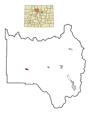
mapsize = 250px
map_caption = Location in Grand County and the state ofColorado
mapsize1 =
map_caption1 =
image_dot_
dot_mapsize =
dot_map_caption =
dot_x =
dot_y =
pushpin_
pushpin_label_position =
pushpin_map_caption =
pushpin_mapsize =
subdivision_type = Country
subdivision_name = USA
subdivision_type1 = State
subdivision_name1 = flag|Colorado
subdivision_type2 = Countycite web | url = http://www.dola.state.co.us/dlg/local_governments/municipalities.html | title = Active Colorado Municipalities | format =HTML | publisher = State of Colorado, Department of Local Affairs | accessdate = 2007-09-01]
subdivision_name2 = Grand
subdivision_type3 =
subdivision_name3 =
subdivision_type4 =
subdivision_name4 =
government_footnotes =
government_type = Statutory Town
leader_title =
leader_name =
leader_title1 =
leader_name1 =
leader_title2 =
leader_name2 =
leader_title3 =
leader_name3 =
leader_title4 =
leader_name4 =
established_title = Founded
established_date = 1881
established_title2 = Incorporated (town)
established_date2 =May 14 ,1904 cite web | url = http://www.colorado.gov/dpa/doit/archives/muninc.html | title = Colorado Municipal Incorporations | format =HTML | publisher = State of Colorado, Department of Personnel & Administration, Colorado State Archives | date =2004-12-01 | accessdate = 2007-09-02]
established_title3 =
established_date3 =
area_magnitude =
unit_pref = Imperial
area_footnotes =
area_total_km2 = 3.4
area_land_km2 = 3.4
area_water_km2 = 0
area_total_sq_mi = 1.3
area_land_sq_mi = 1.3
area_water_sq_mi = 0
area_water_percent =
area_urban_km2 =
area_urban_sq_mi =
area_metro_km2 =
area_metro_sq_mi =
area_blank1_title =
area_blank1_km2 =
area_blank1_sq_mi =
population_as_of = 2000
population_footnotes =
population_note =
population_total = 1578
population_density_km2 = 464.1
population_density_sq_mi = 1213.8
population_metro =
population_density_metro_km2 =
population_density_metro_sq_mi =
population_urban =
population_density_urban_km2 =
population_density_urban_sq_mi =
population_blank1_title =
population_blank1 =
population_density_blank1_km2 =
population_density_blank1_sq_mi =
timezone = Mountain (MST)
utc_offset = -7
timezone_DST = MDT
utc_offset_DST = -6
latd = 40 |latm = 3 |lats = 26 |latNS = N
longd = 106 |longm = 23 |longs = 9 |longEW = W
elevation_footnotes = GR|3
elevation_m = 2229
elevation_ft = 7313
postal_code_type =ZIP code cite web | url = http://zip4.usps.com/zip4/citytown.jsp | title = ZIP Code Lookup| format =JavaScript /HTML | publisher =United States Postal Service | accessdate = October 21 | accessyear = 2007]
postal_code = 80459
area_code = 970
blank_name = FIPS code
blank_info = 08-41560
blank1_name = GNIS feature ID
blank1_info = [http://geonames.usgs.gov/pls/gnispublic/f?p=gnispq:3:::NO::P3_FID:0204655 0204655]
website = [http://www.townofkremmling.org/ Town of Kremmling]
footnotes =Kremmling is a Statutory Town in Grand County,
Colorado ,United States . The population was 1,578 at the 2000 census. The town sits along the upper Colorado River in the lower arid section of Middle Park betweenByers Canyon andGore Canyon . The town was founded in 1881 during theColorado Silver Boom days, but the lack of mineral resources in the nearby mountains made the town grow very slowly in the early days.History
The area started as a general store run by a man named Rudolph "Kare" Kremmling. He had his store on the north side of Muddy Creek. In 1881 two brothers, Aaron and John Kinsey, made part of their ranch into a town and called it Kinsey City. Kare moved his store across the river to the new site and soon people were calling this place Kremmling. The original post office was called Kinsey City and ran from 1881 to 1885 with Kare Kremmling the first Post Master. The name Kremmling was not officially recognized until 1895. After the Moffat railroad, the Denver, Northwestern & Pacific, arrived in July 1906, Kremmling became the county's central shipping point. It was incorporated May 14, 1904. In the 20th century, ranching became the main industry in the valley in the vicinity of the town.
Geography
Kremmling is located at coor dms|40|3|26|N|106|23|9|W|city (40.057240, -106.385896)GR|1.
According to the
United States Census Bureau , the town has a total area of 1.3square mile s (3.4km² ), all of it land.The town is located approximately at the mouth of the both the Blue River, which descends from the south, and Muddy Creek, which descends from the north. This location provides valley access to Dillon and to
Rabbit Ears Pass at theContinental Divide , which then descends into Steamboat Springs.Kremmling is also where the Blue River and Muddy Creek join the headwaters of the Colorado River, which comes in from the East and then passes West through Gore Canyon. This confluence is the primary reason Kremmling was founded.
Demographics
As of the
census GR|2 of 2000, there were 1,578 people, 595 households, and 423 families residing in the town. Thepopulation density was 1,185.9 people per square mile (458.1/km²). There were 646 housing units at an average density of 485.5/sq mi (187.5/km²). The racial makeup of the town was 92.90% White, 0.06% African American, 0.25% Native American, 0.25% Asian, 0.13% Pacific Islander, 4.12% from other races, and 2.28% from two or more races. Hispanic or Latino of any race were 8.56% of the population.There were 595 households out of which 38.8% had children under the age of 18 living with them, 56.3% were married couples living together, 8.4% had a female householder with no husband present, and 28.9% were non-families. 24.4% of all households were made up of individuals and 6.7% had someone living alone who was 65 years of age or older. The average household size was 2.58 and the average family size was 3.07.
In the town the population was spread out with 29.0% under the age of 18, 8.4% from 18 to 24, 33.6% from 25 to 44, 20.8% from 45 to 64, and 8.1% who were 65 years of age or older. The median age was 34 years. For every 100 females there were 101.8 males. For every 100 females age 18 and over, there were 109.0 males.
The median income for a household in the town was $45,605, and the median income for a family was $51,023. Males had a median income of $38,333 versus $25,385 for females. The
per capita income for the town was $19,687. About 8.2% of families and 8.1% of the population were below thepoverty line , including 13.6% of those under age 18 and 1.6% of those age 65 or over.References
External links
* [http://www.townofkremmling.org/ Town of Kremmling website]
** [http://www.dot.state.co.us/App_DTD_DataAccess/Downloads/CityMaps/Kremmling.pdf CDOT map of the Town of Kremmling]
Wikimedia Foundation. 2010.