- El Jebel, Colorado
Infobox Settlement
official_name = El Jebel, Colorado
other_name =
native_name =
nickname =
settlement_type = CDP
motto =
imagesize =
image_caption =
flag_size =
image_
seal_size =
image_shield =
shield_size =
image_blank_emblem =
blank_emblem_type =
blank_emblem_size =
imagesize =
image_caption =
flag_size =
image_
seal_size =
image_shield =
shield_size =
image_blank_emblem =
blank_emblem_type =
blank_emblem_size =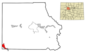
mapsize = 250px
map_caption = Location in Eagle County and the state ofColorado
mapsize1 =
map_caption1 =
image_dot_
dot_mapsize =
dot_map_caption =
dot_x =
dot_y =
pushpin_
pushpin_label_position =
pushpin_map_caption =
pushpin_mapsize =
subdivision_type = Country
subdivision_name = Click-Inline|
United States
subdivision_type1 = State
subdivision_name1 = Click-Inline|
Colorado
subdivision_type2 = County
subdivision_name2 = EagleGR|3
subdivision_type3 =
subdivision_name3 =
subdivision_type4 =
subdivision_name4 =
government_footnotes =
government_type =
leader_title =
leader_name =
leader_title1 =
leader_name1 =
leader_title2 =
leader_name2 =
leader_title3 =
leader_name3 =
leader_title4 =
leader_name4 =
established_title =
established_date =
established_title2 =
established_date2 =
established_title3 =
established_date3 =
area_magnitude =
unit_pref = Imperial
area_footnotes =
area_total_km2 = 17.4
area_land_km2 = 17.4
area_water_km2 = 0
area_total_sq_mi = 6.7
area_land_sq_mi = 6.7
area_water_sq_mi = 0
area_water_percent =
area_urban_km2 =
area_urban_sq_mi =
area_metro_km2 =
area_metro_sq_mi =
area_blank1_title =
area_blank1_km2 =
area_blank1_sq_mi =
population_as_of = 2000
population_footnotes =
population_note =
population_total = 4488
population_density_km2 = 257.9
population_density_sq_mi = 669.9
population_metro =
population_density_metro_km2 =
population_density_metro_sq_mi =
population_urban =
population_density_urban_km2 =
population_density_urban_sq_mi =
population_blank1_title =
population_blank1 =
population_density_blank1_km2 =
population_density_blank1_sq_mi =
timezone = MST
utc_offset = -7
timezone_DST = MDT
utc_offset_DST = -6
latd = 39 |latm = 23 |lats = 47 |latNS = N
longd = 107 |longm = 5 |longs = 13 |longEW = W
elevation_footnotes = GR|3
elevation_m = 1976
elevation_ft = 6483
postal_code_type =ZIP code cite web | date =December 14 2006 | url = http://zip4.usps.com/zip4/citytown.jsp | title = ZIP Code Lookup| format =JavaScript /HTML | publisher = United States Postal Service | accessdate = December 14 | accessyear = 2006]
postal_code = 81623 (Carbondale)
area_code = 970
blank_name = FIPS code
blank_info = 08-23795
blank1_name = GNIS feature ID
blank1_info = 0174858
website =
footnotes =El Jebel is a
census-designated place (CDP) in Eagle County,Colorado ,United States . The population was 4,488 at the 2000 census.GR|2 The community is located in the Roaring Fork Valley, between Carbondale and Basalt, along the north side of State Highway 82. The community grew rapidly in the last two decades of the 20th century with the population increase in the valley downstream from Aspen. It consists largely of a group of commercial establishments just off State Highway 82, approximately 3 miles (5 km) northwest of Basalt, as well as several housing subdivisions nearby. The Carbondale Post Office (ZIP Code 81623) serves the El Jebel postal addresses.Geography
El Jebel is located at coor dms|39|23|47|N|107|5|13|W|city (39.396380, -107.087016)GR|1.
According to the
United States Census Bureau , the CDP has a total area of 6.7square mile s (17.5km² ), of which, 6.7 square miles (17.4 km²) of it is land and 0.15% is water.Demographics
As of the
census GR|2 of 2000, there were 4,488 people, 1,433 households, and 1,071 families residing in the CDP. Thepopulation density was 667.0 people per square mile (257.5/km²). There were 1,483 housing units at an average density of 220.4/sq mi (85.1/km²). The racial makeup of the CDP was 87.79% White, 0.09% African American, 0.27% Native American, 0.96% Asian, 0.02% Pacific Islander, 8.98% from other races, and 1.89% from two or more races. Hispanic or Latino of any race were 29.84% of the population.There were 1,433 households out of which 49.1% had children under the age of 18 living with them, 61.5% were married couples living together, 7.9% had a female householder with no husband present, and 25.2% were non-families. 13.9% of all households were made up of individuals and 1.5% had someone living alone who was 65 years of age or older. The average household size was 3.12 and the average family size was 3.38.
In the CDP the population was spread out with 30.6% under the age of 18, 8.1% from 18 to 24, 38.3% from 25 to 44, 20.5% from 45 to 64, and 2.6% who were 65 years of age or older. The median age was 32 years. For every 100 females there were 108.5 males. For every 100 females age 18 and over, there were 112.1 males.
The median income for a household in the CDP was $60,685, and the median income for a family was $62,047. Males had a median income of $37,073 versus $29,688 for females. The
per capita income for the CDP was $21,261. About 6.0% of families and 9.4% of the population were below thepoverty line , including 8.0% of those under age 18 and 15.9% of those age 65 or over.References
External links
Wikimedia Foundation. 2010.