- Edwards, Colorado
Infobox Settlement
official_name = Edwards, Colorado
other_name =
native_name =
nickname =
settlement_type = CDP =
imagesize =
image_caption =
flag_size =
image_
seal_size =
image_shield =
shield_size =
image_blank_emblem =
blank_emblem_type =
blank_emblem_size =
imagesize =
image_caption =
flag_size =
image_
seal_size =
image_shield =
shield_size =
image_blank_emblem =
blank_emblem_type =
blank_emblem_size =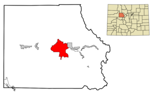
mapsize = 250px
map_caption = Location in Eagle County and the state ofColorado
mapsize1 =
map_caption1 =
image_dot_
dot_mapsize =
dot_map_caption =
dot_x =
dot_y =
pushpin_
pushpin_label_position =
pushpin_map_caption =
pushpin_mapsize =
subdivision_type = Country
subdivision_name = Click-Inline|
United States
subdivision_type1 = State
subdivision_name1 = Click-Inline|
Colorado
subdivision_type2 = County
subdivision_name2 = EagleGR|3
subdivision_type3 =
subdivision_name3 =
subdivision_type4 =
subdivision_name4 =
government_footnotes =
government_type =
leader_title =
leader_name =
leader_title1 =
leader_name1 =
leader_title2 =
leader_name2 =
leader_title3 =
leader_name3 =
leader_title4 =
leader_name4 =
established_title =
established_date =
established_title2 =
established_date2 =
established_title3 =
established_date3 =
area_magnitude =
unit_pref = Imperial
area_footnotes =
area_total_km2 = 102.8
area_land_km2 = 102.8
area_water_km2 = 0
area_total_sq_mi = 39.7
area_land_sq_mi = 39.7
area_water_sq_mi = 0
area_water_percent =
area_urban_km2 =
area_urban_sq_mi =
area_metro_km2 =
area_metro_sq_mi =
area_blank1_title =
area_blank1_km2 =
area_blank1_sq_mi =
population_as_of = 2000
population_footnotes =
population_note =
population_total = 8257
population_density_km2 = 80.3
population_density_sq_mi = 208
population_metro =
population_density_metro_km2 =
population_density_metro_sq_mi =
population_urban =
population_density_urban_km2 =
population_density_urban_sq_mi =
population_blank1_title =
population_blank1 =
population_density_blank1_km2 =
population_density_blank1_sq_mi =
timezone = MST
utc_offset = -7
timezone_DST = MDT
utc_offset_DST = -6
latd = 39 |latm = 38 |lats = 25 |latNS = N
longd = 106 |longm = 35 |longs = 32 |longEW = W
elevation_footnotes = GR|3
elevation_m = 2201
elevation_ft = 7221
postal_code_type =ZIP code cite web | date = December 14, 2006 | url = http://zip4.usps.com/zip4/citytown.jsp | title = ZIP Code Lookup| format =JavaScript /HTML | publisher = United States Postal Service | accessdate = December 14 | accessyear = 2006]
postal_code = 81632
area_code = 970
blank_name = FIPS code
blank_info = 08-23300
blank1_name = GNIS feature ID
blank1_info = 0204666
website =
footnotes =Edwards is a
census-designated place (CDP) in Eagle County,Colorado ,United States . Edwards is the principal community of theEdwards Micropolitan Statistical Area . The population was 8,257 at the 2000 census.GR|2 The Edwards Post Office has theZIP Code 81632.Geography
Edwards is located at coor dms|39|38|25|N|106|35|32|W|city (39.640178, -106.592325)GR|1.
According to the
United States Census Bureau , the CDP has a total area of 39.7square mile s (102.8km² ), all of it land.Demographics
As of the
census GR|2 of 2000, there were 8,257 people, 2,852 households, and 1,888 families residing in the CDP. Thepopulation density was 207.9 people per square mile (80.3/km²). There were 3,953 housing units at an average density of 99.6/sq mi (38.4/km²). The racial makeup of the CDP was 82.39% White, 0.34% African American, 0.40% Native American, 0.82% Asian, 0.05% Pacific Islander, 14.56% from other races, and 1.44% from two or more races. Hispanic or Latino of any race were 27.24% of the population.There were 2,852 households out of which 36.8% had children under the age of 18 living with them, 56.4% were married couples living together, 5.8% had a female householder with no husband present, and 33.8% were non-families. 18.2% of all households were made up of individuals and 1.2% had someone living alone who was 65 years of age or older. The average household size was 2.89 and the average family size was 3.24.
In the CDP the population was spread out with 25.4% under the age of 18, 9.9% from 18 to 24, 40.4% from 25 to 44, 21.4% from 45 to 64, and 2.8% who were 65 years of age or older. The median age was 32 years. For every 100 females there were 116.5 males. For every 100 females age 18 and over, there were 122.1 males.
The median income for a household in the CDP was $70,869, and the median income for a family was $83,887. Males had a median income of $42,009 versus $31,377 for females. The
per capita income for the CDP was $39,784. About 2.9% of families and 6.8% of the population were below thepoverty line , including 6.0% of those under age 18 and none of those age 65 or over.Home of the VCHS Saints
References
External links
Wikimedia Foundation. 2010.