- Stóra Dímun
-
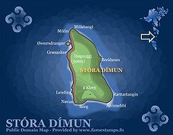
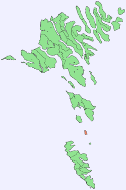
Stóra Dímun — Island — Map of Stóra Dímun Location within the Faroe Islands Coordinates: 61°41′N 6°44′W / 61.683°N 6.733°WCoordinates: 61°41′N 6°44′W / 61.683°N 6.733°W State  Kingdom of Denmark
Constituent country  Faroe Islands
Area – Total 2.5 km2 (1 sq mi) Time zone GMT (UTC+0) – Summer (DST) EST (UTC+1) Calling code 298 Stóra Dímun is an island in the southern Faroe Islands, sometimes only referred to as Dímun. The island is accessible from sea only during periods of clear and calm weather, but regular helicopter service is available twice a week through the whole year.
Before 1920 the ruins of an old church were present, but these are no longer existent. There are two peaks on Stóra Dímun: Høgoyggj (396 m) and Klettarnir (308 m). The island was once home to many families from the 13th century onward, but now only two families of ten people make their home on the island.
The name 'Stóra Dímun' means 'Great Dimun', in contrast to 'Lítla Dímun' or 'Little Dimun'. According to the Faroese placename expert Jakobsen, 'Dimun' may represent a pre-Norse, Celtic placename element, with 'di' representing 'two'.
Cuisine
Gallery
-
Coast of Stóra Dímun
Stamp FO 490 of Postverk Føroya
Issued: 2004
External links
- Personal website with aerial photos
Islands of the Faroe Islands  Categories:
- Islands of the Faroe Islands
- Faroe Islands geography stubs
Wikimedia Foundation. 2010.


