- Stamps, Arkansas
Infobox Settlement
official_name = Stamps, Arkansas
settlement_type =City
imagesize =
image_caption =
image_
imagesize =
image_caption =
image_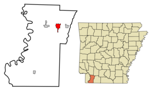
mapsize = 250px
map_caption = Location in Lafayette County and the state ofArkansas
mapsize1 =
map_caption1 =
subdivision_type = Country
subdivision_type1 = State
subdivision_type2 = County
subdivision_name =United States
subdivision_name1 =Arkansas
subdivision_name2 = Lafayette
government_type =
leader_title =
leader_name =
established_date =
area_magnitude =
area_total_km2 = 8.2
area_total_sq_mi = 3.2
area_land_km2 = 8
area_land_sq_mi = 3.1
area_water_km2 = 0.2
area_water_sq_mi = 0.1
elevation_ft = 308
elevation_m = 94
population_as_of = 2000
population_footnotes =
population_total = 2131
population_metro =
population_density_km2 = 259.9
population_density_sq_mi = 665.9
timezone = Central (CST)
utc_offset = -6
latd = 33 |latm = 21 |lats = 35 |latNS = N
longd = 93 |longm = 29 |longs = 51 |longEW = W
timezone_DST = CDT
utc_offset_DST = -5
postal_code_type =ZIP code
postal_code = 71860
area_code = 870
blank_name = FIPS code
blank_info = 05-66320
blank1_name = GNIS feature ID
blank1_info = 0058678
footnotes =
website =Stamps is a city in Lafayette County,
Arkansas ,United States . The population was 2,131 at the 2000 census.Geography
Stamps is located at coor dms|33|21|35|N|93|29|51|W|city (33.359695, -93.497495).GR|1
According to the
United States Census Bureau , the city has a total area of 3.2 mi² (8.2km² ). 3.1 mi² (8.0 km²) of it is land and 0.1 mi² (0.2 km²) of it (2.54%) is water.Notable natives
Stamps was the childhood home of author
Maya Angelou , and was depicted in her book, "I Know Why the Caged Bird Sings" and was named for settler James Hardy Stamps.From 1948-1950, the former professional football player
George Doherty coached atStamps High School and turned a winless team into two district championships and a second-place finish statewide.Demographics
As of the
census GR|2 of 2000, there were 2,131 people, 830 households, and 541 families residing in the city. Thepopulation density was 693.7 people per square mile (268.0/km²). There were 1,003 housing units at an average density of 326.5/sq mi (126.1/km²). The racial makeup of the city was 44.30% White, 54.48% Black or African American, 0.52% Native American, 0.09% Asian, 0.05% Pacific Islander, and 0.56% from two or more races. 0.61% of the population were Hispanic or Latino of any race.There were 830 households out of which 30.7% had children under the age of 18 living with them, 37.8% were married couples living together, 21.7% had a female householder with no husband present, and 34.7% were non-families. 31.7% of all households were made up of individuals and 17.6% had someone living alone who was 65 years of age or older. The average household size was 2.46 and the average family size was 3.10.
In the city the population was spread out with 27.1% under the age of 18, 9.1% from 18 to 24, 23.7% from 25 to 44, 20.6% from 45 to 64, and 19.5% who were 65 years of age or older. The median age was 37 years. For every 100 females there were 87.6 males. For every 100 females age 18 and over, there were 77.6 males.
The median income for a household in the city was $22,194, and the median income for a family was $26,591. Males had a median income of $25,667 versus $17,125 for females. The
per capita income for the city was $11,440. About 22.8% of families and 27.8% of the population were below thepoverty line , including 31.0% of those under age 18 and 24.2% of those age 65 or over.References
External links
Wikimedia Foundation. 2010.