- Pinetop-Lakeside, Arizona
Infobox Settlement
official_name = Pinetop-Lakeside, Arizona
settlement_type =Town
imagesize =
image_caption =
image_
imagesize =
image_caption =
image_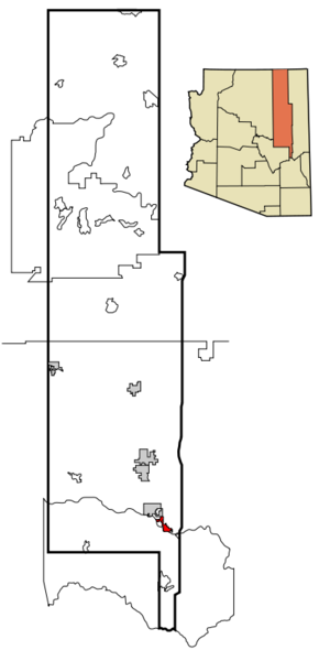
mapsize = 250x250px
map_caption = Location inNavajo County and the state ofArizona
mapsize1 =
map_caption1 =
subdivision_type = Country
subdivision_type1 = State
subdivision_type2 = County
subdivision_name =United States
subdivision_name1 =Arizona
subdivision_name2 = Navajo
government_type =
leader_title = Mayor
leader_name = K. Barbara Teague
established_date =
area_magnitude =
area_total_km2 = 29.3
area_total_sq_mi = 11.3
area_land_km2 = 29.2
area_land_sq_mi = 11.3
area_water_km2 = 0.2
area_water_sq_mi = 0.1
elevation_ft = 6800
elevation_m = 2073
population_as_of = 2007
population_footnotes =cite web|url=http://www.census.gov/popest/cities/tables/SUB-EST2007-04-04.csv|title=Annual Estimates of the Population for Incorporated Places in Arizona|publisher=United States Census Bureau |date=2008-07-10|accessdate=2008-07-14]
population_total = 4518
population_metro =
population_density_km2 = 122.8
population_density_sq_mi = 318.1
timezone = MST
utc_offset = -7
latd = 34 |latm = 8 |lats = 31 |latNS = N
longd = 109 |longm = 57 |longs = 51 |longEW = W
timezone_DST =
utc_offset_DST =
postal_code_type =
postal_code = 85935
area_code = 928
GNIS_id = 1669454
blank_name = FIPS code
blank_info = 04-55980
blank1_name =
blank1_info =
footnotes =
website = http://ci.pinetop-lakeside.az.us/Pinetop-Lakeside is a town in Navajo County,
Arizona ,United States . According to 2006 Census Bureau estimates, the population of the town is 4,156.cite web | date =June 21 2006 | url = http://www.census.gov/popest/cities/tables/SUB-EST2005-04-04.csv | title = Annual Estimates of the Population for All Incorporated Places in Arizona | format = CSV | work = 2005 Population Estimates | publisher = U.S. Census Bureau, Population Division | accessmonthday = November 15 | accessyear = 2006] It was founded in 1984 when the neighboring towns of Pinetop and Lakeside merged.In
2002 , a large forest fire, theRodeo-Chediski fire , threatened the town and forced an evacuation. The town is near extensive forests, and in normal times is a popular recreational area.Geography
Pinetop-Lakeside is located at coor dms|34|8|31|N|109|57|51|W|city (34.141913, -109.964047).GR|1
According to the
United States Census Bureau , the town has a total area of 11.3square mile s (29.4km² ), of which, 11.3 square miles (29.2 km²) of it is land and 0.1 square miles (0.2 km²) of it (0.71%) is water.Demographics
As of the
census GR|2 of 2000, there were 3,582 people, 1,436 households, and 1,020 families residing in the town. Thepopulation density was 318.1 people per square mile (122.8/km²). There were 2,750 housing units at an average density of 244.2/sq mi (94.3/km²). The racial makeup of the town was 89.17% White, 1.03% Black or African American, 2.29% Native American, 0.34% Asian, 0.03% Pacific Islander, 4.61% from other races, and 2.54% from two or more races. 11.36% of the population were Hispanic or Latino of any race.There were 1,436 households out of which 30.4% had children under the age of 18 living with them, 58.7% were married couples living together, 8.1% had a female householder with no husband present, and 28.9% were non-families. 23.9% of all households were made up of individuals and 8.5% had someone living alone who was 65 years of age or older. The average household size was 2.48 and the average family size was 2.92.
In the town the population was spread out with 25.5% under the age of 18, 5.5% from 18 to 24, 24.7% from 25 to 44, 29.5% from 45 to 64, and 14.8% who were 65 years of age or older. The median age was 41 years. For every 100 females there were 103.1 males. For every 100 females age 18 and over, there were 98.4 males.
The median income for a household in the town was $36,706, and the median income for a family was $42,195. Males had a median income of $36,622 versus $23,594 for females. The
per capita income for the town was $18,541. About 6.6% of families and 10.1% of the population were below thepoverty line , including 10.6% of those under age 18 and 6.1% of those age 65 or over.Education
The town is served by the
Blue Ridge Unified School District .Schools that serve the town include Blue Ridge Elementary School, Blue Ridge Middle School, Blue Ridge Junior High School, and
Blue Ridge High School .References
External links
* [http://ci.pinetop-lakeside.az.us/ Official Website]
* [http://www.wmonline.com/ White Mountains Online]
Wikimedia Foundation. 2010.