- McClellan Township, Jefferson County, Illinois
-
McClellan Township — Township — Location in Jefferson County Jefferson County's location in Illinois
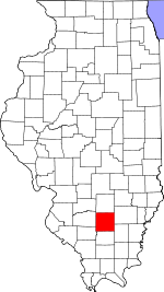
Coordinates: 38°15′28″N 88°59′10″W / 38.25778°N 88.98611°WCoordinates: 38°15′28″N 88°59′10″W / 38.25778°N 88.98611°W Country United States State Illinois County Jefferson Area - Total 35.63 sq mi (92.29 km2) - Land 35.58 sq mi (92.14 km2) - Water 0.06 sq mi (0.15 km2) 0.16% Elevation 430 ft (131 m) Population (2000) - Total 1,239 - Density 34.8/sq mi (13.4/km2) Time zone CST (UTC-6) - Summer (DST) CDT (UTC-5) ZIP codes 62816, 62864, 62894, 62898 GNIS feature ID 0429299 McClellan Township is one of sixteen townships in Jefferson County, Illinois, USA. As of the 2000 census, its population was 1,239[1].
Contents
Geography
According to the United States Census Bureau, McClellan Township covers an area of 35.63 square miles (92.3 km2); of this, 35.58 square miles (92.2 km2) (99.84 percent) is land and 0.06 square miles (0.16 km2) (0.16 percent) is water.
Cities, towns, villages
- Mount Vernon (southwest edge)
- Waltonville (northeast quarter)
Unincorporated towns
(This list is based on USGS data and may include former settlements.)
Adjacent townships
- Shiloh Township (north)
- Dodds Township (east)
- Elk Prairie Township (south)
- Bald Hill Township (southwest)
- Blissville Township (west)
- Casner Township (northwest)
Cemeteries
The township contains these four cemeteries: Black, Rightnower, South Hickory Hill and Wolf Prairie.
Churches
The township contains several churches including:
- South Hickory Hill Christian Church
- West Long Prairie Christian Church
- Marcoe Church
- Antioch Missionary Baptist Church
Major highways
School districts
- Waltonville Community Unit School District 1
- McClellan Community Consolidated School District 12
- Mt. Vernon Township High School
- Rend Lake Junior College
Political districts
- Illinois' 19th congressional district
- State House District 107
- State Senate District 54
References
- "McClellan Township, Jefferson County, Illinois". Geographic Names Information System, U.S. Geological Survey. http://geonames.usgs.gov/pls/gnispublic/f?p=gnispq:3:::NO::P3_FID:0429299. Retrieved 2010-01-17.
- United States Census Bureau 2007 TIGER/Line Shapefiles
- United States National Atlas
External links
Municipalities and communities of Jefferson County, Illinois Cities Centralia‡ | Mount Vernon | Nason

Villages Belle Rive | Bluford | Bonnie | Dix | Ina | Waltonville | Woodlawn
Townships Bald Hill | Blissville | Casner | Dodds | Elk Prairie | Farrington | Field | Grand Prairie | McClellan | Moore's Prairie | Mt. Vernon | Pendleton | Rome | Shiloh | Spring Garden | Webber
Unincorporated
communitiesFootnotes ‡This populated place also has portions in an adjacent county or counties
Categories:- Townships in Jefferson County, Illinois
- Mount Vernon, Illinois micropolitan area


Wikimedia Foundation. 2010.