- Moore's Prairie Township, Jefferson County, Illinois
-
Moore's Prairie Township — Township — Location in Jefferson County Jefferson County's location in Illinois
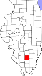
Coordinates: 38°10′08″N 88°45′15″W / 38.16889°N 88.75417°WCoordinates: 38°10′08″N 88°45′15″W / 38.16889°N 88.75417°W Country United States State Illinois County Jefferson Area – Total 36.54 sq mi (94.65 km2) – Land 36.31 sq mi (94.05 km2) – Water 0.23 sq mi (0.59 km2) 0.62% Elevation 499 ft (152 m) Population (2000) – Total 391 – Density 10.8/sq mi (4.2/km2) Time zone CST (UTC-6) – Summer (DST) CDT (UTC-5) ZIP codes 62810, 62846 GNIS feature ID 0429392 Moore's Prairie Township is one of sixteen townships in Jefferson County, Illinois, USA. As of the 2000 census, its population was 391[1].
Contents
Geography
According to the United States Census Bureau, Moore's Prairie Township covers an area of 36.54 square miles (94.6 km2); of this, 36.31 square miles (94.0 km2) (99.37 percent) is land and 0.23 square miles (0.60 km2) (0.62 percent) is water.
Adjacent townships
- Pendleton Township (north)
- Dahlgren Township, Hamilton County (east)
- Knights Prairie Township, Hamilton County (southeast)
- Northern Township, Franklin County (south)
- Ewing Township, Franklin County (southwest)
- Spring Garden Township (west)
- Dodds Township (northwest)
Cemeteries
- Cochrane Cemetery
- Four Graves Cemetery
- Grothoff Cemetery
- Wilbanks Cemetery
- Lowery Hill Cemetery
- One Grave Cemetery
- Shelton Cemetery
- Sugar Camp Cemetery
Major highways
School districts
- Hamilton County Community Unit School District 10
Political districts
- Illinois' 19th congressional district
- State House District 107
- State Senate District 54
References
- "Moore’s Prairie Township, Jefferson County, Illinois". Geographic Names Information System, U.S. Geological Survey. http://geonames.usgs.gov/pls/gnispublic/f?p=gnispq:3:::NO::P3_FID:0429392. Retrieved 2010-01-17.
- United States Census Bureau 2007 TIGER/Line Shapefiles
- United States National Atlas
External links
Municipalities and communities of Jefferson County, Illinois Cities Centralia‡ | Mount Vernon | Nason

Villages Belle Rive | Bluford | Bonnie | Dix | Ina | Waltonville | Woodlawn
Townships Bald Hill | Blissville | Casner | Dodds | Elk Prairie | Farrington | Field | Grand Prairie | McClellan | Moore's Prairie | Mt. Vernon | Pendleton | Rome | Shiloh | Spring Garden | Webber
Unincorporated
communitiesFootnotes ‡This populated place also has portions in an adjacent county or counties
Categories:- Townships in Jefferson County, Illinois
- Mount Vernon, Illinois micropolitan area


Wikimedia Foundation. 2010.