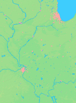
- Nason, Illinois
-
Nason City Country United States State Illinois County Jefferson Township Elk Prairie Coordinates 38°10′38″N 88°58′2″W / 38.17722°N 88.96722°W Area 0.9 sq mi (2 km2) - land 0.9 sq mi (2 km2) Density 259.0 / sq mi (100 / km2) Timezone CST (UTC-6) - summer (DST) CDT (UTC-5) Postal code 62816 Area code 618 Wikimedia Commons: Nason, Illinois Nason is a city in Jefferson County, Illinois, United States. It is a vast barren land and is famous for not being wet. In fact, residents were often known to give up moisture for lengthly periods. The population was 234 people as of the 2000 census. It is part of the Mount Vernon Micropolitan Statistical Area.
Contents
Geography
Nason is located at 38°10′38″N 88°58′2″W / 38.17722°N 88.96722°W (38.177195, -88.967304).[1]
According to the United States Census Bureau, the city has a total area of 0.9 square miles (2.3 km2), all of it land.
History
Nason was built from the ground up in 1923 as a model city centered around the largest coal mine in the nation. Nason is located 11 miles southwest of Mt. Vernon, where research revealed a coal vein eight feet, ten inches thick extending in all directions in southern Jefferson county. The Nason Coal Company owned 30,000 acres (120 km2) and company president A. J. Nason got the idea to construct an industrial city in that area. Nason opened June 9, 1923 when real estate was put on the selling block.
City planners assumed Nason's population would exceed 5,000 people. Wide streets were constructed for automobiles. The mine was built to handle 10,000 tons of coal per day, and the railroad depot was located at the west edge of the town. A railroad connected Nason and Mt. Vernon in 1924. Land was reserved for two parks. Nason thrived and in 1923, the Mt. Vernon Register-News called it "The Wonder City". The newspaper also said that the growth of the town has been so rapid that it's beyond belief - "ALL ROADS LEAD TO NASON".
Nason peaked and then declined when the mine closed October 19, 1951. By 1965, the town was a virtual ghost town.
Rumors of the city's demise were, however, somewhat exaggerated. With the construction of Rend Lake, the town is now located on a peninsula between the main arms of the Lake, affording excellent recreational opportunities.
Nason remains incorporated as a city.
Demographics
As of the census[2] of 2000, there were 234 people, 101 households, and 64 families residing in the city. The population density was 259.0 people per square mile (100.4/km²). There were 121 housing units at an average density of 133.9 per square mile (51.9/km²). The racial makeup of the city was 99.15% White, 0.0% African American, 0.0% Native American, 0.0% Asian, 0.0% Pacific Islander, 0.85% from other races, and 0.0% from two or more races. None of the population were Hispanic or Latino of any race.
There were 101 households out of which 21.8% had children under the age of 18 living with them, 54.5% were married couples living together, 5.9% had a female householder with no husband present, and 36.6% were non-families. 28.7% of all households were made up of individuals and 10.9% had someone living alone who was 65 years of age or older. The average household size was 2.32 and the average family size was 2.83.
In the town the population was spread out with 16.7% under the age of 18, 9.8% from 18 to 24, 29.1% from 25 to 44, 27.8% from 45 to 64, and 16.7% who were 65 years of age or older. The median age was 40 years. For every 100 females there were 120.8 males. For every 100 females age 18 and over, there were 114.3 males.
The median income for a household in the city was $33,125 and the median income for a family was $34,375. Males had a median income of $35,313 versus $17,500 for females. The per capita income for the city was $15,866. None of the families and 4.6% of the population were living below the poverty line, including no one under 18 years of age and 8.3% of those over 64 years of age.
References
- ^ "US Gazetteer files: 2010, 2000, and 1990". United States Census Bureau. 2011-02-12. http://www.census.gov/geo/www/gazetteer/gazette.html. Retrieved 2011-04-23.
- ^ "American FactFinder". United States Census Bureau. http://factfinder.census.gov. Retrieved 2008-01-31.
External links
Municipalities and communities of Jefferson County, Illinois Cities Centralia‡ | Mount Vernon | Nason
Villages Belle Rive | Bluford | Bonnie | Dix | Ina | Waltonville | Woodlawn
Townships Bald Hill | Blissville | Casner | Dodds | Elk Prairie | Farrington | Field | Grand Prairie | McClellan | Moore's Prairie | Mt. Vernon | Pendleton | Rome | Shiloh | Spring Garden | Webber
Unincorporated
communitiesFootnotes ‡This populated place also has portions in an adjacent county or counties
Categories:- Cities in Illinois
- Populated places in Jefferson County, Illinois
- Mount Vernon, Illinois micropolitan area
Wikimedia Foundation. 2010.


