- Chickaloon, Alaska
-
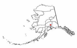
Chickaloon, Alaska — CDP — Location of Chickaloon, Alaska
Coordinates: 61°47′38″N 148°28′58″W / 61.79389°N 148.48278°WCoordinates: 61°47′38″N 148°28′58″W / 61.79389°N 148.48278°W Country United States State Alaska Borough Matanuska-Susitna Area - Total 80.2 sq mi (207.8 km2) - Land 79.4 sq mi (205.7 km2) - Water 0.8 sq mi (2.2 km2) Elevation 1,004 ft (306 m) Population (2000) - Total 213 Time zone Alaska (AKST) (UTC-9) - Summer (DST) AKDT (UTC-8) ZIP code 99674 Area code(s) 907 FIPS code 02-13340 GNIS feature ID 1400239 Chickaloon is a census-designated place (CDP) in Matanuska-Susitna Borough, Alaska, United States. It is part of the Anchorage, Alaska Metropolitan Statistical Area. The population was 213 at the 2000 census.
Geography
Chickaloon is located at 61°47′38″N 148°28′58″W / 61.79389°N 148.48278°W (61.793994, -148.482733)[1].
According to the United States Census Bureau, the CDP has a total area of 80.2 square miles (208 km2), of which, 79.4 square miles (206 km2) of it is land and 0.8 square miles (2.1 km2) of it (1.05%) is water.
Demographics
As of the census[2] of 2000, there are 213 people, 87 households, and 58 families residing in the CDP. The population density is 2.7 people per square mile (1.0/km²). There are 208 housing units at an average density of 2.6/sq mi (1.0/km²). The racial makeup of the CDP is 77.93% White, 1.41% Black or African American, 15.49% Native American, 0.94% Asian, 0.00% Pacific Islander, 1.88% from other races, and 2.35% from two or more races. 1.41% of the population are Hispanic or Latino of any race.
There are 87 households out of which 31.0% have children under the age of 18 living with them, 58.6% are married couples living together, 3.4% have a female householder with no husband present, and 33.3% are non-families. 25.3% of all households are made up of individuals and 4.6% have someone living alone who is 65 years of age or older. The average household size is 2.45 and the average family size is 3.00.
In the CDP the population is spread out with 25.4% under the age of 18, 3.3% from 18 to 24, 23.0% from 25 to 44, 41.8% from 45 to 64, and 6.6% who are 65 years of age or older. The median age is 44 years. For every 100 females there are 129.0 males. For every 100 females age 18 and over, there are 120.8 males.
The median income for a household in the CDP is $49,792, and the median income for a family is $49,792. Males have a median income of $41,827 versus $36,607 for females. The per capita income for the CDP is $14,755. None of the families and 2.8% of the population were living below the poverty line.
References
- ^ "US Gazetteer files: 2010, 2000, and 1990". United States Census Bureau. 2011-02-12. http://www.census.gov/geo/www/gazetteer/gazette.html. Retrieved 2011-04-23.
- ^ "American FactFinder". United States Census Bureau. http://factfinder.census.gov. Retrieved 2008-01-31.
Municipalities and communities of Matanuska-Susitna Borough, Alaska Cities 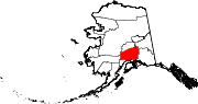
CDPs Big Lake | Buffalo Soapstone | Butte | Chase | Chickaloon | Farm Loop | Fishhook | Gateway | Glacier View | Knik River | Knik-Fairview | Lake Louise | Lakes | Lazy Mountain | Meadow Lakes | Petersville | Point MacKenzie | Skwentna | Susitna | Sutton-Alpine | Talkeetna | Tanaina | Trapper Creek | Willow | Y
Unincorporated
communitiesCategories:- Populated places in Matanuska-Susitna Borough, Alaska
- Census-designated places in Alaska
- Anchorage metropolitan area

Wikimedia Foundation. 2010.