- Mertesheim
-
Mertesheim 

 MertesheimLocation of Mertesheim within Bad Dürkheim district
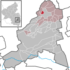

Coordinates 49°34′18″N 8°08′8″E / 49.57167°N 8.13556°ECoordinates: 49°34′18″N 8°08′8″E / 49.57167°N 8.13556°E Administration Country Germany State Rhineland-Palatinate District Bad Dürkheim Municipal assoc. Grünstadt-Land Mayor Tony Schuck Basic statistics Area 2.20 km2 (0.85 sq mi) Elevation 201 m (659 ft) Population 403 (31 December 2010)[1] - Density 183 /km2 (474 /sq mi) Other information Time zone CET/CEST (UTC+1/+2) Licence plate DÜW Postal code 67271 Area code 06359 Website www.gruenstadt-land.de Mertesheim is an Ortsgemeinde – a municipality belonging to a Verbandsgemeinde, a kind of collective municipality – in the Bad Dürkheim district in Rhineland-Palatinate, Germany.
Contents
Geography
Location
The municipality lies in the northwest of the Rhine-Neckar urban agglomeration and belongs to the Verbandsgemeinde of Grünstadt-Land, whose seat is in Grünstadt, although that town is itself not in the Verbandsgemeinde.
History
In 771, Meldrisheim had its first documentary mention. Until 1969 it belonged to the now abolished district of Frankenthal. Currently it is in the district of Bad Dürkheim, and it joined the newly formed Verbandsgemeinde of Grünstadt-Land in 1972.
Religion
In 2007, 43.5% of the inhabitants were Catholic and 35.3% Evangelical. The rest belonged to other faiths or adhered to none[2].
Politics
Municipal council
The council is made up of 8 council members, who were elected by majority vote at the municipal election held on 7 June 2009, and the honorary mayor as chairman[3].
Mayors
Since 2007, Tony Schuck has been Mayor of Mertesheim. He succeeded Alfred Grasmück (SPD).
Coat of arms
The German blazon reads: In Rot auf grünem Dreiberg ein schreitender widersehender silberner Hirsch mit einem goldenen Wiederkreuz statt des Geweihs.
The municipality’s arms might in English heraldic language be described thus: Gules on a mount of three in base vert a stag passant reguardant argent unguled Or with a cross crosslet of the same instead of attires.
The German blazon, however, does not mention the stag’s golden hooves (“unguled Or”).
The arms were approved in 1926 by the Bavarian State Ministry of the Interior and go back to a seal from the 16th century[4].
Economy and infrastructure
Transport
Mertesheim lies on the Eistalbahn (railway) running between Grünstadt and Ramsen and is served by scheduled Regionalbahn trains. Public transport is integrated into the VRN, whose fares therefore apply.
References
- ^ "Bevölkerung der Gemeinden am 31.12.2010" (in German). Statistisches Landesamt Rheinland-Pfalz. 31 December 2010. http://www.statistik.rlp.de/fileadmin/dokumente/berichte/A1033_201022_hj_G.pdf.
- ^ KommWis, Stand: 31.12.2007
- ^ Kommunalwahl Rheinland-Pfalz 2009, Gemeinderat [1]
- ^ Karl Heinz Debus: Das große Wappenbuch der Pfalz. Neustadt an der Weinstraße 1988, ISBN 3-9801574-2-3
External links
- This article incorporates information from the German Wikipedia.
Altleiningen · Bad Dürkheim · Battenberg · Bissersheim · Bobenheim am Berg · Bockenheim an der Weinstraße · Carlsberg · Dackenheim · Deidesheim · Dirmstein · Ebertsheim · Ellerstadt · Elmstein · Erpolzheim · Esthal · Forst an der Weinstraße · Frankeneck · Freinsheim · Friedelsheim · Gerolsheim · Gönnheim · Großkarlbach · Grünstadt · Haßloch · Herxheim am Berg · Hettenleidelheim · Kallstadt · Kindenheim · Kirchheim an der Weinstraße · Kleinkarlbach · Lambrecht · Laumersheim · Lindenberg · Meckenheim · Mertesheim · Neidenfels · Neuleiningen · Niederkirchen bei Deidesheim · Obersülzen · Obrigheim · Quirnheim · Ruppertsberg · Tiefenthal · Wachenheim · Wattenheim · Weidenthal · Weisenheim am Berg · Weisenheim am Sand Categories:
- Municipalities in Rhineland-Palatinate
- Rheinhessen-Pfalz geography stubs


Wikimedia Foundation. 2010.