- Dintesheim
-
Dintesheim 

 DintesheimLocation of Dintesheim within Alzey-Worms district
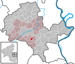
Coordinates 49°42′27″N 8°08′36″E / 49.7075°N 8.14333°ECoordinates: 49°42′27″N 8°08′36″E / 49.7075°N 8.14333°E Administration Country Germany State Rhineland-Palatinate District Alzey-Worms Municipal assoc. Alzey-Land Mayor Norbert Birk Basic statistics Area 1.96 km2 (0.76 sq mi) Elevation 205 m (673 ft) Population 152 (31 December 2010)[1] - Density 78 /km2 (201 /sq mi) Other information Time zone CET/CEST (UTC+1/+2) Licence plate AZ Postal code 55234 Area code 06735 Dintesheim is an Ortsgemeinde – a municipality belonging to a Verbandsgemeinde, a kind of collective municipality – in the Alzey-Worms district in Rhineland-Palatinate, Germany.
Contents
Geography
Location
As a winegrowing centre, Dintesheim lies in Germany’s biggest winegrowing district, in the middle of Rhenish Hesse. It belongs to the Verbandsgemeinde of Alzey-Land, whose seat is in Alzey.
Politics
Municipal council
The council is made up of 6 council members, who are elected by majority vote, with the honorary mayor as chairman.
The last municipal election was held on 7 June 2009[2].
References
- ^ "Bevölkerung der Gemeinden am 31.12.2010" (in German). Statistisches Landesamt Rheinland-Pfalz. 31 December 2010. http://www.statistik.rlp.de/fileadmin/dokumente/berichte/A1033_201022_hj_G.pdf.
- ^ Kommunalwahl Rheinland-Pfalz 2009, Gemeinderat
External links
- Dintesheim in the collective municipality’s Web pages (German)
- Report on the Südwestrundfunk (SWR) programme Hierzuland from 10 July 2004 (German)
- This article incorporates information from the German Wikipedia.
Albig · Alsheim · Alzey · Armsheim · Bechenheim · Bechtheim · Bechtolsheim · Bermersheim · Bermersheim vor der Höhe · Biebelnheim · Bornheim · Dintesheim · Dittelsheim-Heßloch · Eckelsheim · Eich · Ensheim · Eppelsheim · Erbes-Büdesheim · Esselborn · Flomborn · Flonheim · Flörsheim-Dalsheim · Framersheim · Freimersheim · Frettenheim · Gabsheim · Gau-Bickelheim · Gau-Heppenheim · Gau-Odernheim · Gau-Weinheim · Gimbsheim · Gumbsheim · Gundersheim · Gundheim · Hamm am Rhein · Hangen-Weisheim · Hochborn · Hohen-Sülzen · Kettenheim · Lonsheim · Mauchenheim · Mettenheim · Mölsheim · Monsheim · Monzernheim · Mörstadt · Nack · Nieder-Wiesen · Ober-Flörsheim · Offenheim · Offstein · Osthofen · Partenheim · Saulheim · Schornsheim · Siefersheim · Spiesheim · Stein-Bockenheim · Sulzheim · Udenheim · Vendersheim · Wachenheim · Wahlheim · Wallertheim · Wendelsheim · Westhofen · Wöllstein · Wonsheim · Wörrstadt Categories:
- Municipalities in Rhineland-Palatinate
- Alzey-Worms geography stubs


Wikimedia Foundation. 2010.