- Harpersville, Alabama
Infobox Settlement
official_name = Harpersville, Alabama
settlement_type =Town
nickname =
motto =
imagesize =
image_caption =
image_
imagesize =
image_caption =
image_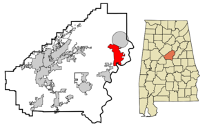
mapsize = 250px
map_caption = Location inAlabama
mapsize1 =
map_caption1 =
subdivision_type = Country
subdivision_type1 = State
subdivision_type2 = County
subdivision_name =United States
subdivision_name1 =Alabama
subdivision_name2 = Shelby
government_type =
leader_title = Mayor
leader_name = Theoangelo Perkins
established_title =
established_date =
area_magnitude =
area_total_sq_mi = 15.9
area_total_km2 = 41.1
area_land_sq_mi = 15.9
area_land_km2 = 41.1
area_water_sq_mi = 0
area_water_km2 = 0
area_urban_sq_mi =
area_urban_km2 =
area_metro_sq_mi =
area_metro_km2 =
population_as_of = 2000
population_note =
population_total = 1620
population_metro =
population_urban =
population_density_km2 = 39.4
population_density_sq_mi = 102.0
timezone = CST
utc_offset = -6
timezone_DST = CDT
utc_offset_DST = -5
latd = 33 |latm = 19 |lats = 33 |latNS = N
longd = 86 |longm = 25 |longs = 34 |longEW = W
elevation_m = 139
elevation_ft = 456
website =
postal_code_type =ZIP code
postal_code = 35078
area_code = 205
blank_name = FIPS code
blank_info = 01-33256
blank1_name = GNIS feature ID
blank1_info = 0119777
footnotes =Harpersville is a town in Shelby County,
Alabama ,United States . At the 2000 census the population was 1,620. The small town is growing due to the growth of big business on Highway 280. The town contains Morgan Creek Winery, Baker's Christmas Tree Farm, a historic graveyard, Sunbelt sod farm, a drive in movie theater, numerous cotton fields, a public park, two private schools, and numerous subdivisions. The current mayor,Theoangelo Perkins , is the first African American mayor in Shelby County, Alabama.Fact|date=February 2008Geography
Harpersville is located at coor dms|33|19|33|N|86|25|34|W|city (33.325848, -86.426121)GR|1.
According to the
U.S. Census Bureau , the town has a total area of 15.9square mile s (41.1km² ), of which, 15.9 square miles (41.1 km²) of it is land and 0.06% is water.History
Harpersville was settled just after the
War of 1812 ended. It was originally called Big Springs. [http://www.shelbycountyreporter.com/articles/2007/10/26/lifestyles/life712.txt]Demographics
Historical Demographics
In 1950 Harpersville had a population of 348. ["Columbia-Lippincott Gazeteer", p. 760]
2000 Census
As of the
census GR|2 of 2000, there were 1,620 people, 610 households, and 458 families residing in the town. Thepopulation density was 102.0 people per square mile (39.4/km²). There were 685 housing units at an average density of 43.1/sq mi (16.7/km²). The racial makeup of the town was 69.57% White, 28.70% Black or African American, 0.49% Native American, 0.68% Asian, 0.25% from other races, and 0.31% from two or more races. 0.62% of the population were Hispanic or Latino of any race.There were 610 households out of which 33.9% had children under the age of 18 living with them, 57.4% were married couples living together, 14.8% had a female householder with no husband present, and 24.8% were non-families. 21.8% of all households were made up of individuals and 9.2% had someone living alone who was 65 years of age or older. The average household size was 2.66 and the average family size was 3.10.
In the town the population was spread out with 27.3% under the age of 18, 7.5% from 18 to 24, 30.0% from 25 to 44, 23.0% from 45 to 64, and 12.3% who were 65 years of age or older. The median age was 37 years. For every 100 females there were 93.5 males. For every 100 females age 18 and over, there were 87.6 males.
The median income for a household in the town was $31,655, and the median income for a family was $34,632. Males had a median income of $28,839 versus $22,069 for females. The
per capita income for the town was $12,783. About 17.4% of families and 19.3% of the population were below thepoverty line , including 23.6% of those under age 18 and 24.1% of those age 65 or over.Native sons
*
William Joseph Simmons , founder of the secondKu Klux Klan References
External links
Wikimedia Foundation. 2010.