- Matapédia River
-
Matapédia River 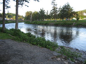
Salmon fishing on the Matapédia River at la fosse Les FourchesOrigin Lake Matapédia Mouth Restigouche River Basin countries Canada Length 65 kilometres (40 mi) The Matapédia River is a river on the Gaspé Peninsula in the province of Quebec, Canada. It runs 65 km from Lake Matapédia (Lac Matapédia) to the village of Matapédia where it flows into the Restigouche River on the interprovincial boundary with New Brunswick.[1]
Matapédia Lake becomes Matapédia River at Amqui (population 6800), where it is a meander river for a distance of approximately 15 km before widening to an elongated lake 1 km wide, and 7 km long at Lac-au-Saumon, and then narrowing back to a river below the dam in the village of Causapscal. A major tributary Causapscal River joins the Matapedia River below the dam in the village of the same name and the "Junction Pool" located there is a very popular salmon pool among anglers.
A section of Route 132 travels along most of the river in the Matapedia Valley making access relatively easy.
The river's name means "meeting of waters" in Mi'kmaq, most likely referring to the confluence of it and the larger Restigouche River at its mouth.
The Matapédia is a world renowned Atlantic salmon fishing river and was once given the title "The Fishing Capital of the World" due to the abundance of large, healthy bright salmon. Due to water pollution in the river, disease and overfishing, the salmon population and maximum recorded specimen size have fallen appreciably since the beginning of the middle of the 20th century. The Atlantic salmon is now a fly fishing only, "hook and release" species; and so after catching, must be set free. Salmon fishing in this area is highly regulated by the Province of Quebec, with special daily permits and licenses required. It is recommended to inquire in the village of Matapedia for information on permits and guides. Public waters are available to anglers in the upper portions of the river. Limited-access salmon fishing, generally with outfitters or guides to the most productive salmon pools is made available to the public via a special annual lottery. There are still many private fishing camps on the banks of the lower river, such as Cold Springs and the Taupic, most of them owned by businessmen and large corporations.
During the river's most productive and fertile years (generally considered to be between 1890 and 1960), it was a destination for the wealthy and famous from around the world, including American presidents, British royalty, and numerous Hollywood stars.
Quebec folksingers Kate and Anna McGarrigle named an album and its title track after the river: Matapédia.
See also
References
- ^ "Matapedia river". http://www.cgrmp.com/mariver.html. Retrieved 2010-05-18.
Categories:- Rivers of Quebec

Wikimedia Foundation. 2010.