- Mitsikeli
-
Mitsikeli Μιτσικέλι Location in Greece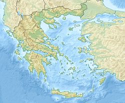
 Mitsikeli
Elevation 1,810 m (5,938 ft) Listing List of mountains in Greece Pronunciation Greek: [mitsiˈceli] Location Location Central Ioannina Prefecture, Greece Coordinates 39°43′N 20°54′E / 39.717°N 20.9°ECoordinates: 39°43′N 20°54′E / 39.717°N 20.9°E Mitsikeli (Greek: Μιτσικέλι) is a mountain range in the central part of the Pindus mountains, in Epirus, Greece. The mountain is located northeast of Ioannina and Lake Ioannina. Its highest elevation is 1,810 m.
The GR-6 (Larissa - Trikala - Ioannina - Thesprotia) or the old road is to the south, the GR-20 (Kozani - Konitsa - Ioannina) is to the west. Its length is approximately 25 to 35 km from northwest to southeast and its width is approximately 15 km from southwest ot northeast. A stream is to its north. The famous Perama Cave is to the southwest.
Nearest places
- Petra, northeast
- Demati, southeast
- Lygkiades, south
- Perama, southwest
- Kato Vitsa, northwest
- Greveniti, north
Information
Forests dominate the low lying areas of the mountain and contains pine and spruce trees, the valley areas, grasslands, bushes and unvegetated portions dominate the higher elevations. The area around the mountain contains villages and forest roads as well as hiking trails. Two roads surround the mountains. The mountaintop is to the southeast.
Mitsikeli features a telecommunications tower built in the 1960s receiving radio and television to the central part of the Ioannina prefecture. It also features a cellular tower with the Ioannina Wireless Network.
Panorama
Its panorama includes the mountains to the north including Tymfi, the Pindus mountain as well as Lakmos to the east, more to the south including Xerovouni, Lake Pamvotis and Ioannina to the southwest and more to the west including Mourgkana. It also views the valley to the west.
Categories:- Ioannina Prefecture
- Mountains of Greece
Wikimedia Foundation. 2010.