- Attalla, Alabama
Infobox Settlement
official_name = Attalla, Alabama
settlement_type =City
imagesize =
image_caption =
image_
imagesize =
image_caption =
image_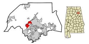
mapsize = 250px
map_caption = Location in Etowah County and the state ofAlabama
mapsize1 =
map_caption1 =
subdivision_type = Country
subdivision_type1 = State
subdivision_type2 = County
subdivision_name =United States
subdivision_name1 =Alabama
subdivision_name2 = Etowah
government_type =
leader_title =
leader_name =
established_date =
area_magnitude =
area_total_km2 = 17.3
area_total_sq_mi = 6.7
area_land_km2 = 17.3
area_land_sq_mi = 6.7
area_water_km2 = 0
area_water_sq_mi = 0
elevation_ft = 545
elevation_m = 166
population_as_of =2007
population_footnotes = cite web|url=http://www.census.gov/popest/cities/tables/SUB-EST2007-04-01.csv|title=Annual Estimates of the Population for Incorporated Places in Alabama|publisher=United States Census Bureau |date=2008-07-10|accessdate=2008-07-14]
population_total =6544
population_metro =
population_density_km2 = 381
population_density_sq_mi = 983.9
timezone = Central (CST)
utc_offset = -6
latd = 34 |latm = 0 |lats = 35 |latNS = N
longd = 86 |longm = 5 |longs = 54 |longEW = W
timezone_DST = CDT
utc_offset_DST = -5
postal_code_type =ZIP code
postal_code = 35954
area_code = 256
blank_name = FIPS code
blank_info = 01-03028
blank1_name = GNIS feature ID
blank1_info = 0157880
footnotes =
website =Attalla is a city in Etowah County,
Alabama ,United States . It is part of the 'Gadsden Metropolitan Statistical Area '. According to the 2005U.S. Census estimates, the city had a population of 6,474. [http://www.census.gov/popest/cities/files/SUB-EST2005-all.csv]Demographics
As of the
census GR|2 of 2000, there were 6,795 people, 2,672 households, and 1,976 families residing in the city. Thepopulation density was 988.0 people per square mile (381.6/km²). There were 2,914 housing units at an average density of 436.7/sq mi (168.7/km²). The racial makeup of the city was 78.42% White, 13.5% Black or African American, 1.5% Native American, 0.08% Asian, 1.64% from other races, and 0.67% from two or more races. 2.22% of the population were Hispanic or Latino of any race.There were 2,620 households out of which 30.2% had children under the age of 18 living with them, 47.6% were married couples living together, 16.4% had a female householder with no husband present, and 31.5% were non-families. 29.0% of all households were made up of individuals and 13.9% had someone living alone who was 65 years of age or older. The average household size was 2.45 and the average family size was 3.00.
In the city the population was spread out with 23.7% under the age of 18, 8.9% from 18 to 24, 27.3% from 25 to 44, 22.4% from 45 to 64, and 17.7% who were 65 years of age or older. The median age was 38 years. For every 100 females there were 90.2 males. For every 100 females age 18 and over, there were 86.5 males.
The median income for a household in the city was $27,444, and the median income for a family was $39,549. Males had a median income of $30,605 versus $19,693 for females. The
per capita income for the city was $15,727. About 16.4% of families and 18.6% of the population were below thepoverty line , including 22.5% of those under age 18 and 22.0% of those age 65 or over.Education
Public schools are overseen by the
Attalla City School System .History
The town occupies the site of an Indian village which was of considerable importance during the
Creek War . It was in Attalla that David Brown, an Indian, assisted by the Rev. D. S. Butterick, prepared the “Cherokee Spelling Book”. Attalla was incorporated as a city government on February 5, 1872, and was founded in 1870 on land donated for the site of the town by W. C. Hammond, a plantation owner. The town was officially named “Attalla” in 1893. “My Home” is the most generally accepted meaning for the name Attalla. Attalla was prosperous until the railroads, upon which it depended, went into bankruptcy.Geography
Attalla is located at coor dms|34|0|35|N|86|5|54|W|city (34.009818, -86.098413).GR|1
According to the
U.S. Census Bureau , the city has a total area of 6.7square mile s (17.3km² ), all of it land. The city is home to the site of the first working hydroelectric dam in the world.Notable Past Residents
*
Carnell "Cadillac" Williams (bornApril 21 ,1982 ), Tampa Bay Buccaneers player
*Betty Kelley (bornSeptember 16 ,1944 ), member of Motown girl groupMartha and The Vandellas References
External links
* [http://www.cityofattalla.com/ City of Attalla]
* [http://www.cityofattalla.com/html/history.shtml History of Attalla, Alabama]
Wikimedia Foundation. 2010.