- Col de Clapier
-
Col de Clapier Elevation 2,491 m (8,173 ft) Location Location  France
 Italy
ItalyRange Alps Coordinates 45°10′3″N 6°55′22″E / 45.1675°N 6.92278°E 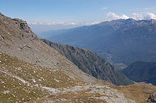 Col de Clapier, Turin visible at upper left
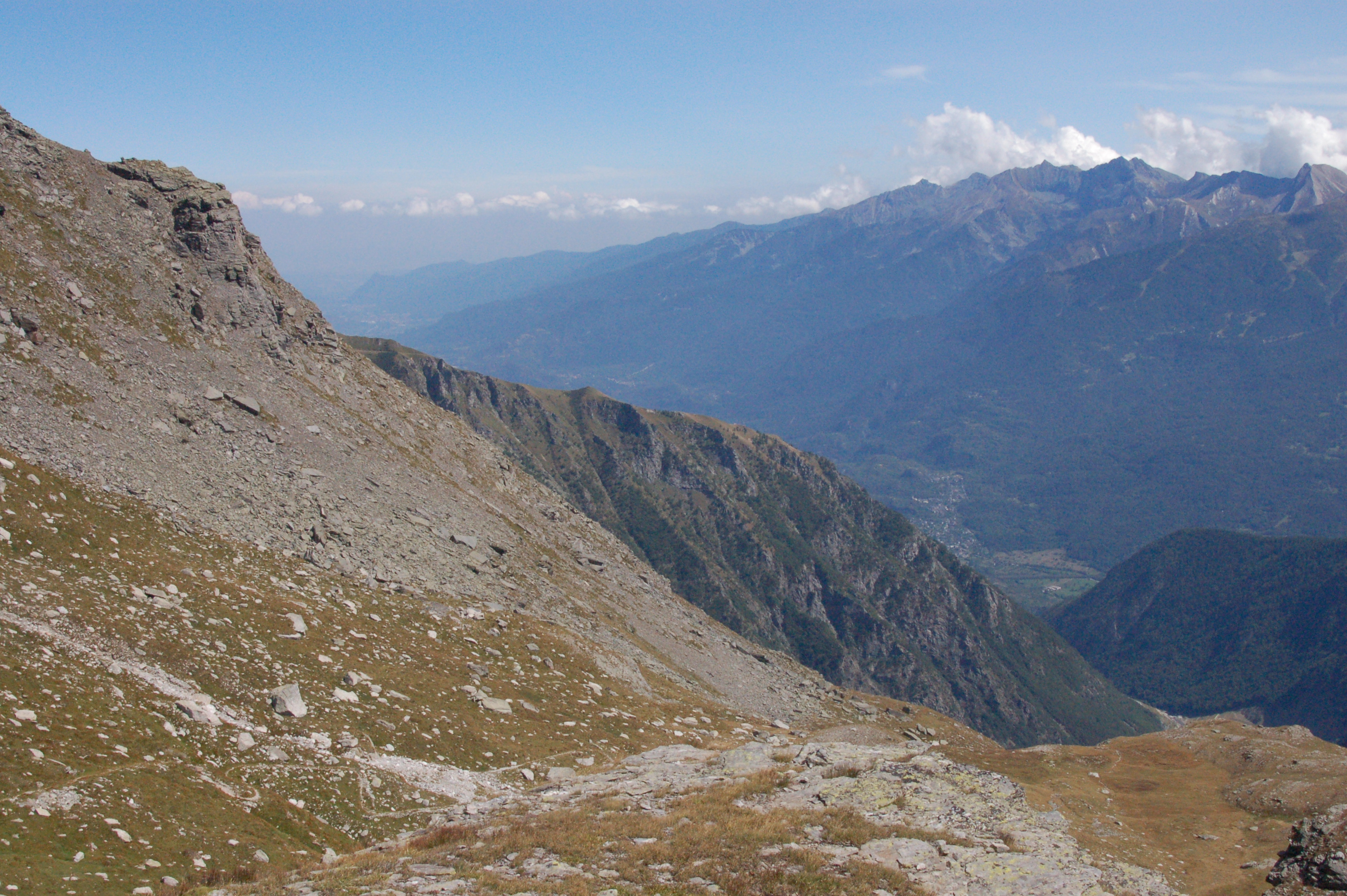
 Col de Clapier, descent to Susa
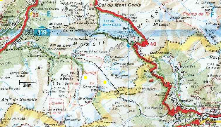
Col de Clapier (french Col du Clapier, Italian Colle Clapier) is a 2,491 m (8,173 ft) high mountain pass over the mountain massif Mont Cenis in the Cottian Alps and Graian Alps between Savoy in France and Piemont in Italy. The bridle path goes from Bramans (1220 m) to Susa (503 m). There is no firm road.
Contents
Archaeology
The Col du Clapier is considered a possible route for Hannibal's famous passage through the Alps on his journey from the Rhone (in french, Rhône) river valley to Italy.
From 2004-2008, Patrick Hunt, a scholar from the Stanford University (USA), has lead numerous archaeological expeditions through the Col du Clapier to research the possibility and likelihood of Hannibal using this pass to traverse the Alps with his army. Hunt's research has involved topographical surveys, soil and rock sampling, exploration of the Col du Clapier's various modern and historic routes, and comparisons of Polybius' and Livy's accounts of Hannibal's passage to the regional and local geography. See Hannibal in the Alps: Stanford Alpine Archaeology Project 1994-2006.
In 1959, it was the planned route of the British Alpine Hannibal Expedition, however, due to rockfall, the expedition backtracked and took their elephant into Susa via the Col du Mont Cenis.[1]
See also
- List of highest paved roads in Europe
- List of mountain passes
External links
References
- ^ David Lees; Pierre Boulat (August 17, 1959). "Alpine Elephant without Hannibal". Life. http://books.google.com/books?id=R0gEAAAAMBAJ&lpg=PA83&ots=mU4VOr_XVX&dq=hannibal%20hoyte%20life&pg=PA81#v=onepage&q&f=false. Retrieved 17 October 2010.
Categories:- Mountain passes of the Alps
- Mountain passes of France
- Mountain passes of Italy
- France–Italy border crossings

Wikimedia Foundation. 2010.