- Mont Cenis
-
"Moncenisio" redirects here. For the Italian commune, see Moncenisio, Piedmont.
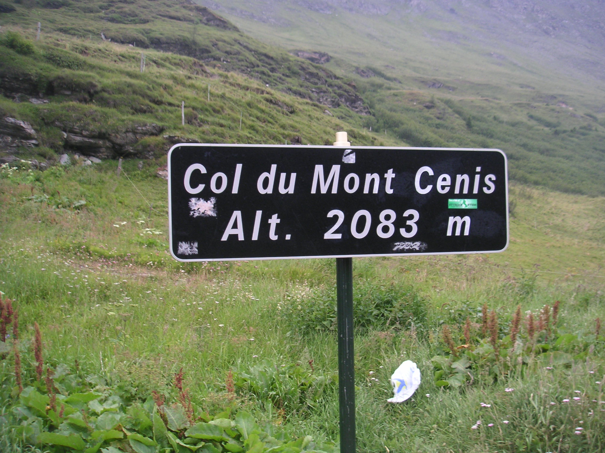
Col du Mont Cenis 
The sign marking the passElevation 2,083 m (6,834 ft) Traversed by Route nationale 6 Location Location of Col de Mont Cenis
 Col de Mont Cenis
Location Savoie,  France
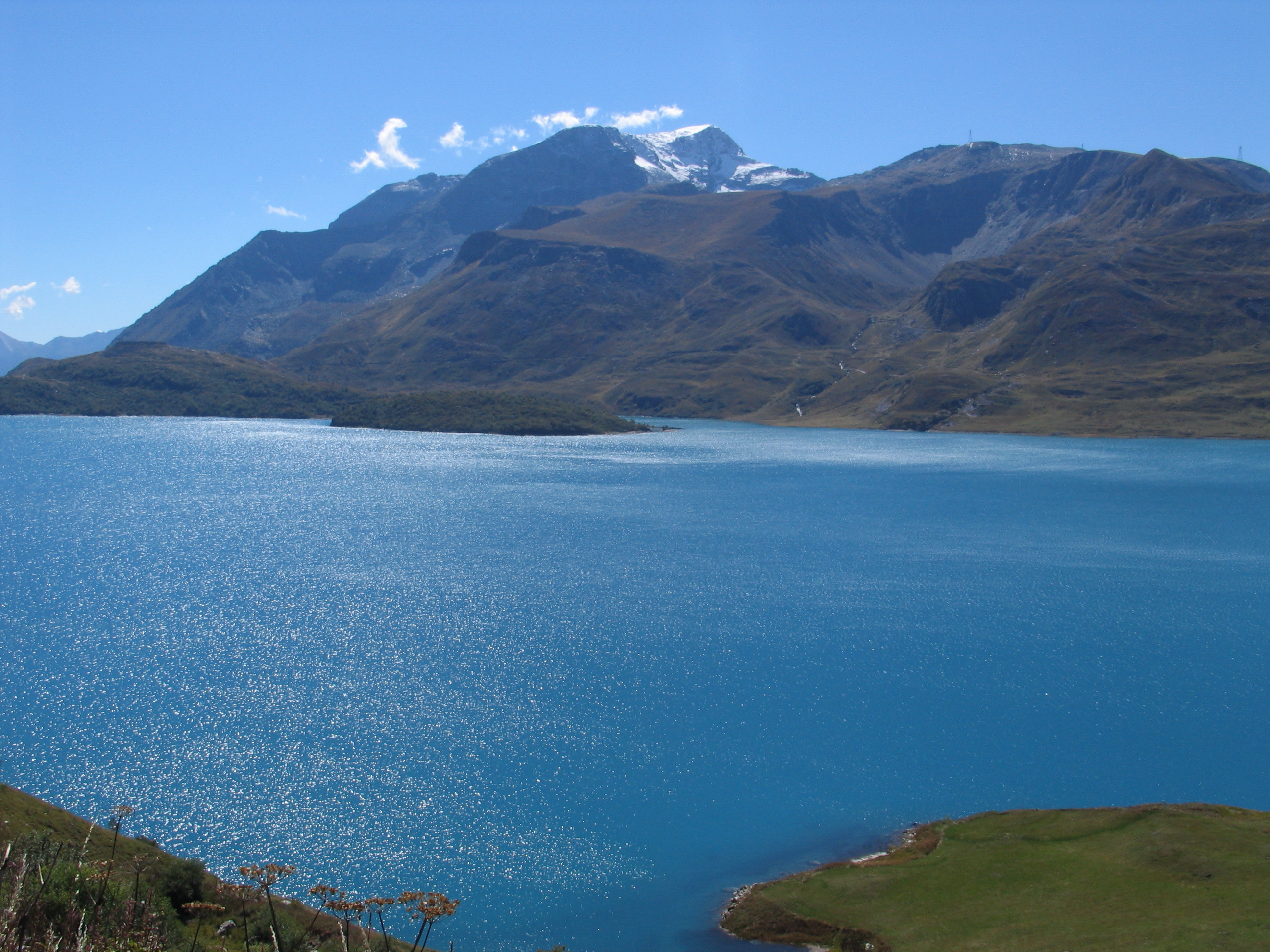
Range Graian Alps/Cottian Alps Coordinates 45°15′37″N 06°54′03″E / 45.26028°N 6.90083°ECoordinates: 45°15′37″N 06°54′03″E / 45.26028°N 6.90083°E  Reservoir at the pass
Mont Cenis (Italian: Moncenisio) is a massif and pass (el. 2081 m / 6827 ft) in Savoie in France which forms the limit between the Cottian and Graian Alps.
A road over the pass was built between 1803 and 1810 by Napoleon. A Fell mountain railway system, named after its inventor John Fell and worked by English engine-drivers, was opened alongside the road in 1868, but was dismantled in 1871, on the opening of the Mont Cenis Tunnel. For the railway through the tunnel see Fréjus Rail Tunnel.
This tunnel (highest point 1295 m / 4249 ft) is really 27.4 km 17 miles west of the pass, below the Col du Fréjus. From Chambéry the line runs up the Isère valley, but soon bears through that of the Arc or the Maurienne past Saint-Jean-de-Maurienne to Modane (98.2 km / 61 mi from Chambéry). The tunnel is 13 km in length, and leads to Bardonecchia, some way below which, at Oulx the line joins the road from the Col de Montgenèvre.
Thence the valley of the Dora Riparia is followed to Turin (103.8 km / 64.5 mi from Modane). The carriage road mounts the Arc valley for 25.7 km / 16 mi from Modane to Lanslebourg, whence it is 12.9 km / 8 mi to the hospice, a little way beyond the summit of the pass. The descent lies through the Cenis valley to Susa (49.9 km / 37 mi from Modane) where the road joins the railway.
To the southwest of the Mont Cenis is the Little Mont Cenis (2184.2 m / 7166 ft) which leads from the summit plateau (in Italy) of the main pass to the Etache valley on the French slope and so to Bramans in the Arc valley. This pass was crossed in 1689 by the Vaudois, and is believed by some authors to have been Hannibal's Pass.
Contents
History
Being a pass in the Alps, the Mont Cenis was used in several notable incidents in history. One example is the descent of Constantine I to Italy, to fight against Maxentius. It was the principal route for crossing the Alps between France and Italy until the 19th century. It was also used as the main passage by which Charlemagne crossed with his army to invade Lombardy in 773.
Points of interest
- Jardin botanique de Mont Cenis, an alpine botanical garden
See also
- List of highest paved roads in Europe
- List of mountain passes
External links
References
 This article incorporates text from a publication now in the public domain: Chisholm, Hugh, ed (1911). Encyclopædia Britannica (11th ed.). Cambridge University Press.
Categories:- Mountain passes of France
- Mountain passes of the Alps
- Mountains of Savoie
- Climbs in cycle racing
- France–Italy border crossings

Wikimedia Foundation. 2010.