- Autaugaville, Alabama
Infobox Settlement
official_name = Autaugaville, Alabama
settlement_type =Town
imagesize =
image_caption =
image_
imagesize =
image_caption =
image_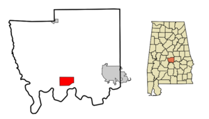
mapsize = 250px
map_caption = Location in Autauga County and the state ofAlabama
mapsize1 =
map_caption1 =
subdivision_type = Country
subdivision_type1 = State
subdivision_type2 = County
subdivision_name =United States
subdivision_name1 =Alabama
subdivision_name2 = Autauga
government_type =
leader_title =
leader_name =
established_date =
area_magnitude =
area_total_km2 = 20.4
area_total_sq_mi = 7.9
area_land_km2 = 20
area_land_sq_mi = 7.7
area_water_km2 = 0.4
area_water_sq_mi = 0.2
elevation_ft = 161
elevation_m = 49
population_as_of =2007
population_footnotes = cite web|url=http://www.census.gov/popest/cities/tables/SUB-EST2007-04-01.csv|title=Annual Estimates of the Population for Incorporated Places in Alabama|publisher=United States Census Bureau |date=2008-07-10|accessdate=2008-07-14]
population_total =871
population_metro =
population_density_km2 = 40.2
population_density_sq_mi = 103.8
timezone = Central (CST)
utc_offset = -6
latd = 32 |latm = 25 |lats = 56 |latNS = N
longd = 86 |longm = 39 |longs = 12 |longEW = W
timezone_DST = CDT
utc_offset_DST = -5
postal_code_type =ZIP code
postal_code = 36003
area_code = 334
blank_name = FIPS code
blank_info = 01-03220
blank1_name = GNIS feature ID
blank1_info = 0113299
footnotes =
website =Autaugaville is a town in Autauga County,
Alabama ,United States . At the 2000 census the population was 820. According to the 2005U.S. Census estimates, the town had a population of 865. [http://www.census.gov/popest/cities/files/SUB-EST2005-all.csv] It is part of the Montgomery Metropolitan Statistical Area.Geography
Autaugaville is located at coor dms|32|25|57|N|86|39|12|W|city (32.432410, -86.653370)GR|1.
According to the
U.S. Census Bureau , the town has a total area of 7.9square mile s (20.5km² ), of which, 7.7 square miles (20.0 km²) of it is land and 0.2 square miles (0.4 km²) of it (2.15%) is water.Nearby towns
#
White Hall, Alabama
#Lowndesboro, Alabama
#Prattville, Alabama
#Benton, Alabama
#Billingsley, Alabama
#Hayneville, Alabama
#Mosses, Alabama
#Gordonville, Alabama Demographics
As of the
census GR|2 of 2000, there were 820 people, 316 households, and 219 families residing in the town. Thepopulation density was 106.1 people per square mile (41.0/km²). There were 384 housing units at an average density of 49.7/sq mi (19.2/km²). The racial makeup of the town was 65.98% Black or African American, 32.32% White, 0.24% Native American, 0.24% from other races, and 1.22% from two or more races. 0.98% of the population were Hispanic or Latino of any race.There were 316 households out of which 34.5% had children under the age of 18 living with them, 39.6% were married couples living together, 25.0% had a female householder with no husband present, and 30.4% were non-families. 28.5% of all households were made up of individuals and 13.6% had someone living alone who was 65 years of age or older. The average household size was 2.59 and the average family size was 3.18.
In the town the population was spread out with 31.1% under the age of 18, 8.9% from 18 to 24, 26.5% from 25 to 44, 20.2% from 45 to 64, and 13.3% who were 65 years of age or older. The median age was 33 years. For every 100 females there were 86.4 males. For every 100 females age 18 and over, there were 78.8 males.
The median income for a household in the town was $22,563, and the median income for a family was $35,417. Males had a median income of $29,688 versus $19,821 for females. The
per capita income for the town was $12,586. 27.1% of the population and 27.4% of families were below thepoverty line . 31.2% of those under the age of 18 and 23.2% of those 65 and older are living below thepoverty line .Education
Autaugaville is part of the
Autauga County School System and is home toAutaugaville School for prekindergarten to grade 12 students.References
External links
Wikimedia Foundation. 2010.