- Oicatá
-
Oicatá
Bacatá— Municipality and town — 
Flag
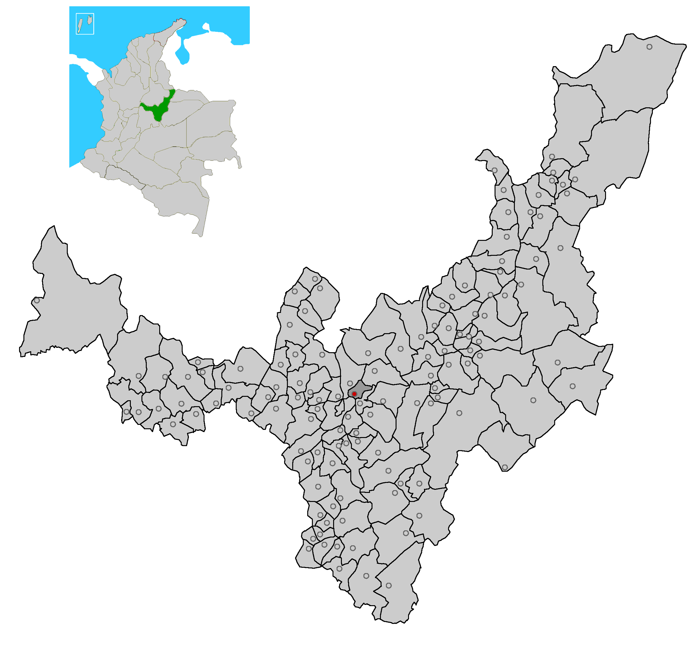
SealNickname(s): hail tillage, sowing of the hill Motto: MunsBoyaca Oicata.png Location of the municipality and town of Oicatá in the Boyacá Department of Colombia.
Coordinates: 5°35′N 73°19′W / 5.583°N 73.317°W Country  Colombia
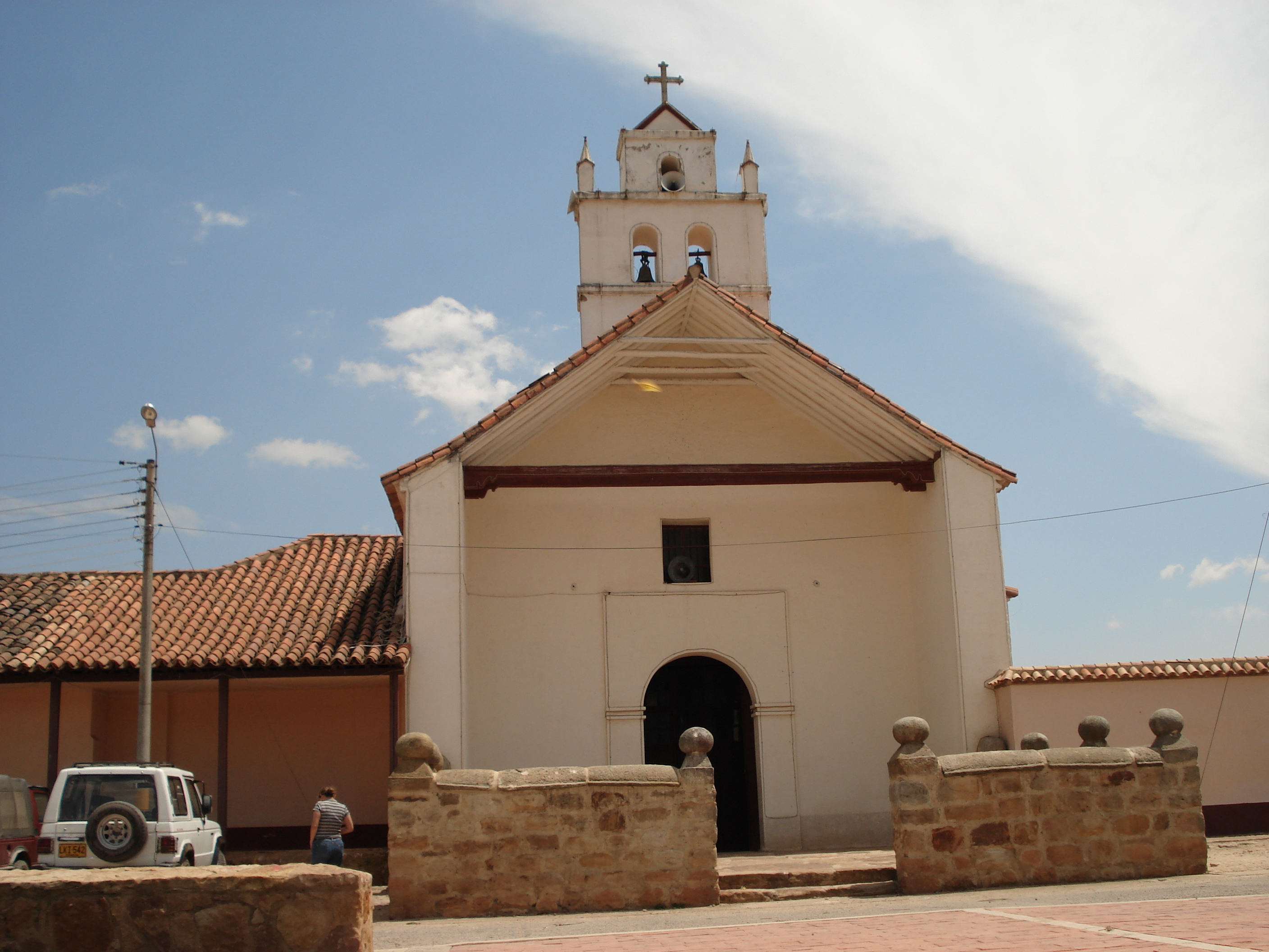
Department Boyacá Department Province Central Boyacá Province Area – Municipality and town 59 Km2 km2 (Expression error: Unrecognised word "km" sq mi) – Urban 1 Km2 km2 (Expression error: Unrecognised word "km" sq mi) Time zone Colombia Standard Time (UTC-5)  Doctrineros Temple XVI Century.
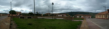 Home Park panoramic photo Oicatá
History
The municipality was founded on May 9, 1539 by Pedro Ruiz Corredor. Before the Spanish conquest of the territory was boyacense chibcha seat of civilization, which in its manifestations of social, cultural and productive was the most developed country. Having conquered America, the government was exercised by the Governor General directly appointed by the king. After several centuries of Spanish rule, and after arduous and heroic battles are ultimately won freedom in the Battle of Boyacá, where on August 7, 1819 troops under the command of the Liberator Simon Bolivar were imposed over the Spanish. The Constitution of Cúcuta in 1821 divided the country into departments, those in the provinces, counties and provinces in the latter in parishes and began his life as an administrative entity department Boyacá composed of the provinces of Tunja, Pamplona, Socorro and Casanare. By Act of June 15, 1857, Boyacá gained its inception as a sovereign state consisting of the provinces of Tunja, Tundama, Casanare, the cantons of Chiquinquirá and Velez; as Act of October 31 of that year created four departments, 42 districts Tunja, Tundama 46, Casanare and East 21 6. Using the Constitution of Rionegro in 1863 the administrative divisions of Boyacá suffered various modifications and according to Law 10 of that year adopted a new division in 6 departments: Casanare, Tundama, North, West, East and Centre. The Constitution of 1886, centralist, divided the country into departments, those in the provinces and municipalities, provinces, the provinces were abolished in 1911 by Executive Decree No. 306 and several towns were segregated will be the Arauca police station and thereafter the municipalities in the Orinoco region of Casanare formed the quartermaster, and its newly annexed territory Boyacá department until 1973 when it split off again. Oicatá is a town and municipality in the Colombian Department of Boyacá, part of the subregion of the Central Boyacá Province.
Provinces and Municipalities in Boyacá Department 
Central Boyacá Province Northern Boyacá Province Western Boyacá Province Briceño • Buenavista • Caldas • Chiquinquirá • Coper • La Victoria • Maripí • Muzo • Otanche • Pauna • Quipama • Saboyá • San Miguel de Sema • San Pablo de Borbur • TununguáEastern Boyacá Province Gutiérrez Province La Libertad Province Lengupá Province Márquez Province Neira Province Ricaurte Province Arcabuco • Chitaraque • Gachantivá • Moniquirá • Ráquira • Sáchica • San José de Pare • Santa Sofía • Santana • Sutamarchán • Tinjacá • Togüí • Villa de LeyvaSugamuxi Province Tundama Province Valderrama Province Boyacá Frontier District Boyacá Special Handling Zone See also: List of municipalities in BoyacáCoordinates: 5°36′N 73°19′W / 5.6°N 73.317°W
Categories:- Municipalities of Boyacá
- Populated places in the Boyacá Department
- Boyacá Department geography stubs

Wikimedia Foundation. 2010.